

FEMA officials have been studying the coast and mapping the flood plains, with the goal of creating a new set of maps. Their designations have great significance.
Additional Photos
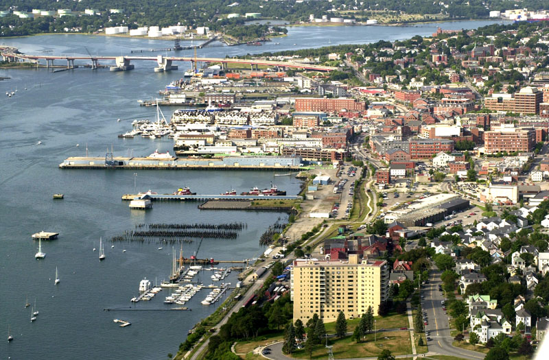
Where a property exists in relation to the flood zone determines how the property can be developed and whether it must have flood insurance. A building destroyed by a storm in a high-hazard zone cannot be replaced.
This could have a huge impact in Portland, where more than 1,800 properties face building restrictions or would be required to buy flood insurance.
FEMA says its flood maps are based on the best science, but forgive us if we have our doubts. The first draft of the map would have excluded development in virtually the entire Portland waterfront, eliminating activities that have been going on for centuries during all manner of storms and floods.
After receiving accurate information from city planning officials, FEMA revised its model. Portland’s planning director, Penny St. Louis Littell, is presenting data to challenge FEMA’s current map to get the agency to change its position on the other properties, just as it did with the waterfront.
As long as this process is fair, the end result should be good. But property owners should not be expected to take on the vast resources of the federal government all on their own.
This is not just an issue for Portland, which has a highly competent professional planning staff, but for every municipality along the coast, where decisions made on these maps will have long-term economic effects on waterfront development.
The maps will only be as good as the science behind them, and if Portland’s research shows that the models here are inaccurate, FEMA should apply what it has learned to other coastal areas.
Copy the Story Link
Send questions/comments to the editors.

Success. Please wait for the page to reload. If the page does not reload within 5 seconds, please refresh the page.
Enter your email and password to access comments.
Hi, to comment on stories you must . This profile is in addition to your subscription and website login.
Already have a commenting profile? .
Invalid username/password.
Please check your email to confirm and complete your registration.
Only subscribers are eligible to post comments. Please subscribe or login first for digital access. Here’s why.
Use the form below to reset your password. When you've submitted your account email, we will send an email with a reset code.