

“If geography is prose, maps are iconography.”
When film director Lennart Meri said those words, he was touching on something profound. Maps aren’t static, nor do they exist in a vacuum. A map shows politics and history and culture — far more than just distances between points.
Additional Photos
Hikers, traveling far from the roads Google Maps and MapQuest show via satellite, have an even greater reliance on trail maps. A good map is one of the best tethers a hiker can have to his or her actual place on the planet. As someone who has spent far too much time searching for trailheads based on web searches and secondhand directions, I can attest to the fact that a good map is hard to find.
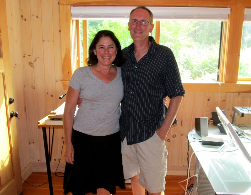
Earlier this summer, I had the pleasure of speaking with Steve Bushey and Angela Faeth, the duo behind Map Adventures. The pair, based on Peaks Island, shed a little light on the life of a Maine map maker.
Unsurprisingly, there’s more to it than calling up a satellite image of one of Maine’s mountains.
Though cartographers can get their hands on GIS data (a digital packet of info on transportation routes, elevations, natural features, contours, etc.) fairly easily, that’s only the first step in creating a map.
“When you get the base GIS data,” noted Faeth, “there’s nothing pretty about it.”
Turning this raw stream of letters and numbers into a useful map is where the hard work comes in. For lovers of the outdoors like Bushey and Faeth, this is also the fun part.
“We still do it the old-fashioned way,” Faeth explained. “We go out, put on our boots, GPS it, get to know the area and get to know the people who go there and what they want to do.”
The pair and a handful of their compatriots have hiked every single mile of trail on their maps with a hand-held GPS, which can pin down a hiker’s location to as close as 6 feet.
The trail lines are true, and the sheer number of trails in the Map Adventures line is a testament to how much mapmaking is done away from a drafting table.
Last fall, Steve hiked more than 200 miles in Baxter State Park alone.
Once the pair has immersed themselves in an area, they can get down to the business of drafting a map. Getting to know the people who’ll use the maps determines what will and won’t make it on to the final copy.
The map of the southern Maine coast, for example, includes day trips, beaches, bike rides and even lighthouses.
The Baxter and Katahdin map, on the other hand, caters to the more serious hiker, with a guide to back-country sites and campgrounds. It even includes a guide to getting to or from Baxter from Logan Airport using only public transportation — a consideration for Appalachian Trail hikers I would never have considered.
After the hearts of outdoorsy Mainers, Map Adventures devotes energy to pointing out which hikes are child- and dog-friendly.
The maps also show the mileages of each segment of each hike, rather than simply the full length — a boon if you’re a hiker like me who obsesses over how much terrain you’ve covered so far.
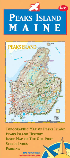
Map Adventures was founded in 1994, but Steve has over 30 years of experience in cartography, geography and outdoor travel tourism. The Map Adventures catalog includes six maps of hiking destinations here in Maine. The scale of the map varies from guide to guide — while their Baxter map includes over 200 miles of trails, the map of Peaks Island covers a stretch of land only about 2 miles long and 1 mile wide.
Along with the maps and guides of the Pine Tree state, Faeth and Bushey have mapped New Hampshire, Vermont and California.
Steve explained the New England natives’ dalliance with the West Coast.
“Sometimes I think of Portland as a little San Francisco. There’s a lot of simpatico between the Bay Area and New England. People there enjoy good food, good wine and — most importantly — the outdoors.”
Along with these common threads, there’s also a practical reason boutique map makers reach beyond New England; in California, the warm outdoor hiking season is 12 months long.
The Maine maps — of Acadia, Baxter, the Camden Hills, Peaks Island, the Portland Trails network, and the southern coast — cover many of the trails my father and I have written about this summer.
The guides are available at MapAdventures.com and independent bookstores throughout Maine.
Josh Christie is a freelance writer and lifetime outdoors enthusiast. He shares this column space with his father, John Christie. Josh can be reached at:
joshua.j.christie@gmail.com
Send questions/comments to the editors.

Success. Please wait for the page to reload. If the page does not reload within 5 seconds, please refresh the page.
Enter your email and password to access comments.
Hi, to comment on stories you must . This profile is in addition to your subscription and website login.
Already have a commenting profile? .
Invalid username/password.
Please check your email to confirm and complete your registration.
Only subscribers are eligible to post comments. Please subscribe or login first for digital access. Here’s why.
Use the form below to reset your password. When you've submitted your account email, we will send an email with a reset code.