

PORTLAND — The last two hurricanes to threaten Maine spun harmlessly to the east but the state is unlikely to be spared from Hurricane Irene, which will bring either rain, or wind, or both, this weekend with the potential for power outages, widespread flooding and dangerous surf, officials said today.
Warning against complacency, the Maine Emergency Management Agency urged residents to start preparing for the storm expected to hit the state on Sunday. Boaters were told to secure their vessels, and the state’s lobstermen began moving their fishing gear farther offshore to avoid damage.
Additional Photos
Lobstermen Greg Griffin, who fishes from Portland, said younger fishermen have never seen the likes of a storm like Irene, which is expected to cause 30-foot seas.
“We have a young generation of lobstermen who’ve never experienced a full-blown hurricane,” Griffin said today, recalling Hurricane Gloria, which hit New England in 1985. “Those of us who’ve been through them know it’s not something to take lightly. It’s a career-ending storm.”
The storm was expected to make landfall in North Carolina on Saturday before picking up speed and tracking northward, with rain arriving later that night in Maine.
The Maine Emergency Management Agency said Irene will be unlike the last two hurricanes — Kyle in 2008 and Earl in 2010 — that threatened eastern Maine before veering away.
With Irene, the National Weather Service predicts winds strong enough to knock down trees and cause power outages and heavy rain that could cause flooding as the storm arrives on Sunday in Maine. An astronomical high tide Sunday night could pose additional problems along the coast.
Uncertainty remained about the precise track of the hurricane, with the eye of the storm passing through the region late Sunday anywhere from upstate New York to Eastport, Maine, said John Jensenius, warning coordinator for the National Weather Service in Gray.
An eastward track would mean more rain and a westward track would mean stronger winds, so Maine will likely get one or the other, or both, Jensenius said.
The storm spelled trouble for organizers of several big outdoor events.
The former Brunswick Naval Air Station was holding its first air show since the based closed, an event aimed at showcasing the newly created Brunswick Executive Airport. And Bangor was hosting its annual American Folk Festival.
The weather looked to be the worst on Sunday.
If it gets really bad, there’s enough hangar space in Brunswick to protect the dozens of aircraft including the Navy Blue Angels and other high-performance jets, said Steve Levesque, executive director of the Midcoast Regional Redevelopment Authority, which was hosting the event.
The board of the American Folk Festival planned to meet Saturday to decide whether or not to hold the final day of performances in Bangor. Rain won’t stop the festival, but high winds might, an official said.
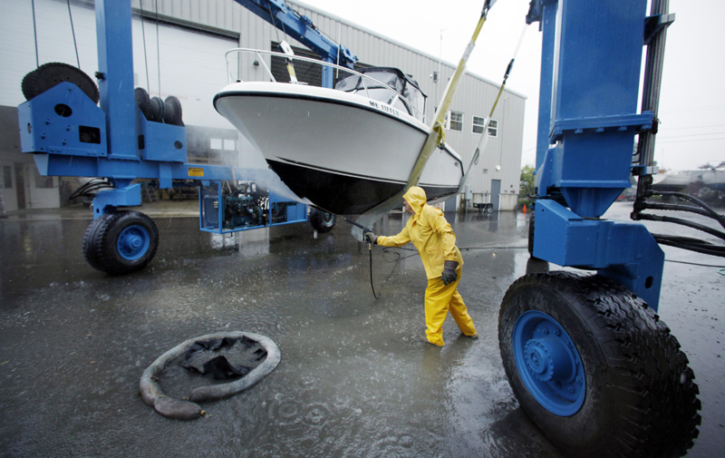
Up and down the coast, recreational boaters were taking steps to protect their craft, either by tying them up at moorings, bringing them to safe harbors, or pulling them from the water altogether.
The moorings at Brewer South Freeport Marine had all been claimed today by boaters who were cruising the Maine coast and seeking refuge from the storm. The marina was also hauling boats out of the water as a precaution.
“We’re getting ready to double up on dock lines and putting out extra fenders, and doing all the things you do for storm preparedness,” said Dave Cox, who works at the marina about 15 miles north of Portland.
Send questions/comments to the editors.

Success. Please wait for the page to reload. If the page does not reload within 5 seconds, please refresh the page.
Enter your email and password to access comments.
Hi, to comment on stories you must . This profile is in addition to your subscription and website login.
Already have a commenting profile? .
Invalid username/password.
Please check your email to confirm and complete your registration.
Only subscribers are eligible to post comments. Please subscribe or login first for digital access. Here’s why.
Use the form below to reset your password. When you've submitted your account email, we will send an email with a reset code.