


WESTBROOK – The small white signs hang on lampposts, wooden stakes and the poles of road signs.
They’re difficult for a passing motorist to detect, but that’s beside the point. They’re intended for slower moving traffic.
Additional Photos
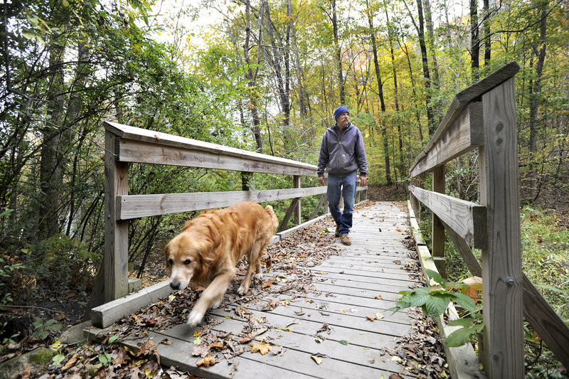
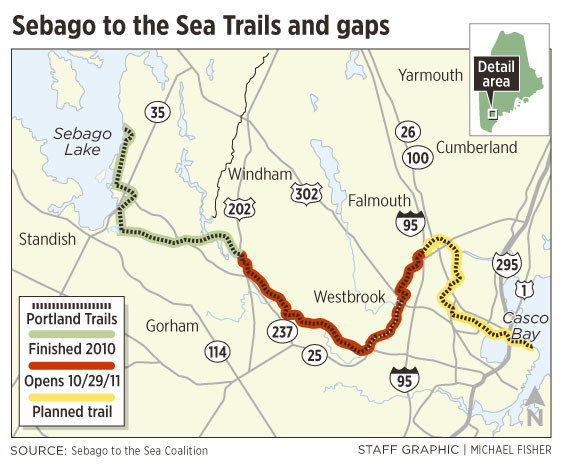
Today, the second of three sections of the Sebago to the Sea Trail officially opens.
About 80 trail signs guide pedestrians and bicyclists on the added 13-mile stretch along riverbanks, city roads and wooded walkways, from Route 202 in South Windham to the Maine Turnpike in Falmouth.
The first eight miles of the trail, starting at Sebago Lake in Standish, opened a year ago. The final six-mile stretch, from the turnpike to Portland’s East End Beach, is scheduled to open next fall.
The work of clearing and connecting the trail is happening quickly, according to the people behind the project. But the process of scouting a route and finding the funding for their vision — to connect Sebago Lake to Casco Bay — began in 2007.
For those who have worked on the trail since its inception, the latest milestone is significant.
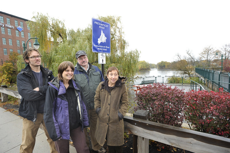
“We can see the end of the trail for the first time,” said Will Plumley, chair of the Presumpscot River Watershed Coalition.
A ceremony scheduled for 10 a.m. today will mark the opening of the new section. After a ribbon-cutting at Waste Management on Forest Avenue in Portland, guides will lead hour-long walks along the trail.
About five miles of the trail along the Mountain Division Rail Line won’t be open for a couple of weeks. That’s when Maine Department of Transportation construction crews plan to clear their equipment away from the rail bed they’ve been reconstructing.
For now, the only way to follow the new route from Windham to Westbrook is by paddling down the Presumpscot.
Also within the next month, eight kiosks with trail maps and information will be built along the new stretch.
One will go up by the river walk in Westbrook, part of a loop around the city’s downtown.
Tania Neuschafer, the Sebago to the Sea project coordinator, said the trail is different from most in Maine because it weaves in and out of urban streets and remote forests.
Much of the trail, including sidewalks along the road and many paths through the woods, didn’t have to be cleared or constructed, said Nan Cumming, director of Portland Trails, a partner in the project.
Creating the Sebago to the Sea Trail mostly involved widening paths, laying gravel and building bridges over soggy ground, she said.
And, of course, there are the signs.
Neuschafer said she doesn’t expect most people who use the trail will follow the signs for the entire 21 miles. Still, she said, knowing the trail connects six communities makes walking any part of it special.
“(You feel) you’re part of this really unique regional network,” she said.
Plumley said he, too, gets sentimental when he thinks about it — that, for the first time, someone can set out from Sebago Lake without a map and follow a continuous footpath to Falmouth.
“There’s just something cool about that,” he said.
Staff Writer Leslie Bridgers can be contacted at 791-6364 or at:
lbridgers@pressherald.com
Send questions/comments to the editors.

Success. Please wait for the page to reload. If the page does not reload within 5 seconds, please refresh the page.
Enter your email and password to access comments.
Hi, to comment on stories you must . This profile is in addition to your subscription and website login.
Already have a commenting profile? .
Invalid username/password.
Please check your email to confirm and complete your registration.
Only subscribers are eligible to post comments. Please subscribe or login first for digital access. Here’s why.
Use the form below to reset your password. When you've submitted your account email, we will send an email with a reset code.