

Trying to plan a hike in the spring in Maine, particularly this year, is a real guessing game. Will there be snow? Or mud? Or will we get lucky with some dry conditions? My safest bet has to assume we’ll be finding a combination of all three.
Because of the unpredictability of spring hiking conditions, my family tends to stick to trails we have visited previously. This ensures that we are familiar with the basics of the terrain (and knowledge of its trail blazes) to help make a more educated guess about our ability to handle the conditions if the trail is snow-covered.
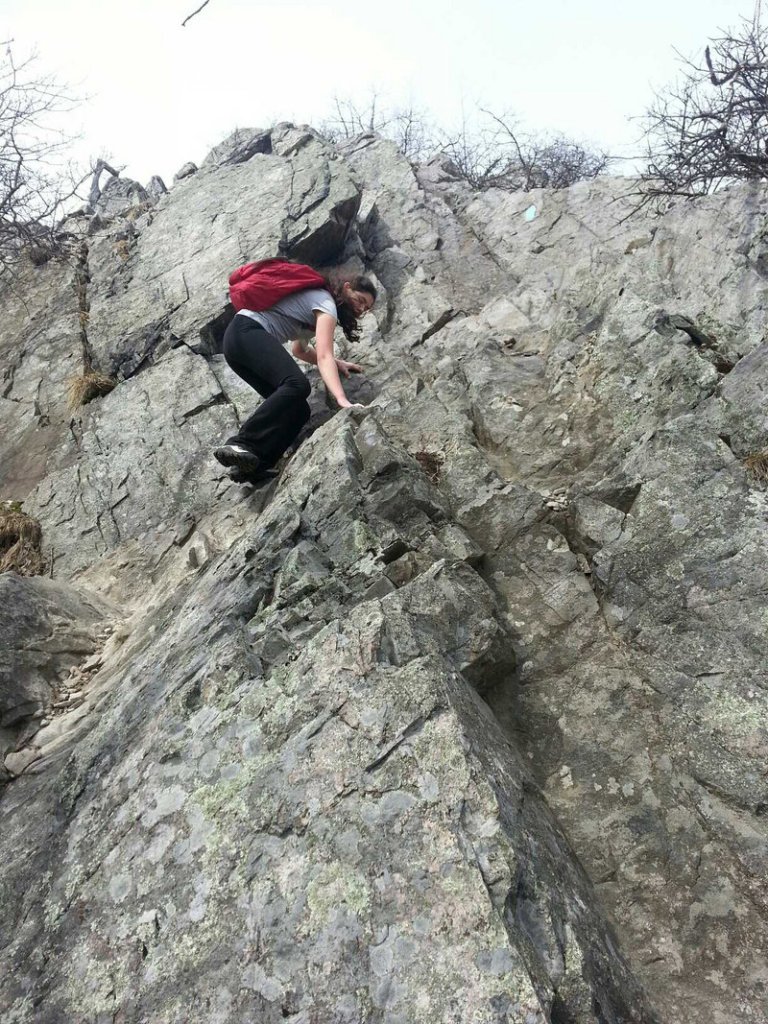
Additional Photos

We decided to visit a mountain trail we are very familiar with — Burnt Meadow Mountain in Brownfield. Last summer we hiked to the summit for the first time (although we’d visited many times before summitting). The hike we took in July was hot and amazingly plentiful in the bug department. We decided after that hike it would be a good idea to visit again during the off-bug season.
On our drive to the mountain I told my passengers (my teenagers as well as our friend Shannon) that we might not make it to the summit of the mountain. We were going to play it safe because there was a steep, rocky climb during the last part of the North Peak Trail.
Luckily for us, the mild temperatures of the day and the recent rain had left little snow on our climb up the mountain. But getting down was another story because we decided to loop back down on the Twin Brook (yellow blaze) Trail to the Burnt Meadow (blue blaze) Trail. Our trouble with Twin Brook Trail was that it was still snow-covered. Shannon said it best when she used the analogy that this part of the hike was like running on sand.
We put a lot of effort into moving without getting very far with all the cautious stepping we did. I also feel that going down a mountain trail is actually harder than climbing up and this particular day confirmed that sentiment.
It was, however, good training for our leg muscles for our trip to Mt. Washington — which we spotted (still heavily snow-covered) from this mountain — and which we plan to tackle later this year.
I made a map of our hiking adventure with my EveryTrail app on my Android phone and there was a bit of a snafu with the GPS tracking. It did a weird zigzag track that ended up calculating more mileage than we actually covered.
I knew from our previous hike that this loop is 3.5 miles with an elevation gain of about 1,200 feet. But our most recent visit recorded over 10 miles. And I have to say that trek down the mountain, which took us twice as long as the climb up, had us commenting that it had in fact felt like we had gone that far (proving once again that numbers really can lie to suit your needs when you want them to).
With this first mountain hike of the spring under our belts, we are researching our next trek. The trick is deciding where to go based on conditions we can handle without any specialized gear. A coastal mountain hike in Camden has made the short list for our next adventure in hopes of a less snow-covered experience.
No matter which mountain you decide to hike this spring, be sure to talk to the kids ahead of time that plans may need to be changed on a moment’s notice based on the trail conditions you find along the way.
Even with teenagers, I find a chat ahead of time saves a lot of “debate” about mom’s decisions on the trail.
• Despite the snow conditions and the early April date, we did run across several flying insects on the loop back down the trail. The bugs on this trail are amazingly hardy.
Staff Writer Wendy Almeida can be contacted at:
wea@mainetoday.com
Twitter & Instagram: wea1021
Blog: www.pressherald.com/blogs/kidtracks
Send questions/comments to the editors.

Success. Please wait for the page to reload. If the page does not reload within 5 seconds, please refresh the page.
Enter your email and password to access comments.
Hi, to comment on stories you must . This profile is in addition to your subscription and website login.
Already have a commenting profile? .
Invalid username/password.
Please check your email to confirm and complete your registration.
Only subscribers are eligible to post comments. Please subscribe or login first for digital access. Here’s why.
Use the form below to reset your password. When you've submitted your account email, we will send an email with a reset code.