

With temperatures in southern Maine expected to reach 70 degrees Monday, it’s easy to forget that a town like Eustis in Franklin County still has 18 inches of snow on the ground.
And that is not good news for Maine’s rivers and streams.
Additional Photos
Margaret Curtis, a meteorologist with the National Weather Service in Gray, said Sunday that the warm temperatures and heavy rain predicted for Tuesday will combine to melt any remaining snow and ice.
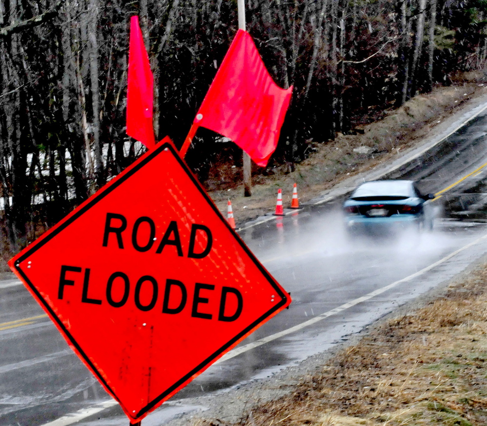
Curtis said the weather service anticipates that the Androscoggin and Kennebec rivers will reach flood stage this week, putting towns and roads near those rivers at risk. Curtis urged people, especially motorists, who approach a flooded road or street to avoid it.
“If the water is moving quickly, even just a foot of water can float your car away,” Curtis said.
Curtis said most of Maine will remain under a flood watch through Wednesday evening. The flood watch was issued Sunday afternoon by the weather service office in Gray.
Despite the heat, Monday won’t be a good beach day. Curtis said water temperatures will be a frigid 40 degrees.
The panel that assesses the state’s river flooding potential will meet Monday for the second time this spring.
Barricades blocked the entrances to Front Street in Augusta on Sunday afternoon, and a sign warned of flooding. Small ice floes bobbed on the swiftly moving dark water. The river from Augusta south to Gardiner frequently floods at this time of year.
“People think we’re out of the woods because there’s no ice down here,” said Richard Beausoleil, Kennebec County’s emergency management director. “There’s still a big snowpack up north, and the concern is if we get rain and warm weather. The problem is it doesn’t soak into the still-frozen ground, it just runs off into small rivers and tributaries.”
Beausoleil noted that “one-fifth of Maine’s water flows out the Kennebec River.”
In Somerset County, Sandy River Road in Mercer and Middle Road in Skowhegan flooded, although both roads remained open, according to a dispatcher for the Somerset County Communications Center.
The state River Flow Advisory Commission will hold a meeting via conference call at 11 a.m. Monday to discuss the current potential for spring flooding, according to Beausoleil.
The panel met last month and determined the likelihood of spring flooding is higher than normal this year.
According to the weather service, the most significant threat of floods is Tuesday into Wednesday, when a cold front could bring an inch of rain or more.
But the weather service alert said Sunday’s rain and Monday’s warmth could also cause high water.
The weather service said the combination of rapid snow melt, mild temperatures and periods of rain “will keep most rivers running high through mid-week.”
“In addition, there remains some ice movement on some rivers, which could cause fluctuations to the river levels.”
The alert said those who live in areas prone to flooding should monitor forecasts and “be prepared to take action should flooding develop.”
Send questions/comments to the editors.

Success. Please wait for the page to reload. If the page does not reload within 5 seconds, please refresh the page.
Enter your email and password to access comments.
Hi, to comment on stories you must . This profile is in addition to your subscription and website login.
Already have a commenting profile? .
Invalid username/password.
Please check your email to confirm and complete your registration.
Only subscribers are eligible to post comments. Please subscribe or login first for digital access. Here’s why.
Use the form below to reset your password. When you've submitted your account email, we will send an email with a reset code.