

The next time some nasty storms are heading your way, the National Weather Service says it will have a better forecast of just how close they could come to you.
The weather service on Tuesday started using a new high resolution computer model that officials say will dramatically improve forecasts for storms up to 15 hours in advance. It should better pinpoint where and when tornadoes, thunderstorms and blizzards are expected.
Additional Images
“This will translate into lives saved and better decision-making on the part of the public,” said Geoffrey DiMego, branch chief of the weather service’s Environmental Modeling Center in College Park, Maryland.
While day-to-day weather forecasts have improved over the years, detailed and accurate predictions of individual storms has still been a problem, he said.
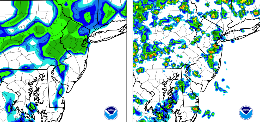
The new computer model has four times more resolution and instead of updating every hour, it will update every 15 minutes.
Until now, forecasts – not radar – would project storms as green blobs over half a state, said meteorologist Geoffrey Manikin. With the new computer model, “you can say there’s a good chance of a thunderstorm in Trenton or Morristown” so instead of a giant swath of green, the forecast shows circles of projected storms. Trenton is almost 50 miles south of Morristown.
The 15 hours in-advance forecasts will look more similar to radar images people watch as storms arrive, Manikin.
And it will be for the entire Lower 48 of the United States on “an almost neighborhood scale,” DiMego said.
While not a huge leap, this new model is “an important step” in making better forecasts, said Jeff Masters, meteorology chief for the private Weather Underground service.
Officials said two new supercomputers and five years of research make it possible for the upgrade in forecasts.
Send questions/comments to the editors.

Success. Please wait for the page to reload. If the page does not reload within 5 seconds, please refresh the page.
Enter your email and password to access comments.
Hi, to comment on stories you must . This profile is in addition to your subscription and website login.
Already have a commenting profile? .
Invalid username/password.
Please check your email to confirm and complete your registration.
Only subscribers are eligible to post comments. Please subscribe or login first for digital access. Here’s why.
Use the form below to reset your password. When you've submitted your account email, we will send an email with a reset code.