

The U.S. Coast Guard said its largest ice-breaking ship in Maine made quick work of ice in the Kennebec River on Wednesday, reaching Richmond and reporting little ice jam flood potential around bridges there.
The trip, which is intended to prevent flooding along the river, came amid good news for Maine’s flood potential. After an unseasonably cold winter that has left deep snowpacks and thick ice, weather has been just above freezing during the day and just below freezing at night, making for a slow melt.
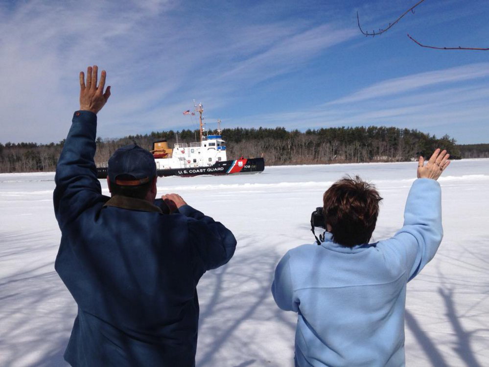
On Wednesday, the 140-foot Thunder Bay set out from Bath and reached Richmond around 11 a.m., said Lt. David Bourbeau, the Coast Guard’s waterways management chief in Maine, who was on the ship. He said ice was between 8 and 12 inches thick for the entire voyage, but “the Thunder Bay made pretty quick work of it,” he said.
Last month, a state weather commission heard that unseasonably deep snowpacks and thick ice could leave the state at risk for flooding if heavy rainfall strikes in April. The Maine River Flow Advisory Commission is set to convene again Thursday to reassess flood risk.
Three 65-foot cutters – the Bridle, the Tackle and the Shackle – plan to head up the river to Gardiner through Saturday to help flush newly broken ice out of the river. The Thunder Bay can’t go beyond the old Richmond-Dresden bridge, which still has pilings in the water after being replaced by the new Maine Kennebec Bridge, which is 115 feet higher.
The extra piers in the water there have been identified as a potential bottleneck for ice jam flooding, particularly since the area around Swan Island has caused some of the region’s worst ice jam floods, including an Augusta-Richmond flood in 1936. But on Wednesday, Bourbeau said ice wasn’t accumulating around there, but as the cutters continue north and break more ice, they’ll have to watch to see if problems develop.
That’s a good sign, said Gregory Stewart, data section chief for the U.S. Geological Survey in Augusta. He said the transition to spring for Maine’s snow and ice packs has begun about two weeks later than usual, but ice on rivers is starting to clear and slow melting is happening along Maine’s streams because of the recent weather.
“Those are signs that spring is moving forward,” Stewart said. “It’s not here yet, but it’s moving forward.”
The National Weather Service is predicting rain Thursday, Friday and early Saturday for Greater Augusta, with temperatures expected to reach a high of 57 degrees on Friday. Sunday will be mostly sunny with a high of only 36 degrees, the weather service forecasts.
Send questions/comments to the editors.

Success. Please wait for the page to reload. If the page does not reload within 5 seconds, please refresh the page.
Enter your email and password to access comments.
Hi, to comment on stories you must . This profile is in addition to your subscription and website login.
Already have a commenting profile? .
Invalid username/password.
Please check your email to confirm and complete your registration.
Only subscribers are eligible to post comments. Please subscribe or login first for digital access. Here’s why.
Use the form below to reset your password. When you've submitted your account email, we will send an email with a reset code.