

It doesn’t take long to find wilderness near Maine’s second-largest urban area, Lewiston-Auburn. Androscoggin Riverlands State Park stretches for 12 miles along the western shoreline of the Androscoggin River just east of Turner Center.
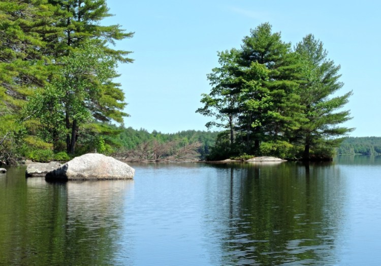
The shoreline has many indentations, small coves and forested islands that offer a variety of exploring options: from an hour after work to all day.
We enjoyed a Sunday morning paddle from the Center Bridge Road boat launch 4 miles downriver to a large cove on the western shoreline before turning around and following the other shoreline upriver to the launch site. The river is popular with fishermen on the weekends, but there is enough room for everyone to find their own version of solitude.
The landmark Clean Water Act of 1972, crafted by Sen. Edmund S. Muskie, was in part inspired by the then heavily polluted Androscoggin. The river is still in the “getting there” phase of recovery, but has come a long way since the foul days of the early 1970s when two-thirds of America’s lakes, rivers and coastal areas were considered unsafe for fishing and swimming.
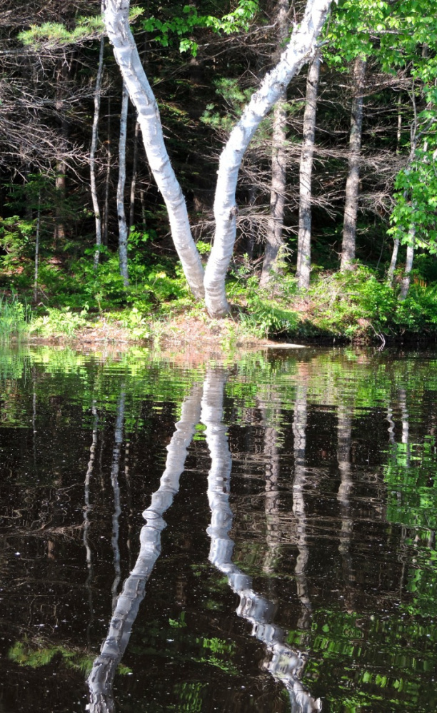
The morning was bereft of wind, which turned our excursion into an artistic delight. Boulders, live trees, fallen trees, reeds and ferns were all reflected in the water, creating a double image of everything we paddled by. We kept our camera busy and had fun quizzing each other along the way with queries of “What does that look like to you?” We came up with some interesting creatures that for the most part matched the doubled objects; a fish chasing a minnow in one spot and a seahorse in another. The various shades of green coupled with a smattering of thin white birches provided a rich tapestry down and back.
We encountered eight islands along the way, some tiny islets with a few small trees, others pine-forested and well worth the stop. We followed a wide pine-needled path through the middle of one island, enjoying the beauty of a few end of season pink lady slippers poking up out of the needles. The sun-dappled forest floor looked so comfortable and inviting, and we sprawled out to enjoy the peace and quiet. It seemed so unusual to be under a large canopy of white pine and not be serenaded by the whisper of the wind through the treetops. It was still dead calm.
The river corridor is lined by gently rolling forested ridges. Except for a few homes tucked into the forest above the river, there is little sign of development along this four-mile stretch. As we entered into the western cove preparing to turn around, we checked our DeLorme map again. It showed a thin appendage protruding north from the southern point of the cove. Was it an island or was it a peninsula? I lost the bet. My wife figured correctly that it was an island and that we would be able to squeeze through a narrow opening. As we cut through the shallow channel, rejoicing all the way, we spied a jumble of rocks on our right. The large one looked just like the head of a giant Snoopy dog, two of them counting the reflection in the water.
Both down and up the river we encountered Canada geese parents with their goslings following behind. Within sight of the Center Bridge on our return, four geese with six goslings tucked between them paddled ahead of us. In a few more yards they found a suitable cut in the banking where they all scampered up and turned around to watch us pass.
Be sure to paddle under the new Center Bridge. Lots of swallow nests are plastered up on the girder walls, and the bridge sports a pleasing artistic curvature. Back at the boat launch, many Sunday afternoon boaters were preparing to head out onto the river for the afternoon. We were thankful for our early start.
On the way home we drove through Minot and came across Jackass Annie Lane on Route 119. We stopped to take a picture and a couple out on a stroll stopped to chat. They told us about Minot’s Mesannie Wilkins who worked in a shoe shop in Lewiston in the late 1940s and commuted to work each day atop her donkey. They urged us to drive over to Mechanic Falls and visit her gravesite in Maple Grove Cemetery. Inscribed on her stone was “The Last of the Saddle Tramps.” At age 63, and in the midst of a bit of a mid-life crisis, she rode a horse to California over a 13-month period, logging 6,000 miles. Our good fortune reaffirmed our belief that sometimes the drives to and from Maine paddling outings are as much a part of the paddling adventure as is the time enjoyed on the water.
Consult the DeLorme Maine Atlas and Gazetteer (map #11) for help in getting to the Center Bridge Road boat launch two miles east of Route 117 in Turner Center.
Michael Perry is the former director of the L.L. Bean Outdoor Discovery Schools and the founder of Dreams Unlimited, specializing in inspiring outdoor slide programs for civic groups, businesses and schools. Contact:
michaelj_perry@comcast.net
Send questions/comments to the editors.

Success. Please wait for the page to reload. If the page does not reload within 5 seconds, please refresh the page.
Enter your email and password to access comments.
Hi, to comment on stories you must . This profile is in addition to your subscription and website login.
Already have a commenting profile? .
Invalid username/password.
Please check your email to confirm and complete your registration.
Only subscribers are eligible to post comments. Please subscribe or login first for digital access. Here’s why.
Use the form below to reset your password. When you've submitted your account email, we will send an email with a reset code.