


For the first time in a while I felt crispness in the air when I got up this morning. I love mornings like this with cool air, low humidity and clear skies. High pressure is in control and is going to stay in control of our weather for the foreseeable future.
There will be changes day to day over the next 7 days, mostly with regard to temperature and humidity, but very little changes in sky condition.
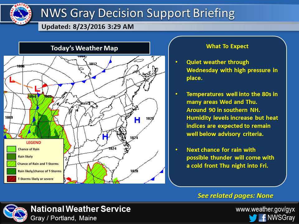
High pressure (blue H), takes control of our weather into the weekend.
School begins next week for many students with Portland public school student beginning on the Aug. 29. This means for many of you its the final week of summer with the entire family home and the ability to head to the beach. If you can take a day this week to enjoy the fine weather, tomorrow is likely one of the best days, but to be honest the rest of the week looks great as well.
On Friday a cold front will pass. This means we’ll have warm and quite humid on Thursday, the day before the front, and again as the front goes through on Friday. There is the chance of a shower or storm as part of the front, but most of us won’t see any rain. As a matter of fact, it might not rain until closer to Labor Day weekend, and since that’s really far out into the future, much can change.
The Length Of The Nights Are Rapidly Increasing
You might notice the daylight is becoming less and less. We are losing just over 2 minutes and 30 seconds of daylight each day. This means over the course of a week, about 20 minutes of daylight have disappeared. Fall is coming even if the temperatures won’t reflect it.
Still In Drought But It’s Better
Rainfall has been more regular lately and although many areas are still in drought conditions, we are not terribly far behind in rainfall since May 1. Look at the chart below. I chose May as the starting point for this chart as that’s the time things are really actively growing and water usage by plants and those of us watering lawns and gardens really increases. Back in 1965, during the middle of the most severe drought New England has seen (at least in the record books), Portland had received about 5 inches of rain in the May to late August period. This year 10 inches has fallen, much close to the average of about 13.
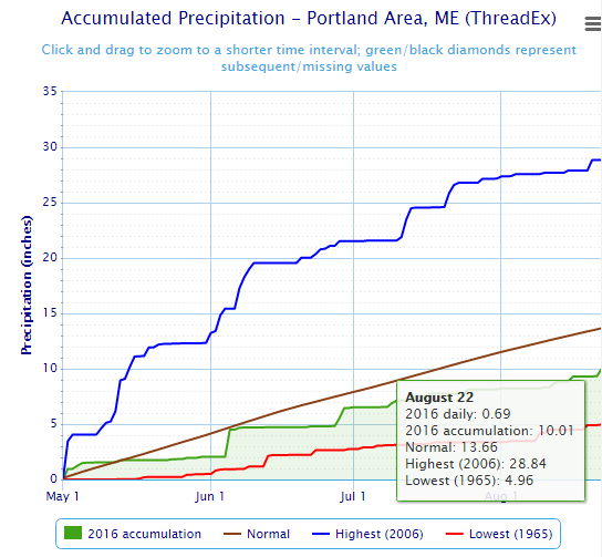
Rain fall has been below average since mid-spring 2016
Cautious Eye To The South
High pressure will remain the dominant player in the weather as we approach the holiday weekend. It’s a bit early for a forecast for the unofficial end of summer, but we will need to keep an eye to the tropics over the next 10 days. We are now entering the period of high activity in the tropics and if Maine is going to be affected by something from that region of the Atlantic it would most likely be during the next 4 weeks. I will be updating the forecast on Twitter @growingwisdom
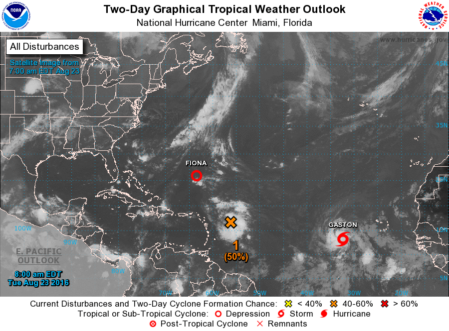
Three tropical systems including tropical storm Gaston are in the Atlantic Basin
Send questions/comments to the editors.

Success. Please wait for the page to reload. If the page does not reload within 5 seconds, please refresh the page.
Enter your email and password to access comments.
Hi, to comment on stories you must . This profile is in addition to your subscription and website login.
Already have a commenting profile? .
Invalid username/password.
Please check your email to confirm and complete your registration.
Only subscribers are eligible to post comments. Please subscribe or login first for digital access. Here’s why.
Use the form below to reset your password. When you've submitted your account email, we will send an email with a reset code.