


More warm weather is on tap for Wednesday, with early-morning clouds, fog or even drizzle giving way to a mostly sunny sky. Temperatures this afternoon will run at least 10 degrees higher than you would expect in the final third of September.
Today is the final day of astronomical summer, the period between roughly June 21 and Sept. 21. The ironic thing about the summer months is that daylight has been shrinking since it began and we are now at roughly equal day and night.
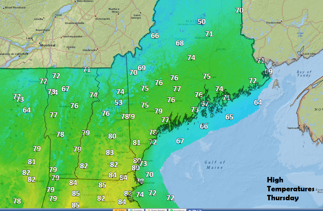
As fall arrives Thursday, it will still feel like summer.
As the sun’s angle becomes lower each day at noon, we have less solar radiation available to heat the Earth, and that’s why temperatures generally fall this time of year.
High pressure remains in control through Thursday night before a cold front marches south. This front is going to usher in the chilliest air of the fall season with highs in the 60s this weekend and nighttime low temperatures in the 40s and even some 30s. Some of the colder interior valleys could see a frost Sunday or Monday morning.
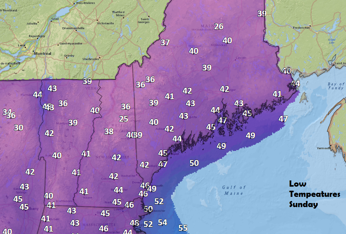
The coolest air of the season arrives Sunday morning.
The cool weather will continue much of next week, but already I am seeing signs of more higher-than-average temperatures destined for New England and, more importantly, a lack of significant rain. In spite of some rain Monday, we need more of it and another few weeks of dry weather can undo much of the good the rain may have done.
Patterns like this can be very difficult to dislodge. This means higher-than-average readings overall through much of the fall and no change in the dry weather until further notice.
Send questions/comments to the editors.

Success. Please wait for the page to reload. If the page does not reload within 5 seconds, please refresh the page.
Enter your email and password to access comments.
Hi, to comment on stories you must . This profile is in addition to your subscription and website login.
Already have a commenting profile? .
Invalid username/password.
Please check your email to confirm and complete your registration.
Only subscribers are eligible to post comments. Please subscribe or login first for digital access. Here’s why.
Use the form below to reset your password. When you've submitted your account email, we will send an email with a reset code.