


City planners are proposing new building height restrictions to preserve the panoramic vista at a popular park on Munjoy Hill in Portland.
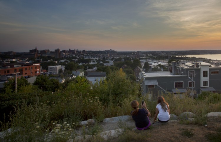
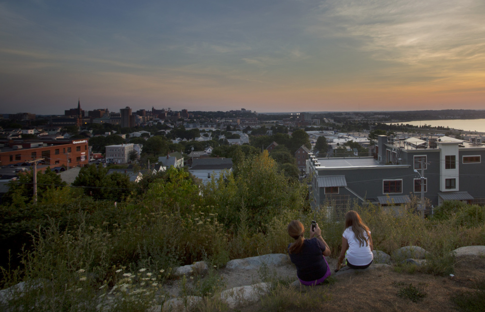
The proposal was prompted by a potential condominium development near Fort Sumner Park on North Street, but neither city officials nor the developer could say on Monday exactly how the project would be affected. The park offers a sweeping panoramic view that includes Back Cove and Mount Washington and is a popular spot with residents and visitors for watching the sunset.
City Councilor Belinda Ray said she supports the proposal for an “overlay zone,” which will be reviewed by the Planning Board in a workshop session on Tuesday. “This is very good,” Ray said.
Ray successfully passed a temporary building moratorium for property abutting Fort Sumner Park after Saco-based developer Bernie Saulnier proposed building condominiums just below the park on Sheridan Street.
Initial plans presented to the Munjoy Hill Neighborhood Organization called for a six-story building at 155 Sheridan St. that would have blocked the entire view of Back Cove. Amid strong opposition by people concerned about the loss of view, the developer whittled down his proposal several times, including a plan for four-story building.
It wasn’t immediately clear how the overlay zone would affect Saulnier’s most recent proposal, said Patrick Venne, a land-use attorney representing the developer.
“Our design professionals will have to crunch the numbers and we’ll take it from there,” Venne said.
No development application has been filed with the city, but the developer has been discussing ideas with city officials and neighborhood residents since last summer. The first proposal for a six-story building would have met the city’s current zoning, which allows 45-foot tall buildings – a height that is measured from the average grade of the steeply sloped land.
The overlay zone would protect a 180-degree vista that would extend 200 feet from a specific point on the Fort Sumner Park viewing platform. Rather than a specific building height throughout the new zone, the proposal would establish a minimum setback of 15 feet for the overlook and set the maximum height of any structure, including mechanical systems and elevator shafts, at roughly 160 feet above sea level, which is the height of the park platform. The maximum building height within a 200-foot radius would be reduced by 1 foot for every 25 feet away from the measuring point, or the apex.
Portland Planning Director Stuart “Tuck” O’Brien said the staff hasn’t studied how it would affect the condo plans, because no application has been filed and because the overlay is not in response to a specific development. Developments outside of the 200-foot radius may affect the view from the park to certain locations, but the vista itself would be preserved, he said.
“This isn’t about the view of a specific point – it’s about a panorama,” O’Brien said. “We felt once you get outside of 200 feet, the vista would remain intact.”
O’Brien said the overlay zone was sought in part because of the park’s history and existing planning studies that called for park enhancements and protections of the vista.
The 1.25-acre park was once the site of an earth-and-timber fort built in 1794 to defend Portland Harbor and Back Cove. It was designated a city park in 1934.
O’Brien said the proposed overlay zone would be reviewed informally by the Planning Board on Tuesday, before heading to board for a public hearing and referral to the City Council.
The moratorium requires planners to present a zoning proposal to the council by Feb. 6.
Send questions/comments to the editors.

Success. Please wait for the page to reload. If the page does not reload within 5 seconds, please refresh the page.
Enter your email and password to access comments.
Hi, to comment on stories you must . This profile is in addition to your subscription and website login.
Already have a commenting profile? .
Invalid username/password.
Please check your email to confirm and complete your registration.
Only subscribers are eligible to post comments. Please subscribe or login first for digital access. Here’s why.
Use the form below to reset your password. When you've submitted your account email, we will send an email with a reset code.