

Two ponds, two states, one day.
We recently crossed the Maine-New Hampshire border, exploring Lower Kimball Pond in Maine, and then a mere half-mile into New Hampshire, Upper Kimball Pond. We spent two hours in each, poking about on a sunny, warm morning.
The tiny boat launch for Lower Kimball is on the western side of the pond. At the boat launch site for Upper Kimball, turn from the paved South Chatham Road onto the gravel Chatham Road. After about 100 yards, turn left onto the Shore Road and follow a few hundred yards to the access lane down to the water. A sign is posted by the town of Chatham. Park back at the Upper Kimball boat launch and walk the five minutes back down to Lower Kimball.
As we headed out, six loons drifted by, welcoming us to their little piece of paradise. There are a number of cottages along the western shoreline so we headed south down around Loon Island and followed the undeveloped eastern shoreline northward.
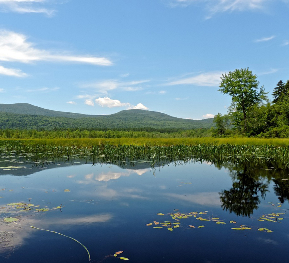
The firm sandy bottom made it easy to get out and swim anywhere we wanted in the crystal-clear water. We spied many sizable fish swimming in the shallows along the shoreline. Mountain peaks and ridges to our west peered down over the pond, beautifully reflected in the mirror calm water. Up ahead a banking of gnarled Scotch pine gave way to thick rows of highbush blueberries. We have paddled in many beautiful places in Maine but have never been able to paddle along and transfer handfuls of blueberries from bush to mouth while still in the canoe. Just be sure to leave enough for the next explorer.
Kingbirds flitted to and fro, their bold white chests in sharp contrast to the dark tangle of pondside birch, and spindly dead spruce and pine. We followed open channels of water through acres of shiny green pickerelweed. Their beautiful blue spikes were just blossoming and a number of hummingbirds flitted about harvesting the nectar. As we swung back to the launch site, the hazy blue profile of Pleasant Mountain rose low over the Saco River Valley about 10 miles to the east.
Upper Kimball Pond offers even more remote exploration down in its southern marsh. There are a few cottages along the shoreline of the narrow cove leading out into the open pond, but after that it is you, the nearby towering peaks and an amazing variety of bog plants and flowers.
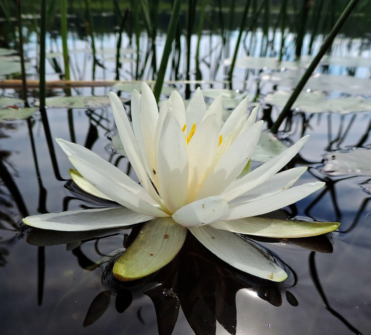
The pink bog laurel was near the end of its showy blooming stage, but pitcher plants, swamp cotton, swamp rose and dense patches of yellow horned bladderwort all vied for our attention. We spent about 40 minutes of actual paddling and 90 minutes precariously getting in and out of the canoe, and into contorted positions taking pictures.
We paddled over to a large beaver lodge and my eagle-eyed wife spied a huge northern water snake wound around a thick maple log near the bottom of the lodge. We marveled at the artistry of the skin patterns, both design and color. Its small head looked out at us from the shadows.
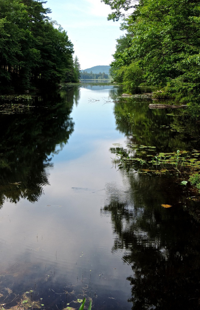
South of the beaver lodge a twisting pickerelweed-lined channel leads a half-mile back into a large open marsh. The barrier of mountains stretches north, from conical Kearsarge North with its firetower looking down on us to The Twins. A few emerging early-afternoon cumulous clouds provided the whipped cream topping on the ridgetops and dazzling reflections in the channel.
Upper Kimball is not a swimming pond as is Lower Kimball, so we splashed each other with water to cool off and headed back to the boat launch, all the while peering left at the phalanx of mountains looking down.
Once we got the canoe secured on our car we headed north for a scenic drive home via Route 113 and Evans Notch. First order of business was a stop at the iconic Ice Cream Store in Stow for you-know-what and sandwiches.
We soon came across a Fork in the Road, yes, a huge fork sticking skyward at the intersection of two gravel driveways adjacent to the Stow Baptist Church. We stopped to check out the bucolic setting of the historic AMC Cold River Camp, vowing to spend some future vacation time here in one of their cozy cabins looking north to the rugged profiles of the Royce and Speckled mountains. Two stops for rejuvenating swims in the large pools of the boulder-lined Wild River happily delayed the homeward trek.
Consult the Delorme Maine Atlas and Gazetteer (map No. 10) for help in getting to the Kimball Ponds area. You only have time to paddle one of the ponds, which one? We won’t take sides, just pick one and enjoy, keeping in mind that one pond is better for swimming and blueberries, the other for boreal bog exploring and timeless seclusion.
Michael Perry is the former director of the L.L.Bean Outdoor Discovery Schools, and founder of Dreams Unlimited, specializing in inspiring outdoor slide programs for civic groups, businesses, and schools. Contact:
michaelj_perry@comcast.net
Send questions/comments to the editors.

Success. Please wait for the page to reload. If the page does not reload within 5 seconds, please refresh the page.
Enter your email and password to access comments.
Hi, to comment on stories you must . This profile is in addition to your subscription and website login.
Already have a commenting profile? .
Invalid username/password.
Please check your email to confirm and complete your registration.
Only subscribers are eligible to post comments. Please subscribe or login first for digital access. Here’s why.
Use the form below to reset your password. When you've submitted your account email, we will send an email with a reset code.