

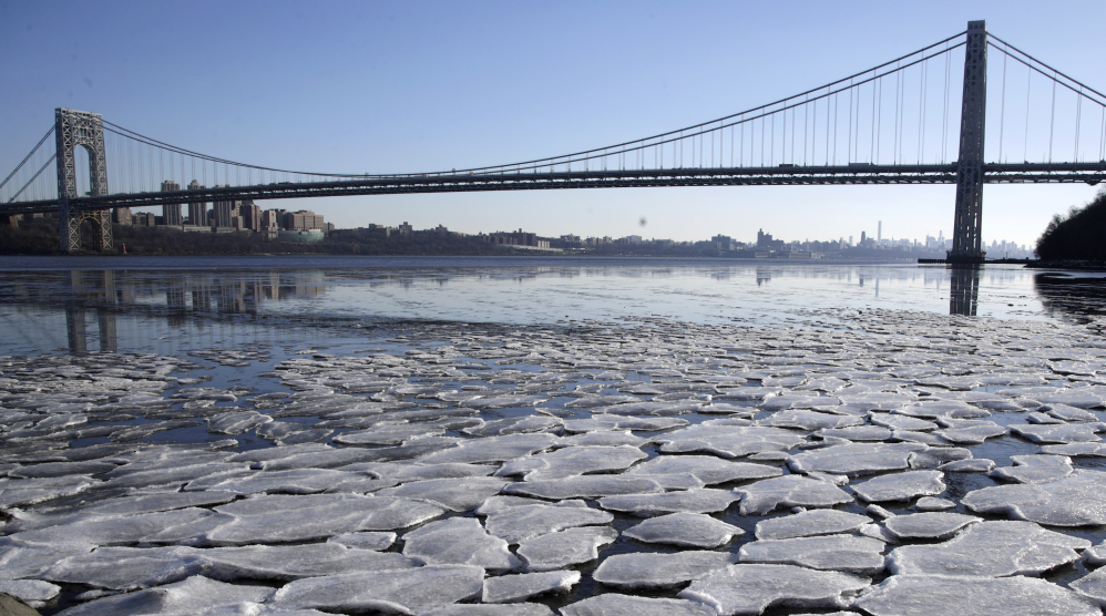
WASHINGTON — Anchorage, Alaska, was warmer Tuesday than Jacksonville, Florida. The weather in the U.S. is that upside down.
That’s because the Arctic’s deeply frigid weather escaped its regular atmospheric jail that traps the worst cold. It then meandered south to the central and eastern United States. And this has been happening more often in recent times, scientists say.
WHY IS IT SO COLD?
Super cold air is normally locked up in the Arctic in the polar vortex, which is a gigantic circular weather pattern around the North Pole. A strong polar vortex keeps that cold air hemmed in.
“Then when it weakens, it causes like a dam to burst,” and the cold air heads south, said Judah Cohen, a winter storm expert for Atmospheric Environmental Research, a private firm outside Boston.
“This is not record-breaking for Canada or Alaska or northern Siberia, it’s just misplaced,” said Cohen, who had forecast a colder than normal winter for much of the U.S.
IS THIS UNUSUAL?
Yes, but more for how long – about 10 days – it has lasted, than how cold it has been. On Tuesday, Boston tied its seven-day record for the most consecutive days at or below 20 degrees that was set exactly 100 years ago.
More than 1,600 daily records for cold were tied or broken in the last week of December, according to the National Oceanic and Atmospheric Administration. For Greg Carbin of the National Weather Service’s Weather Prediction Center, the most meaningful statistics are how last week’s average temperature was the second coldest in more than a century of record-keeping for Minneapolis, Chicago, Detroit and Kansas City, third coldest in Pittsburgh and fifth coldest in New York City.
IS IT JUST THE U.S.?
Pretty much. While the United States has been in the deep freeze, the rest of the globe has been toastier than normal. The globe as a whole was 0.9 degrees warmer than normal Tuesday and the Arctic was more than 6 degrees warmer than normal, according to the University of Maine Climate Change Institute’s analysis.
WHAT MAKES THE VORTEX MOVE?
This is an area of hot debate and research among scientists and probably is a mix of human-caused climate change and natural variability, said Jason Furtado, a University of Oklahoma meteorology professor. Climate change hasn’t made the polar vortex more extreme, but it probably is making it move more, which makes the weather seem more extreme, he said.
A recent study by Potsdam Institute climate scientist Marlene Kretschmer found the polar vortex has weakened and meandered more often since 1990, but that study focused more on Europe. Ongoing research shows that there seems to be a similar connection for more frequent Arctic cold snaps like what the U.S. is now experiencing, Kretschmer said.
HOW CAN IT BE SO COLD WITH GLOBAL WARMING?
Don’t confuse weather – which is a few days or weeks in one region – with climate, which is over years and decades and global. Weather is like a person’s mood, which changes frequently, while climate is like someone’s personality, which is more long-term, Furtado said.
“A few cold days doesn’t disprove climate change,” Furtado said. “That’s just silly. Just like a couple down days on the stock market doesn’t mean the economy is going into the trash.”
Send questions/comments to the editors.

Success. Please wait for the page to reload. If the page does not reload within 5 seconds, please refresh the page.
Enter your email and password to access comments.
Hi, to comment on stories you must . This profile is in addition to your subscription and website login.
Already have a commenting profile? .
Invalid username/password.
Please check your email to confirm and complete your registration.
Only subscribers are eligible to post comments. Please subscribe or login first for digital access. Here’s why.
Use the form below to reset your password. When you've submitted your account email, we will send an email with a reset code.