


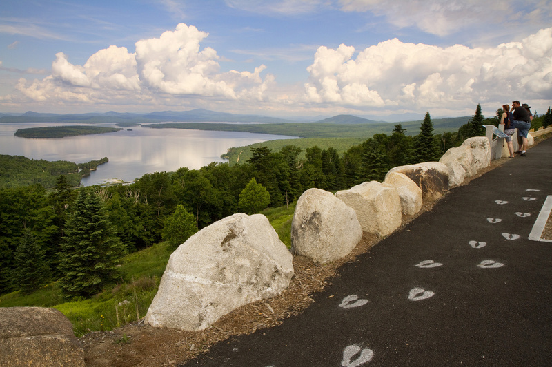
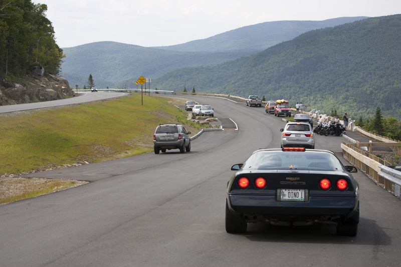
TOWNSHIP D — At least since the Appalachian Trail was rerouted up and over Spruce Mountain in 1975, and probably long before that, the scenic overlook above Mooselookmeguntic Lake has been a sought-out viewing spot. But for years the road that leads to it left motorists with feelings of terror more than the awe and inspiration hikers experience.
“You didn’t get to really see it. It was just a dirt turnoff. You kind of took your life in your hands with the logging traffic if you stopped. When those pulp trucks come through, they’re moving,” said Chuck Bellegarde of Mexico, who was at the overlook last Saturday.
Additional Photos
Now, thanks to federal highway money and the desire at the Rangeley Lakes Heritage Trust, “Height of Land,” as it is known, is being developed into a remarkable outdoor destination, and very soon it will become a place to spend most of a day when the upgrades continue next summer.
The first part of a roughly $4 million project was completed last October when the overlook got a large parking and turnaround area and natural stone benches, as well as information panels about the Appalachian Trail, the watershed and conservation in the region.
But Height of Land is going to get even better when the Trust creates its conservation walkway, a restroom facility, a sitting area, and a 1- to 2-mile trail near the Appalachian Trail next summer.
The “Conservation Walk” will have quotes of conservation leaders on stones and boulders, a tribute to conservation icons past and present in a region of Maine where protected land has created a remarkable, unspoiled landscape.
“I think it will be unique. And Rangeley has become an iconic place for conservation and species that have been protected. This is a way to honor that spirit,” said Nancy Perlson, the Trust’s executive director.
The trust bought the land in 2007 with $379,000 from the Land For Maine’s Future and a $246,000 grant from a settlement agreement related to the licensing of dams on the lake. The Rangeley land trust still must raise $300,000 to pay for the $1.2 million cost of the 500-acre purchase.
But a federal highway appropriation of $2.9 million that the trust applied for was granted to make the scenic overlook safer, and a destination that will help generate economic development in the region, said Rebecca Kurtz, the trust’s scenic byway director. That funding also will pay for the abutting area where motorists can linger.
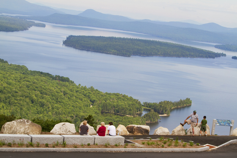
As it is now virtually any time of day, crowds can be found gathering at the Height of Land, where even on a hazy day the view pours over Mooselookmeguntic Lake and Toothaker and Students islands.
On a good day the site lets a visitor travel in their mind over Rangeley and Cupsuptic lakes, west to the White Mountains and east to Saddleback Mountain. Dusk draws locals to see a sky full of shades of purple and orange.
The man who mapped the Appalachian Trail path over Height of Land saw the potential here.
“I picked the spot that came out right there. It’s really a spot I wanted hikers to see. The big problem (used to be) there was no parking. It was not a safe place,” said David Field of Hampden, a 50-year member of the Maine Appalachian Trail committee.
Some of those who stopped at the overlook last weekend didn’t know of the future upgrades and were delighted to find it would become more of a place to spend time.
Last Saturday, Pauline Paladino seemed to be a tourist lucky to hit the overlook on a clear day. In fact, the Paladinos have traveled to Rangeley in the summer and winter for 30 years and always stop here.
“It never gets old. I would like to have a trail, and more of an area to stop, to be able to have a picnic. We love it here,” said Paladino, of Poland.
Cindy Paine of Dixfield, who stopped at the view last weekend, said the spot holds a special meaning, knowing her late father would stop whenever he could.
“My dad was a game warden for 30 years. This was one of his favorite spots. That’s great they’re going to improve it. It’s right in our backyards and we didn’t know,” Paine said.
This love of place is what the trust hoped to create in the upgrades and in the future tribute to conservation that will go there.
“I hope one day it becomes a place people want to get married,” said Bill Pierce, development director at the trust. “To me it’s the same kind of view I can get when I climb Avery Peak, or Saddleback.”
Staff Writer Deirdre Fleming can be contacted at 791-6452 or at:
dfleming@pressherald.com
Twitter: Flemingpph
Send questions/comments to the editors.

Success. Please wait for the page to reload. If the page does not reload within 5 seconds, please refresh the page.
Enter your email and password to access comments.
Hi, to comment on stories you must . This profile is in addition to your subscription and website login.
Already have a commenting profile? .
Invalid username/password.
Please check your email to confirm and complete your registration.
Only subscribers are eligible to post comments. Please subscribe or login first for digital access. Here’s why.
Use the form below to reset your password. When you've submitted your account email, we will send an email with a reset code.