

Bauneg Beg Mountain rises inconspicuously above the rural outskirts of North Berwick in York County. Driving to the main trailhead on Fox Farm Hill Road, the mountain and its three peaks aren’t distinguishable until you’re nearly upon them. Perhaps that’s because it is — incredibly — the only mountain in southern Maine without a communications tower.
The mountain is part of the 89-acre Bauneg Beg Mountain Conservation Area, which is owned and managed by Great Works Regional Land Trust. The trust assembled the preserve from three parcels of land purchased between 2000 and 2001, effectively saving a good chunk of the mountain from potential development.
Additional Photos
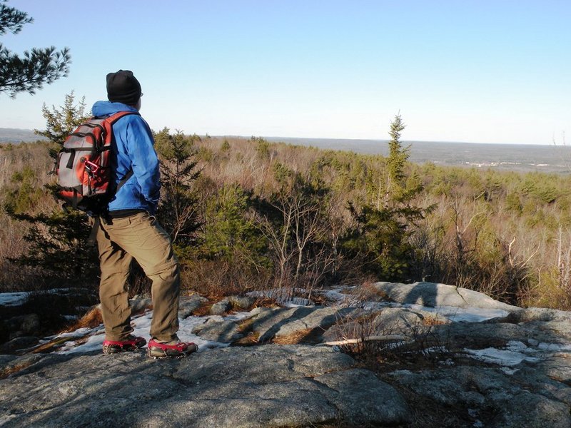
Despite the mountain’s low profile, a 20-minute, half-mile hike via Bauneg Beg Trail (sign, kiosk, trail maps at trailhead parking lot) to the craggy ledges atop 860-foot Middle Peak reveals distant views northwest to Pleasant Mountain and beyond to the jumbled mass of the White Mountains. To the southeast, glimpses of the Atlantic Ocean are possible through the trees.
The trail forks a short distance below the peak in a level area thick with white pines. To the left, Ginny’s Way wends easily up the ridgeline of the summit cone. To the right, the path climbs more directly through Devil’s Den, a rugged area of cliffs and large boulders, before emerging on top.
Just steps from the summit, Tom’s Way diverges left, winding pleasantly downhill through mixed forest to a point on Bauneg Beg Hill Road. It’s entirely worth the 1-mile out-and-back if you’re up for a little extra exploration.
For the descent back to your car at Fox Farm Hill Road, take the scenic loop path over North Peak, with its lovely stone walls and treetop views. The land encompassing North Peak is owned by the Town of North Berwick and nicely complements the Bauneg Beg property.
When you visit the trails of Bauneg Beg, plan to do so at a saunter. Stop often — sit even — to savor the viewpoints and listen to the quiet of the forest. You, too, I trust, will be amazed at this little pocket of wildness just three miles from the heart of busy Sanford.
Interestingly, the south peak of the mountain (on private property just south of trust land) is the site of the former Bauneg Beg Ski Area, which operated from about 1937 to 1945. This small, family-run business featured a 250-foot vertical drop, rope tow, warming hut, and even a slope-side snack bar. The ski hill was resurrected briefly sometime around 2001 and run as Bauneg Beg Ski Trails. More historical information and old photos of this and other “Lost Maine Ski Areas” can be found at www.nelsap.org/me/me.html.
The unusual name of Bauneg Beg (pronounced, as I understand it, like “Bonny Beg”) has caused its share of confusion over time. According to the book, “Mountains of Maine: Intriguing Stories Behind Their Names,” by Steve Pinkham, Bauneg Beg was once thought to be of Scottish origin. But historian Fanny Hardy Eckstorm proved the name to be a derivative of the native Wabanaki word Bannebeaugue, which means “spread out” and “still water.” It is believed to describe Bauneg Beg Pond at the mountain’s eastern base, essentially a part of the Great Works River, which is wide and slow moving.
Great Works Regional Land Trust works primarily in the six-town area of Eliot, South Berwick, Berwick, North Berwick, Wells and Ogunquit. Since its founding in 1986, the trust has managed to protect an impressive 4,812 acres in 92 conservation projects. The trust has a busy calendar of hikes, outings and events that are open to the public, and the support of new members is always welcome! Find out more at www.gwrlt.org or call 646-3604.
Carey Kish of Bowdoin is editor of the 2012 AMC Maine Mountain Guide. Comments are welcome at:
MaineOutdoors@aol.com
Send questions/comments to the editors.

Success. Please wait for the page to reload. If the page does not reload within 5 seconds, please refresh the page.
Enter your email and password to access comments.
Hi, to comment on stories you must . This profile is in addition to your subscription and website login.
Already have a commenting profile? .
Invalid username/password.
Please check your email to confirm and complete your registration.
Only subscribers are eligible to post comments. Please subscribe or login first for digital access. Here’s why.
Use the form below to reset your password. When you've submitted your account email, we will send an email with a reset code.