

– By DAVID ROBINSON
Morning Sentinel
Additional Photos
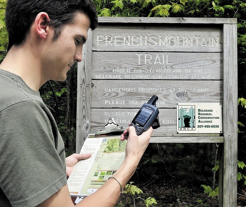
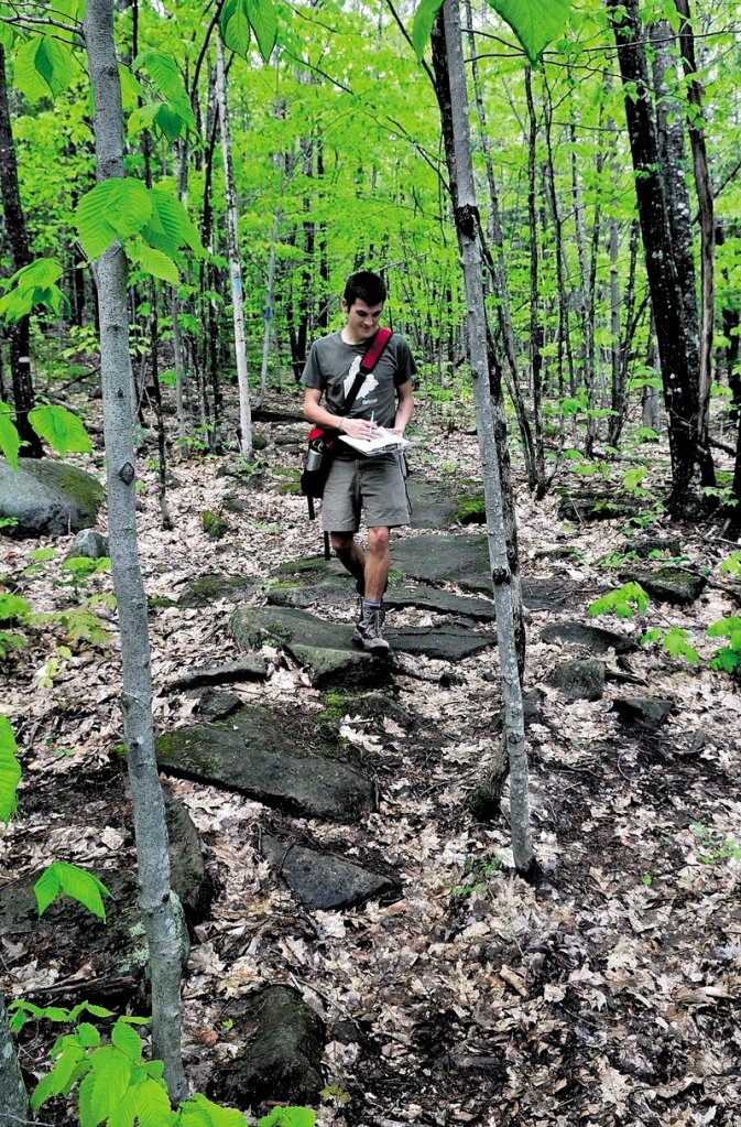
FARMINGTON – Joel Alex always wanted to hike in the Kennebec Highlands, but until last week he just drove by the majestic views.
The 25-year-old, an avid hiker whose job is mapping Maine’s recreational trails, admitted he needed help finding the trail.
“You literally drive by the trailheads to these views off (Route 27) and you’d just never know they were there,” he said the day before his first hike of the highlands in the Belgrade Lakes region.
He heard about the trail while working on the award-winning website MaineTrailFinder.com, which is redefining how people discover Maine’s trail systems.
Alex works with three other people to gather trail features, from global positioning coordinates and landowner permission to photos and hikers’ anecdotes. They work out of an office in Farmington for the Center for Community GIS, which is an acronym for geographic information system, said Alex, of Farmington.
Volunteers, land trusts and other agencies also tell the nonprofit group about trails, and Alex’s hike last week was to check out some tips about the highlands, he said.
Everything they find is put on the website, and people can search the site for trails based on difficulty, location and other features listed alongside maps, current weather and tips on each trail.
MaineTrailFinder.com was recently named the best website in 2010 for finding trails and their features, a category in a national recreational trails’ website competition sponsored by American Trails, a California-based advocacy group.
The Farmington center’s website launched last summer with just 15 trails, all in Franklin County. It has grown to feature 94 of Maine’s more than 1,000 recreational trails, and the group hopes to have 100 trails online by National Trails Day on Saturday.
The project’s goal is to make it easier for people to find, share and promote Maine’s outdoor recreation, said Alex, project coordinator and a Colby College graduate.
“I think it’s got incredible potential to be a great resource for tourism, economic development, land management, conservation and for community health,” he said of the website.
Outdoors’ groups and state agencies have plenty of information about snowmobiling and all-terrain vehicle trails, but a void exists for finding details about trails for hiking, mountain biking, snowshoeing and cross-country skiing, the four uses targeted by the center’s website, Alex said.
“It’s definitely about increasing access. Some of these trails are hidden in plain sight,” he said.
MaineTrailFinder.com has been steadily adding trails over the last year by working with state agencies and other recreational groups, expanding into public and private lands beyond Franklin County.
The nonprofit center in Farmington is a program of the Quebec-Labrador Foundation, an environmental advocacy group for the Northeast.
Ken Gross, a project manager at the Farmington center, said he struggled to find good trails before he started working on the website.
“I’m not from Maine, I’m from Chicago, and when I started here you pretty much had to know somebody who could tell you about the great hikes,” Gross said.
He said the website helped him discover Angel Falls, a 90-foot-high waterfall in Township D south of Rangeley Lake State Park in Franklin County.
“To find a trail like that is kind of difficult and you have to know what road to turn off, and these roads are tough to find,” Gross said.
Now more people, local residents and tourists alike, can find Angel Falls because of the website, Gross said.
Send questions/comments to the editors.

Success. Please wait for the page to reload. If the page does not reload within 5 seconds, please refresh the page.
Enter your email and password to access comments.
Hi, to comment on stories you must . This profile is in addition to your subscription and website login.
Already have a commenting profile? .
Invalid username/password.
Please check your email to confirm and complete your registration.
Only subscribers are eligible to post comments. Please subscribe or login first for digital access. Here’s why.
Use the form below to reset your password. When you've submitted your account email, we will send an email with a reset code.