

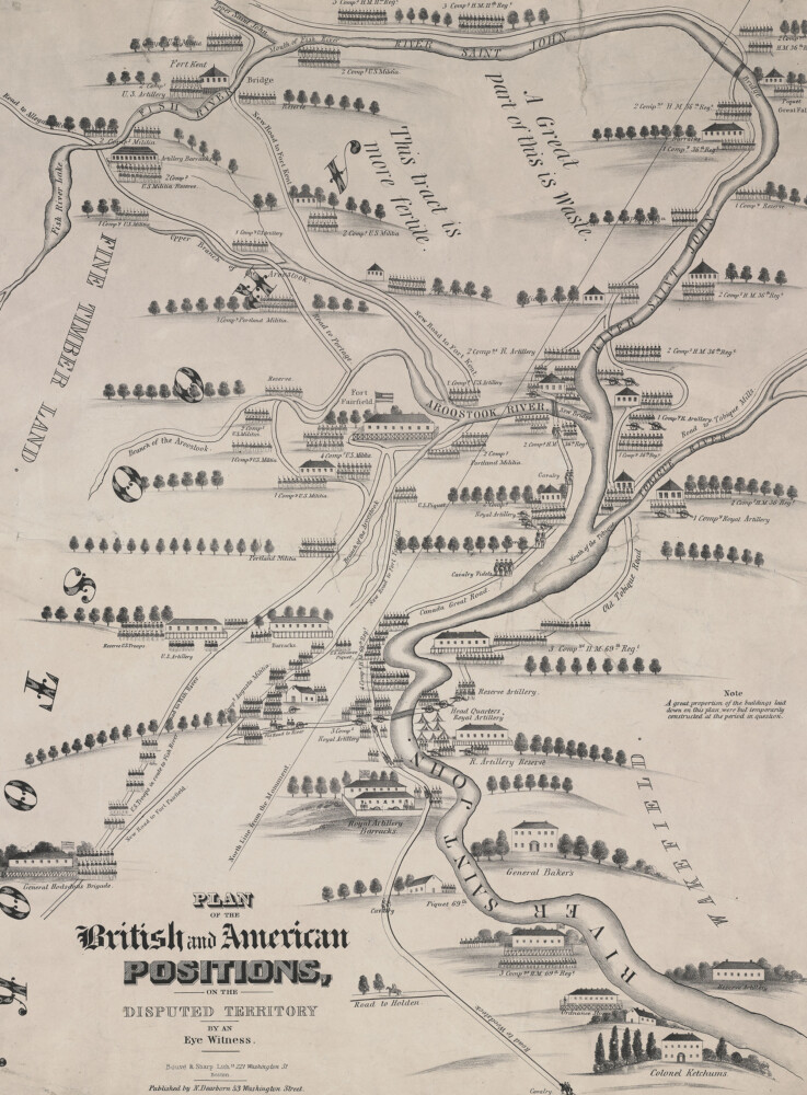
Plan of the British and American Positions, on the Disputed Territory by an eye witness.
Location of individual companies of U.S. Militia and British troops drawn pictorially, plus illustrations of barracks and forts in the Aroostook River Valley, Maine. Map by Nathaniel Dearborn dated 1843.
Courtesy of the Osher Map Library, University of Southern Maine
MeBi
Comments are not available on this story.
Send questions/comments to the editors.
Related Stories

Latest Articles