

When we walk down to Portland’s waterfront, our senses are focused inevitably on the water. The smell of the ocean and the sounds of boats and birds beckon. But the sight of the water is what we yearn for.
Our visual connection to this place is constantly broken by buildings and then re-established through view corridors.
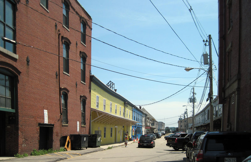
Additional Photos
Views from a distance are balanced by walkways along the water’s edge. This variety of water view experiences is what makes Portland a distinct place.
To answer the question of how to build here, we need not get too complicated. We just need to acknowledge the deep structure formed by history that has worked all along.
A map of Portland in 1690 shows just three roads: one along the shore, Fore Street; one going uphill from that one, now India Street; to one along the ridge, now Congress Street.
By the time Capt. Moet burned the city down in 1775, piers had begun to sprout along the waterfront, a few of them aligned with the streets coming down from the spine of Congress Street.
By 1823, many more piers had sprung up, most of them extensions of the city’s street fabric, coming down from Congress Street, across Middle and Fore and into the harbor.
Starting at the west end and moving east, streets became piers at State, Anne, High, Center, Cotton, Cross, Union (the largest wharf, Union Wharf), Plum, Exchange, Market, Silver, Willow, Deer, Moose, Tyng, King (India), Hancock and Monitor. Tyng Street actually went out into the water as a pier and ended at an “L” intersection over the water with Thames Street’s pier extension.
As the piers grew longer, they began to differ little from the streets on land, with rows of buildings along both sides, except the backs of the buildings were at the water’s edge, where ships tied up. Portland’s street fabric was one of the city running right out into the sea.
The Portland experience was of walking down a street, seeing the water at the end and, toward the end, glimpsing the water on both sides between buildings and realizing you were over the water. Anyone who walked down and between wharfs could experience a myriad of building forms, views, wharf edge depths, sightlines, people and ships.
As with many human-scaled environments, the Industrial Revolution inadvertently erased a large portion of this experience. In 1852, the railroad tracks to Montreal were laid across the wharfs, close to land. The line of tracks became Commercial Street when the water between the tracks and Fore Street was filled in. The crenellated outline of the waterfront was replaced by a monotonous straight one.
Piers still multiplied and grew farther into the harbor while railroad track spurs ran down the piers to expedite the movement of goods. The new tracks divided the waterfront into a city side and a wharf side. You knew if you were over the water or not because you had to cross the tracks first. Mystery and intrigue, essential components of the heightened urban visual and spatial human experience, began to evaporate.
Now, with the trains long gone, we see the gradual restoration of Portland’s street fabric, especially at the east end of the waterfront. Commercial Street has become a sort of Main Street of the waterfront. The Thomas Block, below, at 100 Commercial St., exemplifies the kind of building form we generally enjoy along the water side of that street.
At four stories, it is not too tall; it curves along the sidewalk, forming a wall to enclose the street so that we experience the street as an outdoor public room; and it has storefronts at ground level to engage the pedestrian and provide a sense of safety and activity. We can use the building as a model for development along the water side of Commercial Street.
It is clear that the most crucial aspect of development on the piers is that streets run down the middle of them and imitate the streets of the Old Port. That means sidewalks on both sides, or a totally pedestrian street, and nothing at the end to block the view. Buildings could line both sides to a height of two or three stories, without blocking too much sunshine or overwhelming the feel of the old established building fabric.
Buildings should have to be built to the sidewalk edges, to make them walls to the streets’ hallways. Breaks in the buildings should occur at mandated intervals to allow people to see the ocean and walk to the pier’s long edges from the street, and to break up the potentially long building walls. Such human-scaled, pre-industrial fabric generates the livability we enjoy, and thus attracts the income we depend on.
Since all uses except marine ones can be accommodated anywhere else, it is natural that the ground floors of most space on piers beyond the depth of a Thomas Block-size building be reserved for marine use. Once that space is handed over to nonmarine use, the whole logic of the city begins to fall apart and our sense of place unravels.
We in Portland passed marine-only zoning because we panicked when Chandler’s private condominiums and gated street went up. We instinctively knew that the whole city as a place was at risk.
Seafood restaurants with moderate-income menus like the Porthole and Becky’s feel natural to us on the ground floor, as does a fish market. We interact with the ground floor of a building, which provides us with a sense of place. On the floors above, I’m not sure it makes much difference whether there are restaurants, offices or concert halls.
The exception is residential, which can cause problems when condo owners act naturally territorial. Homes cannot be changed to a different use if the public changes the zoning. There must be a way for property owners to make a deserved profit while the greater good and Portland’s long-term interests are preserved.
If we write zoning to get the street space the way we want and the form of the buildings to create that street space – public space – then Portland will always be the best experience we can get. That means writing a form-based code instead of a function-based code.
Zoning language should emphasize that use requirements may change to accommodate public interest, and that building form requirements will stay. That actually stabilizes owners’ long-term viability, since they can build the form and fill it with whatever use is approved at any point in time.
Finally, the pier edges should be well thought out to allow a certain amount of public strolling. That is easy if an 8-foot strip along the water is open for walking, with exceptions for work such as unloading fish, which would pose a danger to the public. The public could walk along most of the waterfront edge for a magnificent experience, and the piers would lure tenants.
So we see that the solutions to our needs on our waterfront are simple: a street down the middle with no building to block the end view; buildings such as the Thomas Block on Commercial Street, with storefront on the ground floor; a human building height along piers; access to the edges; marine-only ground floors; and buildings on either side that meet the sidewalks.
It is the unique street space that we love in our city. Pier streets have always been Portland’s essence.
Michael Belleau, a fourth-generation Mainer, is principal of Michael Belleau Architect, an architecture and urban planning firm in Portland. He has worked since 1992 on Portland’s urban design issues. He can be reached at www.michaelbelleau.com or his blog: www.mainearchitecture.blogspot.com.
Send questions/comments to the editors.

Success. Please wait for the page to reload. If the page does not reload within 5 seconds, please refresh the page.
Enter your email and password to access comments.
Hi, to comment on stories you must . This profile is in addition to your subscription and website login.
Already have a commenting profile? .
Invalid username/password.
Please check your email to confirm and complete your registration.
Only subscribers are eligible to post comments. Please subscribe or login first for digital access. Here’s why.
Use the form below to reset your password. When you've submitted your account email, we will send an email with a reset code.