

At the northern end of Baxter State Park is the 29,587-acre Scientific Forest Management Area, a wild area of deep woods, lakes, ponds and streams, and not much else besides moose.
It is also the only place in the park where timber harvesting is allowed, per the desires of Percival Baxter, who believed having such an area set aside was in the interest of good forestry science.
Additional Photos
This special area, established in the mid-1950s, was mandated to serve as “a show place for those interested in forestry, a place where a continuing timber crop can be cultivated, harvested and sold — an example and inspiration to others,” wrote Baxter in 1955.
According to Jensen Bissell, director of Baxter State Park, Percival Baxter had a lifelong interest in natural resource management, and was so impressed with the forests he had seen on visits to Sweden, Norway, Finland, Germany, Chile and Russia that he felt Maine could conduct similar sustainable forest management practices.
Despite having existed for more than 50 years, the concept of a professionally managed working forest in the midst of the wilderness of Baxter State Park may still be surprising to some.
I had known about the area for years, it being clearly delineated on park maps, but I’d never visited until a backpacking trip there last October.
So I can attest that any forestry operations will not spoil your hiking experience.
“Hikers may pass through areas of active or recent timber harvesting and at times may hear harvesting equipment, but most hikers have a sense of remoteness, well deserved in this location,” said Bissell.
Another fact that may be not well known is that Baxter State Park is not part of the Maine state parks system, but rather is a large public trust. As such, the park “is independently funded from a combination of trust endowment revenues and fees generated in-house,” explained Bissell. “Revenues from wood products sustainably harvested from the SFMA provide an important component of the park’s revenue stream.”
Jobs are also an important by-product.
“Contractors employed to conduct harvesting and road maintenance have provided steady employment in the region for over 20 years,” Bissell said.
Backpackers seeking an extended backcountry trek can combine the Freezeout Trail with the Frost Pond and Wadleigh Brook Trails for an outstanding 35-mile loop hike, beginning and ending at Trout Brook Farm Campground.
A leisurely five to six days is time enough to soak in the beauty, solitude and history of the area.
“The Freezeout Trail was likely established with the advent of early logging activities,” Bissell said. The area’s “rough logging roads,” like the Freezeout Trail and others, eventually were “recovered by forest and converted to hiking trails. Vehicle access ceased around 1975.”
Remnants of logging days past are visible along the Freezeout Trail, including stretches of corduroy road on the way into Webster Lake and the remains of a Lombard log hauler and tools, cookware and a camp stove along Webster Stream.
The loop hike backpackers enjoy today is relatively new. It’s only in the last 10 years that the park developed the Wadleigh Brook and Frost Pond trails and erected lean-tos at Hudson Pond and Frost Pond en route.
In all, five well-situated lean-tos allow you to travel and camp without a tent, a weight-saving bonus. Each shelter sleeps four persons.
Advance reservations are required, and assure that your group will enjoy plenty of peace and quiet. Canoes are available for use at Frost and Hudson ponds and Webster Lake, so you can paddle about and further enjoy the beauty of each unique spot. Paddles and PFDs hang outside the shelters at each location.
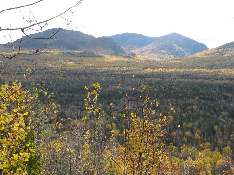
The route is mostly a woods walk through classic northern forest cover types, but good views of the Traveler Mountain complex and Black Cat Mountain near South Branch Pond can be had atop the ridgeline of Wadleigh Mountain.
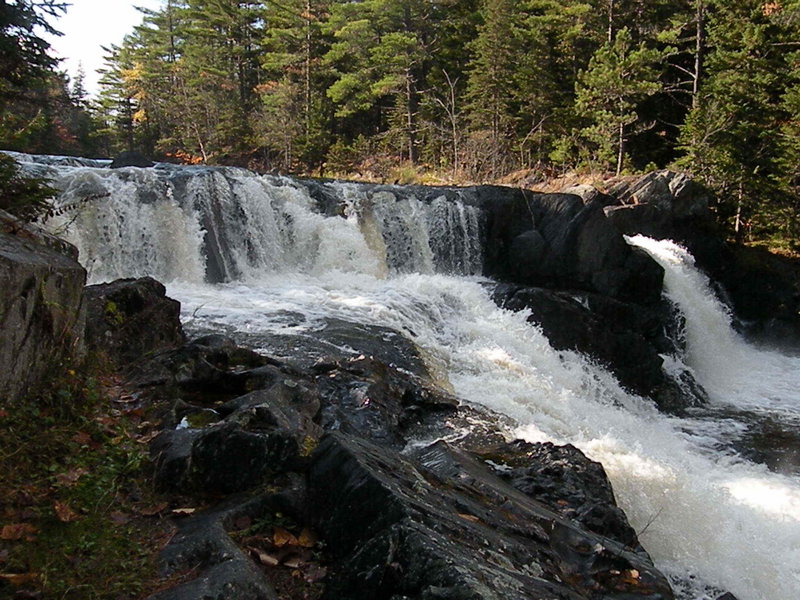
The lakes and ponds encountered along the way are truly delightful, and the walk from Webster Lake to Matagamon Lake, paralleling Webster Stream, is superb, highlighted by the roaring Grand Pitch Falls.
The SMFA is most easily accessed via the Matagamon gate west of Patten. If you have the time, you can also drive the park road through from the Togue Pond gate at the park’s south end, a 43-mile trip resplendent with scenery and wildlife.
Carey Kish of Bowdoin is a freelance writer and avid hiker. Send comments and hike suggestions to:
MaineOutdoors@aol.com
Send questions/comments to the editors.

Success. Please wait for the page to reload. If the page does not reload within 5 seconds, please refresh the page.
Enter your email and password to access comments.
Hi, to comment on stories you must . This profile is in addition to your subscription and website login.
Already have a commenting profile? .
Invalid username/password.
Please check your email to confirm and complete your registration.
Only subscribers are eligible to post comments. Please subscribe or login first for digital access. Here’s why.
Use the form below to reset your password. When you've submitted your account email, we will send an email with a reset code.