

A very dry September is about to have a very wet ending.
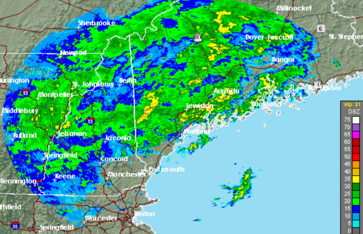
The National Weather Service in Gray has issued a flood watch for inland and coastal areas of Maine as a slow-moving cold front arrives that could bring 4 to 5 inches of rain between Tuesday night and late Wednesday.
“At times, possibly, the rainfall could be torrential,” said Chris Legro, a meteorologist for the weather service.
Legro said that could mean rain falling at a rate of 1 inch per hour. The Portland area is expected to get 3 to 4 inches of rain, while cities to the north, such as Augusta and Lewiston, could get 4 to 5 inches.
That rain, coupled with strong onshore winds and extreme high tides, could lead to flooding and beach erosion on the coast. The weather service issued a flood watch for 2 a.m. Wednesday through 8 a.m. Thursday.
Temperatures, which should reach into the 60-degree range, will make it “feel a little tropical,” Legro said.
Even though small streams and riverbeds are low, the amount of rain expected in a short period could send water over the banks. Localized urban flooding also is possible. On a positive note, the rain could ease or even erase the moderate drought in southwest Maine and recharge wells, following a summer of below-average rainfall.
Just 1.16 inches of rain fell in September through Monday.
CHANCE OF COASTAL FLOODING
A greater concern for the weather service than the local flooding is the potential for coastal flooding during Wednesday’s high tide at 1:14 p.m.
This week’s “supermoon” has brought astronomical tides, with a high tide above 11 feet due Wednesday after 1 p.m. in Portland Harbor. The actual high tide will reach an elevation of 11.6 feet, just four-tenths of a foot from flood stage.
“We’re going to get soaked, no matter where you live. It’s looking pretty unavoidable,” Legro said.
The promise of heavy rain has officials at the Cumberland County Fair considering shutting it down on Wednesday, especially the harness racing and entertainment. Fair President Mike Timmons said he will make a final decision at 8 a.m. Wednesday.
“We won’t do anything that will create a safety hazard,” Timmons said Monday evening. “We’re going to be very cautious.”
The fairgrounds in Cumberland could get flooded if 4 or more inches of rain fall on Wednesday, Timmons said. But he assured children who are in 4-H clubs that their animals will be fed regardless of whether the fairgrounds are closed or remain open.
If Timmons decides to close the gates, it would only be the second time that has happened in the last decade or so.
The Cumberland County Fair got off to a great start on Sunday’s opening day, with more than 10,000 people attending, Timmons said.
‘UNCERTAINTY’ ABOUT JOAQUIN
As rainy conditions ease Thursday, the weather service will be keeping on eye on tropical storm Joaquin, which may be heading toward the East Coast and could bring more rain to Maine over the weekend.
The National Hurricane Center said Joaquin seems to gaining strength with winds reaching speeds up to 65 mph. The Hurricane Center said Joaquin could develop into a hurricane by Wednesday evening.
“Joaquin is still in a holding pattern. There is still a lot of uncertainty about what it is going to do,” Legro said.
Send questions/comments to the editors.

Success. Please wait for the page to reload. If the page does not reload within 5 seconds, please refresh the page.
Enter your email and password to access comments.
Hi, to comment on stories you must . This profile is in addition to your subscription and website login.
Already have a commenting profile? .
Invalid username/password.
Please check your email to confirm and complete your registration.
Only subscribers are eligible to post comments. Please subscribe or login first for digital access. Here’s why.
Use the form below to reset your password. When you've submitted your account email, we will send an email with a reset code.