


BOSTON – A warm start to winter has New Englanders feeling wary as Tuesday’s winter solstice approaches. And who can blame them?
Last winter began much the same way, only to dump a record 9 feet of snow on Boston.
“I’m very concerned,” said Mary Donovan, a Beverly, Massachusetts, resident, as she waited for her train at Boston’s North Station last week wearing a light coat in 50-degree weather. “We had $20,000 worth of damage on our home last year because of ice dams. And there’s no guarantee it won’t happen again. It’s very frustrating.”
Dave Green, who also was in North Station that day, said he’s resigned to another round of painfully long commutes from his home in Carver, near Cape Cod.
“If you look back, there was ’82 and ’83. Back-to-back bad years,” he said with a shrug. “It’s gonna be the same thing.”
Forecasters say the region isn’t due for another winter from hell, but many New Englanders aren’t taking any chances – even though record warmth in the mid-60s is forecast for the Boston area on Christmas Eve.
“People are actually being smart,” quipped Tim Duell, a worker at Manchester Hardware in Manchester, Connecticut, where customers are already loading up on rock salt, heavy-duty shovels and roof rakes.
State officials are also readying to battle the elements as places like Boston; Providence, Rhode Island; and Hartford, Connecticut, are all on pace for their warmest December on record.
In metro Boston, where a creaky transit system virtually ground to a halt during last year’s historic snows, trains are being outfitted with plows, worn third rails are getting replaced and rail switches are getting heaters as part of a five-year, $83 million “winter resiliency” effort.
“We have to prepare for the worst-case scenario at all times,” says Alex Ambrosius, at Rhode Island’s Emergency Management Agency. “It has been so nice and warm, it’s hard to imagine any snow right now. But it’s New England. We’ll get it.”
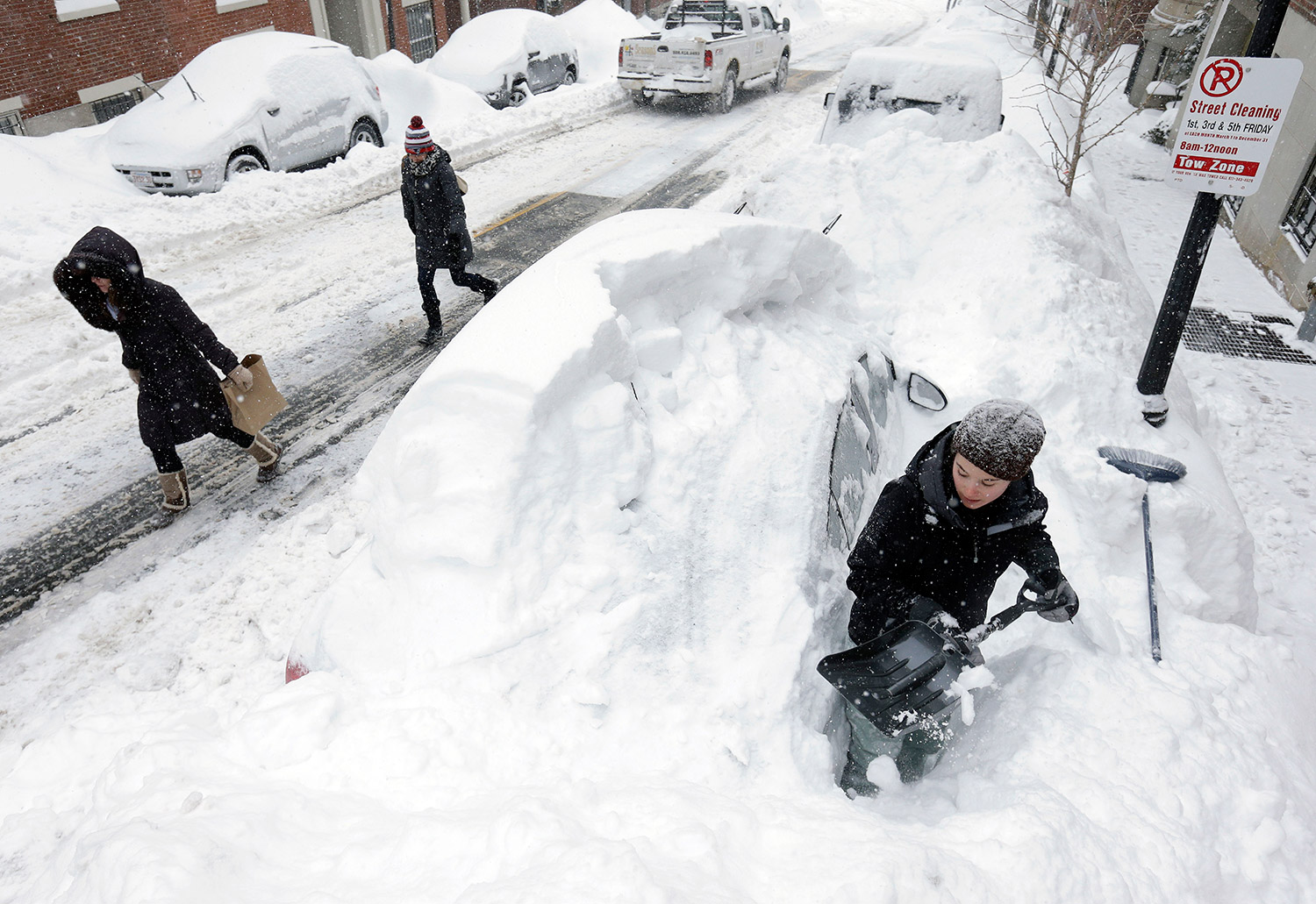
Taylor LaBrecque digs her car out of a snow pile on Beacon Hill last Feb. 9 in Boston.
To be sure, it’s an altogether different concern in the snow and ski country of Vermont, New Hampshire and Maine, where some resorts have suspended operations because there’s simply not enough fresh powder.
“Up here, the snow is our lifeblood,” said Eric Friedman, spokesman at the Mad River Glen ski area in Waitsfield, Vermont. “It’s really been a bummer. We are so chomping at the bit.”
A sign at the base of the mountain reads: “All we REALLY want for Christmas is snow.”
Forecasters predict the northern reaches of New England will still see significant snow, as they do every year.
But a particularly strong El Nino will continue to bring warmer weather to northern and central parts of the country, meaning a good portion of the above-average precipitation expected for New England will fall as rain, rather than snow.
States in the South, meanwhile, are expected to see colder than normal weather and drought-stricken California should see a heavy dose of rain and snow from El Nino.
“I don’t really see a crazy winter for the Boston area,” says Matthew Rosencrans, a meteorologist at the National Oceanic and Atmospheric Administration, in College Park, Maryland. “You’ll get one or two good storms this year that will be all or mostly rain, and that’ll be enough to cut your snowfall total. Having those rains in between the snows totally changes the dynamic.”
Jack Boston, a Wichita, Kansas-based meteorologist for AccuWeather, agreed, predicting the winter, while tempered, will progress much like last year, with a mild start to the New Year followed by colder, inclement weather in late January, a messy February, a few surprise March storms and an early April freeze for good measure.
“The chances of seeing over 100 inches of snow in Boston is pretty slim,” he said, projecting snowfall would be closer to the 50 inches of snow the region typically sees.
But Peter Geiger, editor of Maine’s beloved Farmer’s Almanac, which has relied on a formula of sunspots, moon phases and tidal action to make weather predictions for nearly two centuries, says he’s standing firm on his “winter deja vu” prediction from a few months back.
“It’s been a sluggish start to winter, but it’s January and February that we’re talking about,” he says. “Just like last year.”
Send questions/comments to the editors.

Success. Please wait for the page to reload. If the page does not reload within 5 seconds, please refresh the page.
Enter your email and password to access comments.
Hi, to comment on stories you must . This profile is in addition to your subscription and website login.
Already have a commenting profile? .
Invalid username/password.
Please check your email to confirm and complete your registration.
Only subscribers are eligible to post comments. Please subscribe or login first for digital access. Here’s why.
Use the form below to reset your password. When you've submitted your account email, we will send an email with a reset code.