

Red Brook in Scarborough is on the Maine Department of Environmental Protection’s list of impaired streams due to the degradation of the aquatic habitat from development and man-made alterations to the course of the stream.
That’s why the town has joined together with the Cumberland County Soil & Water Conservation District to create a watershed management plan designed to improve the water quality in the seven-mile brook, which also runs through parts of Gorham and Westbrook.
Using a grant from the federal Environmental Protection Agency, Scarborough has now taken the first in a series of steps that staff hope would restore the brook to a more natural state and improve conditions for insects and fish.
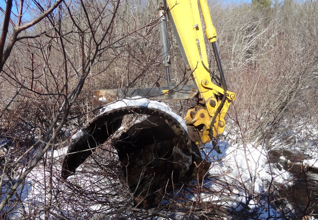
On Jan. 20 the town removed a failing culvert near New Road, which should allow Red Brook to flow more freely, according to Angela Blanchette, Scarborough’s town engineer, who said it’s taken several years for the watershed management plan to come to fruition.
Blanchette said that the headwaters for Red Brook begin on the northerly side of County Road and the stream runs parallel along Route 114 and the I-295 spur, where it enters South Portland and ultimately Clark’s Pond.
She said, in all, the watershed that drains into Red Brook covers more than three square miles in some of the most heavily developed parts of Scarborough, South Portland and Westbrook.
Mike Shaw, Scarborough’s public works director, said the benefit of having a watershed management plan for Red Brook is that it would not only help improve the water quality, but also provide a blueprint that would enable new development and additional stormwater runoff to be managed in a planned way.
Shaw said town staff would be responsible for the bulk of the projects proposed in the watershed management plan because that’s the way Scarborough will provide the necessary matching funds required under the Environmental Protection Agency grant.
He said the culvert the town removed last week, which was located between New Road and Kala Lane, was obstructing the natural flow of Red Brook, which is why it was slated to be taken down as part of the watershed management plan.
Shaw said the overall goal of the watershed project is “to return the stream to a more natural state by removing impediments to flow, such as unneeded culverts or undersized drainage structures.”
He added, “Another goal is to (better) manage development within the watershed boundaries” by giving “prospective developers a good understanding of what they will need to do to meet the stormwater requirements for their given project,” which ultimately saves both time and money.
Blanchette said that under the watershed management plan the town would be completing various additional projects in the watershed within the next year.
Those projects include making upgrades to a stream crossing, making improvements to a stormwater pond in the Payne Road commercial corridor and providing stormwater treatment of road runoff for an upcoming project on Spring Street.
She said, “It should also be noted that the town is being proactive within other watersheds that are at risk through development.”
For instance, Blanchette said, “We have just received another (Environmental Protection Agency) grant for the development of the Phillips Brook Watershed Management Plan.”
Phillips Brook is located near Dunstan Corner, to the northwest of Route 1, and the new management plan is scheduled for completion by the end of 2017, according to Blanchette.
In terms of the partnership between Scarborough and the Cumberland County Soil and Water Conservation District, Jodie Keene, the district’s municipal outreach coordinator, said, “(We) continue to be impressed by the town’s unwavering dedication to clean water.
“Scarborough has proven (to be) an enthusiastic and effective partner with a clear, long-term vision for not only maintaining clean water but also improving water quality in our region, and their efforts do not stop with Red Brook.”
Keene also mentioned the work being put into creating a watershed management plan for Phillips Brook, which she said would “provide a road map to protect and improve that stream.”
 Red Brook culvert removal
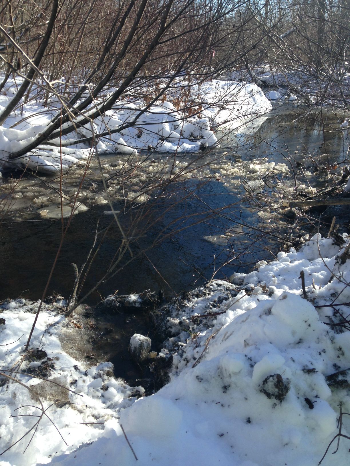 Red Brook in Scarborough is running more freely now that the town has removed an old culvert that was blocking the stream. Taking down the culvert was the first step in the town’s watershed management plan for the brook.
Send questions/comments to the editors.

Success. Please wait for the page to reload. If the page does not reload within 5 seconds, please refresh the page.
Enter your email and password to access comments.
Hi, to comment on stories you must . This profile is in addition to your subscription and website login.
Already have a commenting profile? .
Invalid username/password.
Please check your email to confirm and complete your registration.
Only subscribers are eligible to post comments. Please subscribe or login first for digital access. Here’s why.
Use the form below to reset your password. When you've submitted your account email, we will send an email with a reset code.