


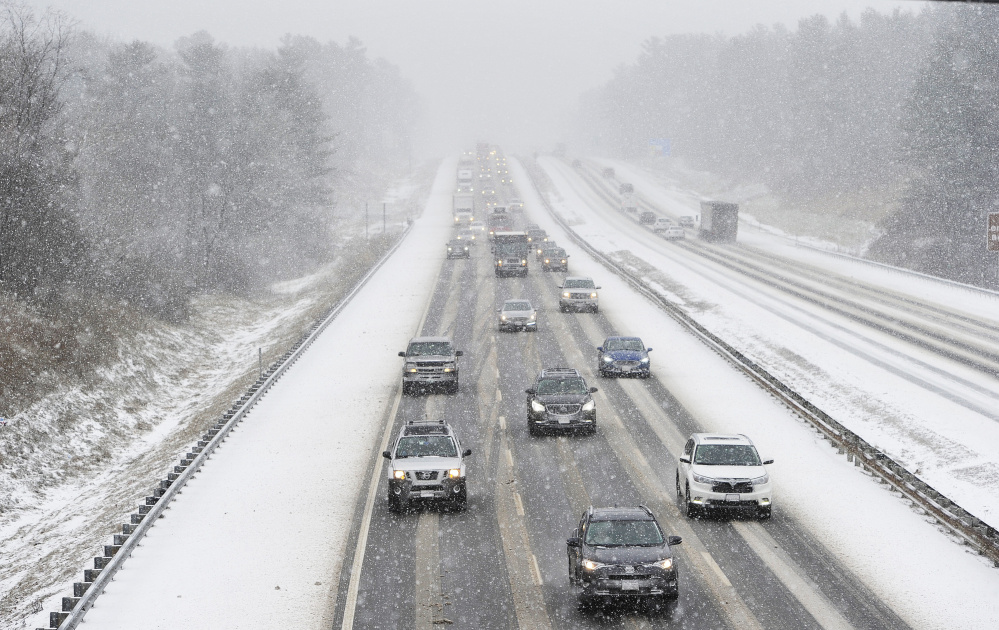
Drivers navigate a slick stretch of the Maine Turnpike in Saco on Thursday as a winter storm brings the first significant snowfall to parts of southern Maine. The speed limit was reduced to 45 mph for the highway’s entire length. Shawn Patrick Ouellette/Staff Photographer
A nor’easter blew into Maine on Thursday, bringing heavy snowfall to western and northern parts of the state and drenching rain along the coast that turned to snow in Portland around 9 p.m. and was expected to deposit about 4 inches in the city by Friday morning.
While it was raining along the coast Thursday night, some York County towns only 10 miles inland had received significant snowfall. Hollis was reporting 11.8 inches as of 8 p.m., and Sanford and Acton had gotten 8.1 inches, said Chris Kimble, a forecaster with the National Weather Service in Gray.
The storm also was expected to pack heavy wind gusts that could cause power outages. As of 11:25 p.m., Central Maine Power Co. was reporting 8,538 outages, with 3,030 in Cumberland County and 1,698 in York County.
The storm brought some joy to Maine’s largest ski resorts. Sunday River in Newry, Shawnee Peak in Bridgton, and Sugarloaf in Carrabasett Valley were reporting large crowds and lots of snow.
“It’s still snowing really hard. We love it,” said Ethan Austin, a spokesman for Sugarloaf. The resort had received 5 inches of snow by 7 p.m. and forecasters said it would continue through the night and into Friday. “The timing of the storm was ideal. For this much snow during a school vacation week. It’s just awesome.”
Sunday River in Oxford County reported that lodging availability for the New Year’s Day weekend, much like Sugarloaf, was nearly at capacity. And the snow was coming down Thursday night at a rapid clip, Sunday River spokeswoman Darcy Lambert said.
“There is no sign of it letting up anytime soon,” said Lambert, who said the base had received 6 inches of new snow. “We want to see as much snow as possible.”
Shawnee Peak in Bridgton posted a message on its website that read, “It’s officially dumping out there. We have received 5 inches of fresh new snow. It’s epic.”
‘NO BIGGIE,’ BUT IT ISN’T OVER
A dispatcher for the Oxford County communications center in South Paris said it was snowing hard Thursday evening. She cautioned drivers to stay off roads if possible.
Augusta police tried to cheer people up as the storm swept through the region by posting a positive message on the department’s Facebook page.
“Everyone knows about the nor’easter that’s coming to dump a lot of snow on us. Please don’t panic! It’s snow, this is December, and we are Mainers. It’s no biggie,” Augusta police wrote.
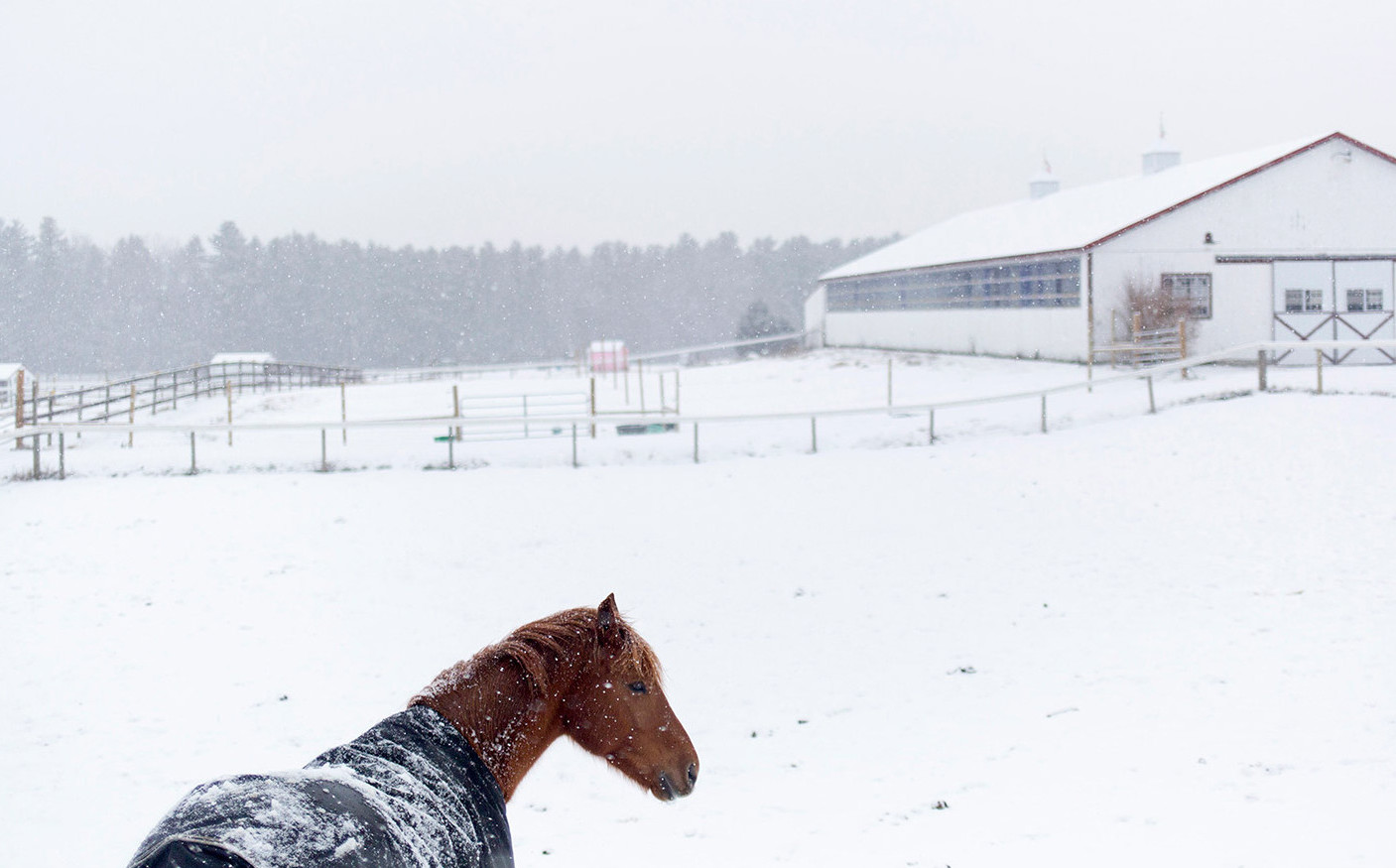
A horse covered in a blanket roams in a snowy field Thursday at Rummler Run Farm in Buxton. Brianna Soukup/Staff Photographer
The weather service in Gray said the storm did shift to the east more than anticipated, which left York County towns dealing with heavy snow while Lewiston, which was forecast to receive 12 inches of snow, only got 3.5 inches.
Kimble said Hollis could end up receiving 16 inches.
“They’re reporting snow falling at the rate of 5 inches an hour,” Kimble said Thursday night. “That’s definitely not normal.”
When it snows that hard and fast, the friction in the upper atmosphere can lead to thunder and lightning. Kimble said so-called “thunder snow” was being reported in northeastern parts of Massachusetts. He said Mainers could see some thunder snow as the storm moved deeper into the state.
Portland was in line to see some heavy snowfall overnight. Kimble said the Portland International Jetport reported getting 1.2 inches during the day, but the overnight snowfall could increase that amount by as much as 4 inches. Freezing rain and rain, which started in Portland around 5 p.m., significantly reduced the city’s snowfall accumulation.
By Friday morning, the snow will have ended and the skies will slowly begin to clear during the day, Kimble said.
Strong wind gusts were forecast to start after the snow ends. Portland could experience wind gusts up to 50 mph early Friday morning, causing more power outages, Kimble said.
CMP spokesman John Carroll said crews were bracing for the worst and reinforcements were called in from Canada, Connecticut and New York state. Crews were prepared to hit the ground running at 5 a.m. Friday. Carroll said CMP brought in 125 contract crews and had 100 tree crews standing by.
“The forecast that we’ve seen is really for a mixed bag, so several aspects of it will be difficult,” Carroll said. “There’s going to be a band of some pretty wet, heavy snow, and that is going to cause problems with trees and limbs. Along the coast we’re also expecting some pretty high winds – gusts into the 50s.”
In Waterville, Mark Turner, the city’s director of Public Works, said his 13 trucks and crews went on duty at 7 a.m. He said crews would remain on duty all night if necessary.

Wayne Hutchins, 78, of Dayton scrapes a layer of light snow from his driveway Thursday afternoon. The storm is expected to end by Friday morning, with skies gradually clearing throughout the day. Shawn Patrick Ouellette/Staff Photographer
“We’ll stay right through the night if we have to,” Turner said.
At the Department of Public Works in Augusta, Director Lesley Jones said her department will stay on the job for as long as it takes.
“We’re ready to tackle whatever we get for snow, rain,” Jones said. “We’re geared up for 5 or 10 inches of whatever Mother Nature brings us.”
PLOWS DEPLOYED IN FORCE
Earlier Thursday in Portland, 11 trucks were out sanding and salting main and residential roads, according to Steve Earley, operations manager for Portland Public Works.
Earley said his department will deploy at least 20 trucks after 11 p.m. to start plowing with more standing by in case they’re needed.
“It’s a tricky little storm,” Earley said. “It’s not doing anything like what they said so we’ll just stay with it.”
Officials in Brunswick issued a parking ban from 12 a.m. to 7 a.m. for all streets and municipal lots.
Speed limits on the Maine turnpike were reduced during the day Thursday to 45 mph at the request of Maine State Police. Multiple cars were reported sliding off the road Thursday morning, according to Rebecca Grover, spokeswoman for the turnpike authority.
A box truck traveling northbound Thursday afternoon slid into the median in the York/Wells area, briefly blocking the left lane before being cleared, Grover said. Another northbound crash in Wells also was cleared.
Grover urged drivers to slow down to prevent accidents. Turnpike commuters can tune in to 1610AM or Maine Turnpike Facebook or Twitter feeds for traffic updates.
The Maine Department of Transportation treated roads Thursday morning in preparation for the storm and will have up to 350 trucks deployed across the state as the storm unfolds, said Ted Talbot, department spokesman.
“We’d just like to remind folks to let the plows do what they need to do and give them plenty of room,” Talbot said. “The road behind the plow is a lot better than the road in front of it.”
Press Herald Staff Writer Kate McCormick and Morning Sentinel Staff Writer Doug Harlow contributed to this report.
Copy the Story Link
Send questions/comments to the editors.

Success. Please wait for the page to reload. If the page does not reload within 5 seconds, please refresh the page.
Enter your email and password to access comments.
Hi, to comment on stories you must . This profile is in addition to your subscription and website login.
Already have a commenting profile? .
Invalid username/password.
Please check your email to confirm and complete your registration.
Only subscribers are eligible to post comments. Please subscribe or login first for digital access. Here’s why.
Use the form below to reset your password. When you've submitted your account email, we will send an email with a reset code.