
We’re a day closer to the storm and its impacts are coming into focus. Coastal flooding and erosion continue to be the most concerning threat for Maine.
RAIN AND SNOW
Snow showers will move through the foothills and mountains Friday, with minimal accumulation. In southern Maine, especially in York and Cumberland counties, periods of rain and downpours will move through. In these areas, an inch or more of rain is possible.
There will be even heavier rain in southern New England, where a few inches of rain may cause flooding of rivers and streams.
Late Friday, there may be a switch from rain to wet snow in part of the area. This is the most difficult part of the forecast. It’s most likely to happen in New Hampshire and central Massachusetts, where higher elevations should receive several inches of heavy, wet snow.
COASTAL FLOODING AND EROSION
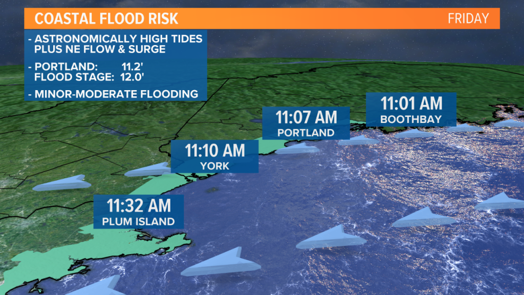
As we’ve discussed for days, the combination of the storm and high astronomical tides will produce flooding.
The water levels may be similar to the Jan. 4 blizzard, which swamped harbors and roads from the midcoast to York County.
At least three high tides pose flood risks: Friday midday, Friday night and Saturday midday.
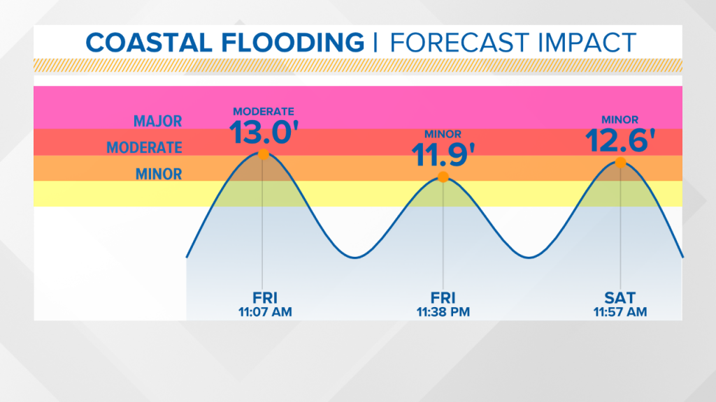
A storm surge of 2-3 feet is possible. This means moderate flooding is likely, especially during the midday Friday high tide.
The National Weather Service says pockets of major flooding cannot be ruled out, especially in York County and on the seacoast of New Hampshire.
Major flooding is likely in northeast Massachusetts, more exposed to the northeasterly fetch.
The most vulnerable homes along our southwestern coast should be secured and watched carefully.
In addition to the tidal flooding, pounding surf will cause significant splashover and erosion through Sunday, as the storm slowly pulls away.
WIND
A high-wind watch has been issued for eastern York County, where the risk for northeasterly gusts to 55 mph is highest.
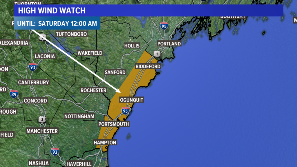
The rest of the coast will see gusts between 40 and 50 mph. Power outages are most likely in southwestern Maine, but possible along the entire coast.
Follow our updates on-air and online as the storm approaches.
Comments are no longer available on this story