

As a resident of Yarmouth, I’ve long availed myself of the many walking and hiking trails preserved by the Royal River Conservation Trust.
The RRCT, which grew out of the Friends of the Royal River, and four local land trusts in Yarmouth, Pownal, North Yarmouth and New Gloucester, is now in its 30th year. Owners of 11 preserves totaling nearly 500 acres, and holder or steward of nearly 3,000 acres of private and municipal land in eight towns, the organization has protected far more land than many locals will ever explore.
To that end I recently realized that while I’ve got a good sense of the lands around me in Yarmouth, I’ve done little exploring on nearby Cousins and Littlejohn Islands. I remedied that by exploring the spectacular Littlejohn Island Preserve, as well as other lands on neighboring Cousins.
To reach the Littlejohn Preserve Island Preserve by car, simply follow Gilman Road from Yarmouth onto Cousins Island. A mile after reaching the island, a left onto Talbot Road carries you over to Littlejohn. A left onto Pemasong Lane leads to the small public parking lot for the Preserve, consisting of four parking spots.
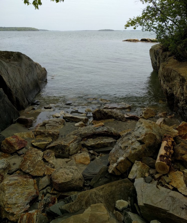
From the parking lot, a short walk down the gravel Pemasong Lane takes hikers to the preserve proper– a roughly mile-long loop with views to Chebeague, Little Mosier, Lanes and Cousins islands. The 26-acre preserve is a gem, with flat and easy hiking along the coast over wooden plank bridges and a bed of wood chips. Spur trails lead to a number of small rocky beaches, and stretches of rough sand and seagrass.
With only four spaces in the small parking lot for the popular preserve, getting a spot can be tricky. This is particularly true on weekends, even during the winter. As there’s no parking permitted on the shoulders or private driveways, your options for visiting the Littlejohn Island Preserve on busy days can be slim.
Small parking lots at the Cousins-Littlejohn causeway (about a mile from the preserve) can be used, as can the lot about two miles away at Sandy Point Beach.
The latter gives hikers the opportunity to follow the West Side Trail on Cousins Island to Talbot Road, and then follow the roads from there. (The West Side Trail can actually be taken from a trailhead near Tyler Technologies on Route 1, for the truly ambitious cyclists and hikers.)
Bikers can also ride into the Littlejohn Preserve even when the lot is full – there’s bike parking at the waystation where the hiking trail leaves Pemasong Lane.
If navigating the limited parking seems too much of a hassle, other nearby trails present options. On neighboring Cousins Island, the 15-acre Tinker Preserve offers a chance to meander through oak, pine and other shrubs. Small open fields provide limited vistas, and a cemetery, stone walls and artifacts of the original home and barn on the property remain. (Unlike many other island preserves, there are no water views).
Created via a donation to The Nature Conservancy nearly 50 years ago, the parcel serves as both a sanctuary for plant and animal life, and as an educational resource.
About a half-mile of trails wind through the preserve, flat and easy to navigate. Currently there’s a “Story Walk” installation along the trail – signs featuring pages from Olive Wadsworth and Ezra Jack Keats’ Over In The Meadow, which share the story of the book and encourage trailside activities for children (and adults) like jumping jacks.
Also on Cousins, the Sandy Point Beach and Camp SOCI at the island’s north end offer ample room to explore – and one of the few sandy public beaches on this stretch of the coast. A parking lot at the end of Snodgrass Bridge (on Cousins Street) has plenty of room even on busy days, and provides access to both spaces. From the parking lot, a short path provides access to the beach.
While the beach is small at high tide, low tide exposes a long sandbar that extends into the Atlantic, and a shallow slope to the beach allows lots of room to wade out and swim. As an added bonus, the relatively gentle slant means that the water warms quickly, providing some relief from the usual chill of the Atlantic. Popular to beachgoers, Sandy Point is also a great launching point for canoes and kayaks.
Across the road from the parking lot, a short trail leads to Camp SOCI (Scouts Of Cousins Island) alongside a bluff overlooking the shore. A stairway at the end of the trail leads back down to the water, and you can easily walk the shoreline under the bridge and power lines back to Sandy Point Beach. The shore below Camp SOCI is classic New England rocks and seaweed, rather than sandy, but provides a pleasant spot for bird watching or a picnic.
At the end of Madeleine Point Road, on Cousins’ western shore, Madeleine Point abuts the land of the Wyman Station power plant.
While there’s a public dock and mooring area on the point, the real appeal for visitors is a small beach.
It’s a popular picnic spot, and gives great views of the shores of Cumberland and Falmouth to the west.
Most of the lands discussed in this piece are protected and maintained by either Yarmouth Community Services or the Royal River Conservation Trust. You can find more information about these and other public spaces, including trail maps and guides, at YarmouthCommunityServices.org and RRCT.org.
Josh Christie is a freelance writer living in Portland. Along with his brother, Jake, he writes about great Maine destinations for outdoors enthusiasts. Josh can be reached at:
joshua.j.christie@gmail.com
Send questions/comments to the editors.

Success. Please wait for the page to reload. If the page does not reload within 5 seconds, please refresh the page.
Enter your email and password to access comments.
Hi, to comment on stories you must . This profile is in addition to your subscription and website login.
Already have a commenting profile? .
Invalid username/password.
Please check your email to confirm and complete your registration.
Only subscribers are eligible to post comments. Please subscribe or login first for digital access. Here’s why.
Use the form below to reset your password. When you've submitted your account email, we will send an email with a reset code.