

Four tropical cyclones are swirling in the Pacific Ocean this week, at least one of which is a significant threat to land.
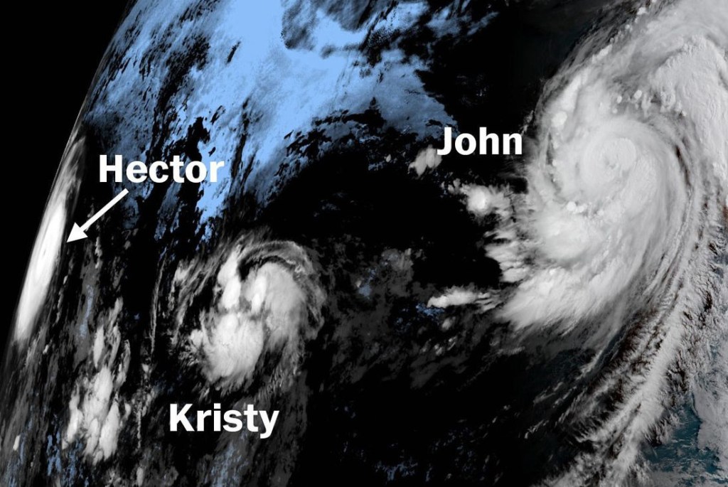
The most interesting of these is Hurricane Hector, which on Monday had a maximum wind speed just 1 mph short of Category 5. The storm is east of Hawaii and tracking west, but is expected to slide just south of the island chain Wednesday and Thursday. Forecasters are cautiously optimistic, but note that slight changes in Hector’s track could put Hawaii at greater risk.
On the other side of the Pacific, Typhoon Shanshan is approaching Japan with maximum winds around 100 mph. When it reachs northeast Japan on Wednesday, forecasters say more than a foot of rain is possible over 48 hours.
Closer to the U.S. mainland, Hurricane John is strengthening in bathlike ocean water south of the Baja Peninsula. Forecasters at the National Hurricane Center expect John to strengthen to 120 mph, or Category 3, on Wednesday morning.
The last – and weakest – cyclone in the Pacific is Tropical Storm Kristy, which is no threat to land.
Send questions/comments to the editors.

Success. Please wait for the page to reload. If the page does not reload within 5 seconds, please refresh the page.
Enter your email and password to access comments.
Hi, to comment on stories you must . This profile is in addition to your subscription and website login.
Already have a commenting profile? .
Invalid username/password.
Please check your email to confirm and complete your registration.
Only subscribers are eligible to post comments. Please subscribe or login first for digital access. Here’s why.
Use the form below to reset your password. When you've submitted your account email, we will send an email with a reset code.