


When you’re climbing a mountain, eight-tenths of a mile seems a lot more like 3. But when you’re that close to the summit, you have no choice but to continue to put one foot in front of the other until that summit sign you’ve been hoping to see since Mile 2 of a 41/2-mile trek comes into view.
Then comes the adrenaline that pushes you to the top, where all focus turns to the summit photos that will prove to all your Facebook followers that you really did scale all 14 of Maine’s 4,000-foot mountains.
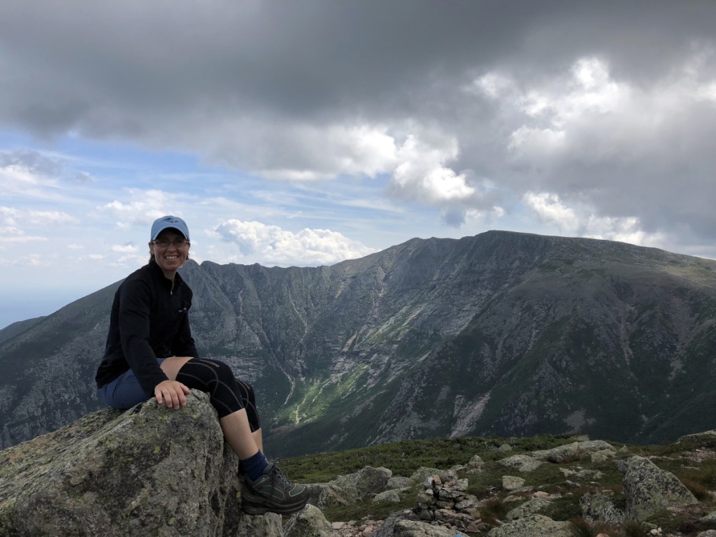
My wife, Margo Batchelder, and I completed the list on July 31 at the top of North Brother Mountain (4,151 feet) in Baxter State Park. Perched in the north country far from the more popular peaks of Mt. Katahdin, North Brother was a fitting summit to finish with because it mirrored our quest in that we felt we would never get there.
WE’LL NEVER GET THERE
The journey that resulted in 55,329 feet of mountains began on July 15, 2017 at Old Speck (4,170 feet) in Grafton Notch. With a moderate 7.6-mile route that mostly follows the Appalachian Trail, it was the perfect starting spot for a couple 50-plus-year-olds. The reward was the 360-degree views of the White Mountains and Speck Pond from the old summit tower.
Before Old Speck, we had done plenty of hiking, but when we traipsed around Pleasant Mountain or the Camden Hills we didn’t pay much attention to elevation. After Old Speck, Margo added a hike of Katahdin to her bucket list. Why not knock of 13 more 4,000-plus mountains on the way there?
It took nine hikes and parts of two summers, but we completed the list and learned a little bit while we were at it.
Saddleback in Rangeley was the second 4,000-footer we tackled. Because of our lack of experience with mileage that goes up instead of around flat ground, mistakes were made.
The trail map showed 5.7 miles along the AT. How long could that take?
A very long time.
We hit the ledge and figured the summit was just over the next rise. It wasn’t.
The next one, for sure. Nope.
By the time we hit the true summit and spotted Saddleback Horn 1.7 miles away we were worried about daylight. We headed back down the trail knowing we’d have to make another trip for the Horn.
HEAD LAMPS and RAIN PONCHOS
We made up for it on the next excursion, getting South Crocker, Mount Redington and Crocker Moutain in what was supposed to be an 8.6-mile trek in Carrabassett Valley.
Supposed to be.
The lesson? Be prepared for everything.
One missed turn for the bushwhack to Redington had us struggling for about a mile along the rugged Boundary Trail, which the trail guide clearly stated “is not meant for hikers.” Retracing our steps added two miles to our distance. That wouldn’t have been a big deal if it hadn’t started raining before we reached our third summit. We descended 3.1 miles in a downpour to arrive at our car soaked and shivering (in August!) as night fell. We never again hiked without extra water, headlamps, rain ponchos, a first aid kit and Mylar blankets.
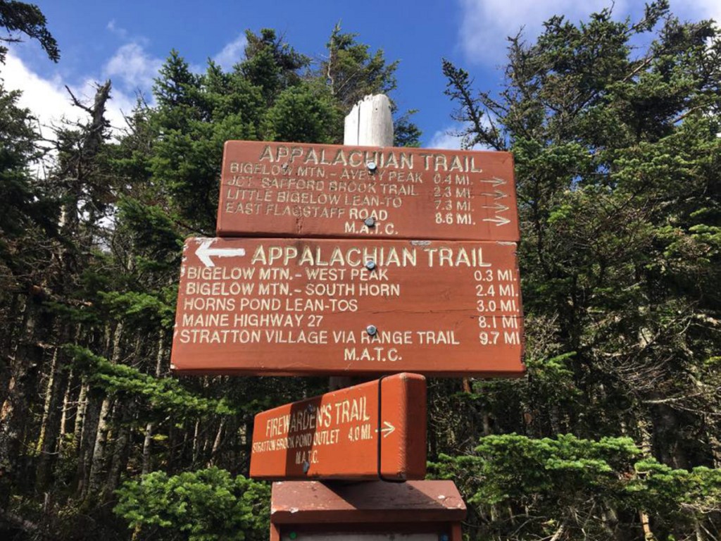
We waited two weeks to get the Bigelows – West and Avery. The trail started with postcard-worthy pictures at Stratton Brook Pond but the final 11/2 miles was like going up 200 flights of stairs. Twice. As we were struggling along we ran into Isadora Diamond Dubinski, ultra dog, and her parents. The trio from New Hampshire was going for 67 (climbing all of new England’s 4,000-footers) and Isadora was leading the way.
When we hit the summit we saw why Isadora was such a happy dog. The views of Flagstaff Lake were made even more incredible as fog and wispy clouds swirled across the summit.
BEEN THERE …
We loved the hikes but we hated the driving.
Too bad.
We were off to Carrabassett Valley again, this time to get Maine’s third highest mountain, Sugarloaf (4,237), and Spaulding Mountain. Not quite as pretty as the Bigelows. The views on Sugarloaf included a pair of mountain-top cell towers. The summit sign for Spaulding was nailed to a tree. Zero views.
That’s where the 4,000-footers quest left off for 2017. But when Memorial Day arrived this year we were back in Rangeley, getting Saddleback Horn, the 10th peak. Another lesson learned: ski trails are pretty easy on the way up, but coming down is agony. Sure we saved several miles, but the descent of the Grey Ghost ski trail was mostly a straight-down jog. The legs didn’t work quite right for several days.
Next up, Mount Abraham where the trailhead was down several miles of rocky, unpaved, washed out roads. (Note to self: Never again do this in a Mazda Miata convertible.) Climbing the 4-mile Fire Warden’s Trail – which included a half-mile of bouldering before the summit – was less painful than the drive. And there was plenty to see at the top, including a hidden rock shelter, a fallen fire tower and a crowd of hikers taking photos. It was June 9 but the wind was frigid so we got our selfies and headed down knowing all we needed was a trip to Baxter State Park.
OH YES WE DID!
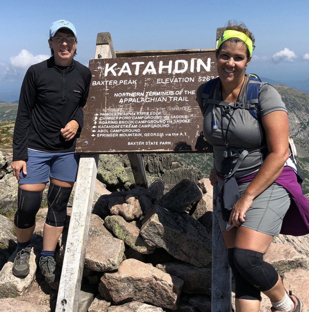
When we told people we planned to bag both Baxter Peak (5,268) and Hamlin Peak (4,756) on Mt. Katahdin on the same day, most looked at us kind of funny. When we told them we planned to do North Brother (4,151) two days later they changed the subject.
Take that, nonbelievers.
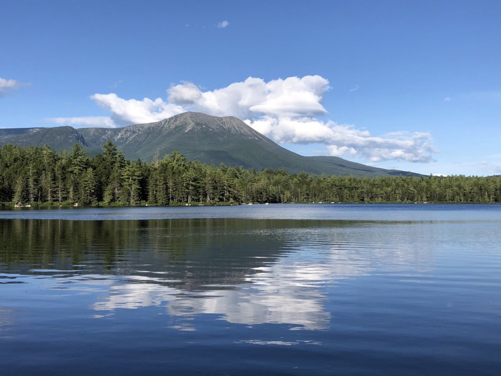
Knowing we needed to be in the park early, we stayed at Daicey Pond Campground the night before our trek. And there was Katahdin, rising up behind the pond into a clear blue sky.
No blue sky could be seen at 4:30 a.m. when we headed out for the hour-long drive to Roaring Brook Campground and the Chimney Pond Trail. We geared up and checked in at the ranger station at 5:41 a.m.
It took six hours to climb to Chimney Pond, then up Saddle Trail and on to the Baxter summit, but it seemed like no time at all before we were posing next to the sign on Maine’s biggest mountain. We wanted to linger over our PB&Js but we still had a two-mile traverse to bag Hamlin.
As every other hiker headed back down but we continued on for a second summit, taking in the stunning views of Baxter across the Chimney Pond basin.
A ranger had suggested we come down Hamlin Ridge Trail, known as “Mini Knife’s Edge,” if we had the time. It was difficult and technical and added about two hours to our hike. It was also amazing. We navigated over and around huge boulders along a 5-foot-wide trail that connects the two basins. To our left we could see a pair of black bears wandering far below.
We hit the Roaring Brook ranger station at 5:40 p.m., 11 hours and 59 minutes after our hike began. (And we were damn proud to come in under 12.)
Maybe it was the Clif Bars or the PB&J, but we decided we didn’t need a rest day, so 17 hours after getting off a trail, we were back on another.
One hour after that the humidity made us think we’d made yet another mistake, but we did that one-foot-in-front-of-the-other thing for about 41/2 miles of switchbacks, through thick woods and up a river bed. We finally earned us a view of the summit sign. We touched it, then immediately commenced with the selfies.
Alone at the top, we ate yet another PB&J, then prepared to make one a final descent.
That’s when we remembered we had brought a sign: “WE DID ALL 14.”
So what if in every selfie it actually says “41 LLA DID EW?” Our Facebook friends got the message.
Karen Beaudoin is director of digital content platforms for MaineToday Media. You can follow the intrepid hikers on Facebook at:
Adventures with Margo and Karen
Copy the Story LinkSend questions/comments to the editors.

Success. Please wait for the page to reload. If the page does not reload within 5 seconds, please refresh the page.
Enter your email and password to access comments.
Hi, to comment on stories you must . This profile is in addition to your subscription and website login.
Already have a commenting profile? .
Invalid username/password.
Please check your email to confirm and complete your registration.
Only subscribers are eligible to post comments. Please subscribe or login first for digital access. Here’s why.
Use the form below to reset your password. When you've submitted your account email, we will send an email with a reset code.