

The piney woods and pretty lakes along Route 5 between Fryeburg and Bethel make it one of the most scenic stretches of road in western Maine. Partway along the drive in North Lovell, just east of the White Mountain National Forest, is where you’ll find the Heald and Bradley Ponds Reserve, 802 acres cared for by the Greater Lovell Land Trust.
Heald and Bradley Ponds Reserve includes one mile of shoreline on Heald Pond and a half-mile of frontage on Bradley Pond, plus three peaks of modest height: Amos Mountain (995 feet), Flat Hill (891 feet) and Whiting Hill (801 feet). An intricate network of footpaths, old woods roads and carriage roads crisscross the reserve, adding up to about 10 miles of hiking possibilities.
Five trailheads provide entry points into the reserve, three on Route 5, one on Slab City Road and another at the end of Heald Pond Road. There’s also a boat launch on Slab City Road at the southern end of Heald Pond, a good spot for launching a canoe or kayak.
No camping is allowed at the reserve, but a number of privately operated campgrounds are in the vicinity.
Slab City is an interesting name, for sure. Benjamin Heald built a sawmill on Heald Pond (hence the pond’s name) in 1840, when timber – white pine in particular – was the economic mainstay of the region. When the huge logs were sawn for lumber at this and other sawmills nearby, the rough outside cuts called slabs were discarded and piled up, giving the area and the road their names.
In 1996, with the help of The Nature Conservancy, The Conservation Fund and numerous generous local conservationists, GLLT acquired 600 acres from what was then the James River Paper Company. This deal included much of the land around Whiting Hill and all of the western shore of Heald Pond, plus a good chunk on the west slope of Flat Hill.
Otter Rocks on Heald Pond is a nice spot for a break and a swim. Photo by Carey Kish
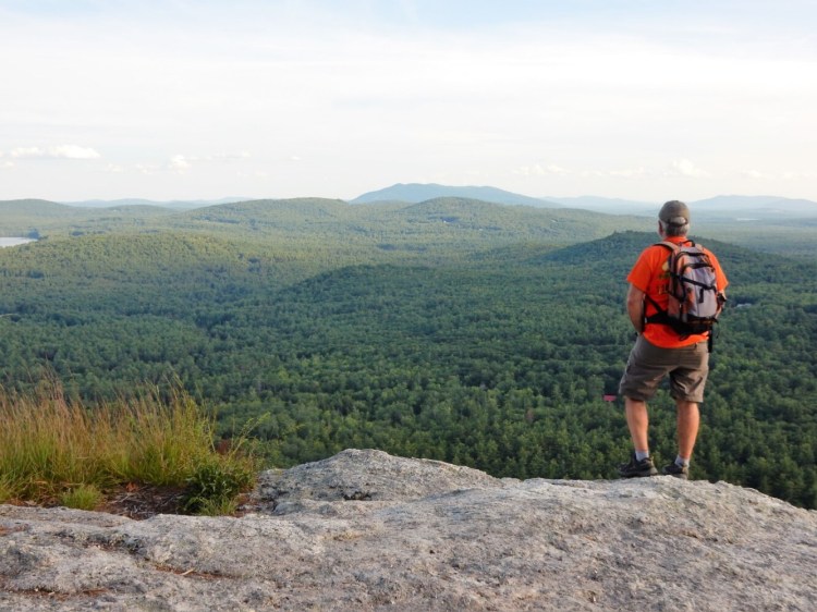
For a good look around Whiting Hill, start from Route 5 on the Westways Spur, then make a clockwise 2.5-mile loop over the wooded peak by combining the Red & Blue, Blue and Red trails. The Whitten Overlook on top, marked by a cairn and a bench, offers a view west to Kezar Lake and Mt. Kearsarge. On the east side of the hill, be sure to make the short side trip to Otter Rocks on Heald Pond, a pleasant spot for lunch and a swim.
The Flat Hill Trail is an easy 11/2 miles out and back. Since I was last up on Flat Hill, the trail has been partially rerouted, and the view from the ledges on top opened up more so you can now see Mt. Washington, a big bonus.
In 2008, 200 acres on Amos Mountain were purchased by GLLT from the Rogers Family, which had maintained some trails and old roads on the property. A granite bench on the summit honors the memory of Eddie and Howie Rogers, “who loved Amos Mountain.”
In an undisclosed location on the mountain grows the tallest American Chestnut in North America.
The Devil’s Staircase on the Green & Orange Trail on the southwest side of Amos Mountain is a natural staircase up a narrow cleft in the mossy cliff face. You can avoid the climb to either side, but what fun is that? The new Heritage Trail connects the Amos Andrews and Saddle trails along the 700-foot contour and adds to the loop possibilities.
Working since 1985 in Lovell, Stoneham, Stow and Sweden, the Greater Lovell Land Trust has protected 5,300 acres across the Kezar Lake, Kezar River and Cold River watersheds, acquiring 2,800 of those acres on 17 properties and holding conservation easements on another 2,500 acres.
Enjoy views of the White Mountains from the summit of Flat Hill. Photo by Carey Kish
GLLT hosts 20 miles of trails overall, so if you’ve got extra time, do consider exploring further.
Five Kezar Ponds Reserve features four trails and extraordinary Presidential Range views, while the trails at Wilson Wing Moose Bog Preserve and Bishop Cardinal Reserve connect to the White Mountain National Forest. The state owns Sabattus Mountain, but GLLT maintains the two-mile loop trail, which rewards with expansive views from the sweeping summit cliffs.
For more info and trail maps, visit www.gllt.org.
Carey Kish of Mount Desert Island is the author of “AMC’s Best Day Hikes Along the Maine Coast” and author/editor of the “AMC Maine Mountain Guide.” Follow Carey’s adventures on Facebook @CareyKish
Send questions/comments to the editors.

Success. Please wait for the page to reload. If the page does not reload within 5 seconds, please refresh the page.
Enter your email and password to access comments.
Hi, to comment on stories you must . This profile is in addition to your subscription and website login.
Already have a commenting profile? .
Invalid username/password.
Please check your email to confirm and complete your registration.
Only subscribers are eligible to post comments. Please subscribe or login first for digital access. Here’s why.
Use the form below to reset your password. When you've submitted your account email, we will send an email with a reset code.