


This story is part of Covering Climate Now, a global collaboration of more than 220 news outlets to strengthen coverage of the climate story.
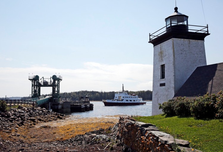
Living on a rocky speck of greenery about 10 miles offshore, residents of Monhegan Island rely on the mainland for food, fuel and many of the necessities of daily existence, with one notable exception – water.
Most of the seasonal homes and businesses across the 500-acre Maine island known for its artist colonies and rich history tap into a freshwater aquifer protected from the salty Atlantic by a narrow seam of bedrock.
But as a warming climate changes the Gulf of Maine around Monhegan, this tiny island community is coming to grips with the fact that – sometime in the future – the island’s “sole source” aquifer could be compromised.
“As sea levels rise, the potential for higher tides and increased storm surge to push water over the 2-foot bedrock rise or through the culvert underneath the road … is a threat that any islander or bystander who has witnessed a highest annual tide on Monhegan can easily visualize,” said Andrew Dalrymple, Monhegan’s second assessor and the head of the island’s public water company.
Island communities such as Monhegan face unique vulnerabilities from sea level rise and other havoc wrought by a changing climate.
From the ferry terminals linking islands to the mainland, to commercial fishing piers and oceanfront businesses needed to support year-round living, Maine’s islands are micro-economies that critically depend on the very type of infrastructure most vulnerable to the effects of a changing climate.
Yet island communities are not waiting to see what happens with climate change – in part because they’re already seeing dramatic shifts in the Gulf of Maine, and in part because they cannot afford to delay. Through programs offered by the Island Institute and agencies like the Maine Coastal Program and the Lincoln County Regional Planning Commission, islanders are analyzing their vulnerabilities and planning for the long-term, potentially costly projects needed to protect their communities.
“I feel like they are super resilient because they are creative and proactive,” said Susie Arnold, a marine scientist with the Island Institute who works closely with several island communities on climate-related issues. “They are thinking about solutions to problems that people on the mainland may not have to think about.”
Shey Conover stands at The Narrows, an isthmus on Islesboro that is exposed to wetlands on one side and East Penobscot Bay on the other. Rising sea levels could inundate The Narrows and effectively create two islands, cutting the northern half off from the ferry terminal and the island’s amenities. Conover is leading the Islesboro Board of Selectmen’s efforts to identify risks from sea level rise. Ben McCanna/Staff Photographer Buy this Photo
“Now it is time to get it at it, spend some money, figure out what we have to do and do it,” said Archibald Gillies, chairman of the board of selectmen on Islesboro, an island whose year-round population of 650 roughly quadruples during the summer. “We’re not afraid of big projects and we know this is one we are going to have to tackle.”
Globally, sea levels rose 3 inches between 1993 and 2017 and continue to rise at a rate of roughly one-eighth of an inch annually as glaciers melt and seawater expands thermally as it warms, according to the National Oceanic and Atmospheric Administration. That is roughly double the rate for much of the 20th century.
How much seas will continue to rise depends on a host of factors, including greenhouse gas emission levels and the rate of glacial melting. But a 2012 NOAA study predicted that seas will rise at least 8 inches and as much as 6.6 feet by 2100.
Stretching 11 miles through the heart of Penobscot Bay, Islesboro is divided into the “up island” and “down island” sections in local vernacular. And in between is The Narrows – a scraggly vein of rocks, trees and wetlands that is barely wider, at points, than the two-lane road that traverses it.
The only way to get from “up island” to “down island” is through The Narrows, unless you have a boat or desire a dip in the chilly waters of the bay. While the top of a rock retaining wall was more than 10 feet above the lapping water on one recent afternoon, Maine’s large tidal swings and the island’s location in Penobscot Bay mean The Narrows already experiences minor flooding once or twice a year.
The Camden Hills rise behind the Grindle Point Sailor’s Museum and Lighthouse on Islesboro. An analysis prepared for the town by the Maine Geological Survey showed Grindle Point under various depths of water during storms or astronomical high tides, depending on the extent of sea level rise. Ben McCanna/Staff Photographer Buy this Photo
“The good news is it is relatively protected from one side,” said local resident and selectwoman Shey Conover, pointing to the retaining wall separating the harbor from Islesboro’s Main Road. “But a good easterly wind and it is coming in here,” Conover added as she scanned the wetlands on the other side of the road.
Conover, a mother of two who runs a boatyard and mussel aquaculture business with her husband, has been appointed the Islesboro selectboard’s point person for examining impacts from sea level rise. In addition to The Narrows, which would cut the island in two if overwhelmed by the sea, the only entrance and exit road to Islesboro’s ferry terminal on Grindle Point also has a low-lying section already susceptible to flooding.
A vulnerability analysis prepared for the town using historic storm surge data and futuristic mapping by the Maine Geological Survey showed both The Narrows and Grindle Point being under various depths of water during storms or astronomical high tides, depending on the extent of sea level rise.
“When you put 6 inches (of rain) together with wind from a certain direction and storms and tides, we’ll be underwater in those two locations for who knows how long,” Gillies said.
Islesboro has hired an engineering firm to recommend options – and estimated price tags – for addressing those vulnerabilities. Once the town has that report some time next year, Gillies and Conover said, the broader conversation with town residents will begin about how to proceed. While the need for major construction may still be years or decades away, Conover said there is also talk about locating fire and EMS services on both ends of the island in the nearer future to ensure they can respond to emergency calls even if The Narrows is underwater.
“The concern here is very different than on Vinalhaven … because here it’s about making sure we can maintain access to our critical infrastructure and making sure parts of the island are not inaccessible,” Conover said.
Concerns about rising waters are so acute – and the threats so real – on the nearby island of Vinalhaven that the town has an official Sea Level Rise Committee charged with identifying vulnerabilities and proposing potential adaptation options.
Located less than 10 miles south of Islesboro, Vinalhaven is home to about 1,200 year-round residents but swells in size during the summer months from seasonal residents and tourists taking the hour-long ferry ride from Rockland. Once an exporter of the massive granite blocks used to construct iconic structures such as the Brooklyn Bridge and the Washington Monument, Vinalhaven still hosts a vibrant commercial fishing industry (mostly lobster), as well as a thriving community of artists.
Unlike Islesboro, Vinalhaven has a town center – the Carver’s Harbor area also sometimes referred to as “Downstreet” – lined with shops, galleries, a market, homes and the infrastructure that supports the island’s commercial fishermen. All of this is within walking distance of the ferry terminal connecting Vinalhaven to the mainland.
Lower-lying parts of Main Street as well as a large downtown parking lot periodically flood during annual astronomical high tides or “king tides,” but the ground floors of most buildings stay dry thanks to a slight elevation. So the town applied for a grant to hire a consultant, Ransom Engineering, to analyze vulnerabilities under various sea level rise scenarios and then received another grant to offer technical assistance.
Under a sea level rise of 1 foot, all of Main Street would be inundated during “king” tides and would be under several feet of water in a repeat of the November 1978 storm that serves as a benchmark for the worst flooding.
The impacts get more severe with higher sea level rise, of course, to the point where parts of the wharf important to the fishing fleet also would be underwater during normal high tides and many buildings would flood during king tides.
“What the model showed was some certainty up until 2050 or 60 but after that … there’s less certainty,” Vinalhaven town manager Andrew Dorr said. Those studies are now encouraging the town to consider the potential impacts of sea level rise as they discuss options for protecting downtown as well as future upgrades to the ferry terminal, roads and bridges in the coming decades.
“We are being proactive and trying to understand and plan smarter,” Dorr said. “By virtue, folks have always been very intuitive and creative in how we deal with things out here … so there might be some who roll with the tide. But the more we come up with some planning, that will help us prepare for the future.”
Peter Slovinsky, who performs shoreline change and sea level inundation mapping for the Maine Geological Survey, said Vinalhaven has done a “fantastic job of bringing sea-level rise and ocean acidification” issues to the attention of local residents. Other island and coastal communities are also taking the threat seriously and trying to plan now for the seemingly inevitable rising seas, even if the extent of that increase remains unclear.
The challenge, Slovinsky said, is translating those plans into action because federal grants often only pay for major projects after a community has been hit by a flood or a storm, not beforehand.
“It’s relatively inexpensive to determine what the vulnerability is or even to determine what you have to do about it,” Slovinsky said. “It is a whole other step to figure out how to do a million and a half dollar sea wall.”
That challenge will be the focus of a conference in Belfast this month that is expected to draw town officials, planners and scientists from throughout coastal Maine.
Back on Monhegan, where the town’s public water source could be threatened by sea level rise, islanders are planning a three-pronged approach to the threat.
An updated groundwater modeling analysis will examine vulnerabilities under several sea level rise scenarios, while another study will examine existing wells near the so-called “meadow” aquifer to look for early signs of saltwater intrusion. Finally, another bedrock study will look at other potential locations to tap into groundwater on the island.
Dalrymple, the assessor who oversees the Monhegan Water Company, said both year-round and seasonal residents on Monhegan “are extremely protective of their water supply.” Signs urging water conservation are a common sight during the dry months of July and August as usage exceeds re-fill rates in storage tanks.
Dalrymple said there is some concern about additional stresses on groundwater reserves as more seasonal homes are converted to year-round residences, therefore requiring new wells. And while it’s easy to visualize a massive storm surge contaminating the freshwater aquifer, the more imminent threat could be overdrawing from other wells combined with saltwater creeping into bedrock fractures as sea levels rise, Dalrymple said.
The various studies underway or planned on Monhegan aim to provide additional clarity to those fuzzy questions, thereby allowing islanders to make more informed decisions about future, potentially costly, water projects.
“The community as a whole is very supportive of these projects,” Dalrymple said in an email. “Inns and guesthouses all rely on the public water supply to support their business and most of the summer residents rely on the public water supply for water at their summer cottages. Without the summer residents and tourist industry, Monhegan’s economic viability would undergo a huge almost unimaginable transformation.”
Send questions/comments to the editors.

Success. Please wait for the page to reload. If the page does not reload within 5 seconds, please refresh the page.
Enter your email and password to access comments.
Hi, to comment on stories you must . This profile is in addition to your subscription and website login.
Already have a commenting profile? .
Invalid username/password.
Please check your email to confirm and complete your registration.
Only subscribers are eligible to post comments. Please subscribe or login first for digital access. Here’s why.
Use the form below to reset your password. When you've submitted your account email, we will send an email with a reset code.