

Sunday into Tuesday:
Snow showers on Sunday morning make things briefly slick in Maine. This isn’t a big, blockbuster storm…especially compared to the amounts Mainers saw Tuesday. Let’s get right to it and talk about what to expect across the state.
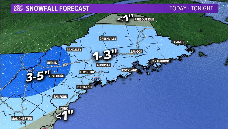
Forecast Snow Totals through noon Sunday. NEWS CENTER Maine
Still, if you’re out and about Sunday morning, expect back roads and untreated surfaces to be just a bit slick.
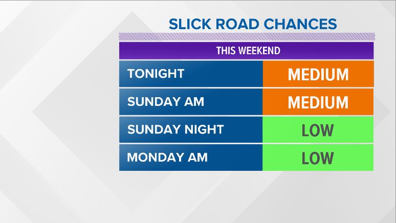
Forecast road conditions for Sunday. NEWS CENTER Maine
Sunday afternoon brings about partly cloudy skies and some blustery northwest winds. Over the last couple of weeks, it’s been pretty warm. That changes Sunday afternoon. Get ready for a more classic wintry feel.
Monday could feature a handful of snow showers, but they do not look to be a big deal at all. Clouds are on the increase Tuesday, which could translate to another batch of snowfall on Wednesday.
Wednesday Storm Potential:
This storm is not being modeled too well just yet. No surprise; we’re still a few days out. There are two paths that look possible right now, and these have different impacts on what Maine could see in the middle of the week.
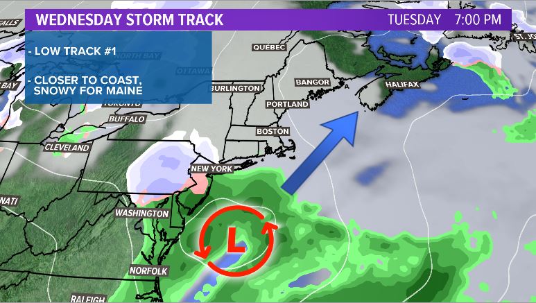
Storm track 1 would favor the low moving closer to the coast of Maine. If this were to verify, it would be a snowier solution. Skiers, listen up…this is the storm track to root for! A storm track like this would mean measurable snowfall for a good chunk of the state.
NEWS CENTER Maine
Model spread is pretty variable right now, but there are definitely some models that favor a track similar to this one.
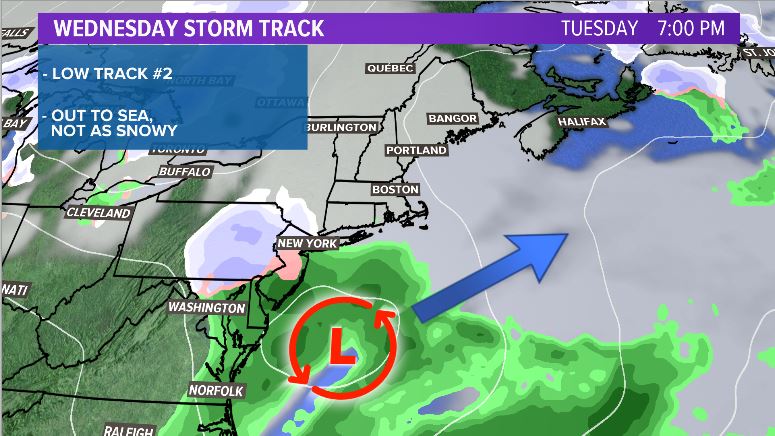
The other track is what you should root for if you want a break from the recent winter weather.
Again, model spread is pretty variable. Some models are starting to hint that a track will be more similar to the one below. This would favor an out to sea track, and snow would be much less likely in Maine.
NEWS CENTER Maine
While a track like this could still potentially bring some snow to Maine, it would be much less than a track with the low closer to the coastline.
Bottom line:
Models will start to converge on a solution as we get closer. Any trends in the forecast will be more apparent come Sunday evening and especially so on Monday morning. Follow me on Twitter for updates as we get closer.
Send questions/comments to the editors.

Success. Please wait for the page to reload. If the page does not reload within 5 seconds, please refresh the page.
Enter your email and password to access comments.
Hi, to comment on stories you must . This profile is in addition to your subscription and website login.
Already have a commenting profile? .
Invalid username/password.
Please check your email to confirm and complete your registration.
Only subscribers are eligible to post comments. Please subscribe or login first for digital access. Here’s why.
Use the form below to reset your password. When you've submitted your account email, we will send an email with a reset code.