

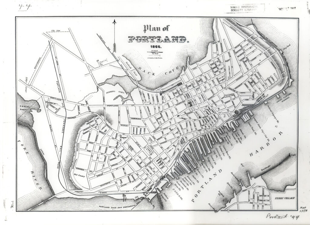
By 1866, the city of Portland had grown into a complex system of streets. The most important addition is Commercial Street, which extended the waterfront. As the name suggests, it was built to meet the needs of the city’s growing economy. The railroads and ferry lines depicted on the map are also signs of Portland’s growth. These new forms of transportation connected Portland to other cities and towns both near and far. Collections of Maine Historical Society. Order a copy at VintageMaineImages.com, item #4173
In commemoration of Maine’s bicentennial this year, The Forecaster is featuring historical highlights from our communities’ past 200 years, in print and online every other week.
Comments are not available on this story.
Send questions/comments to the editors.
