

As we round out the final week of April, another snowstorm looms. While this one will not drop quite as much as the last one, it still could be enough for some isolated power outages.
A large storm system is spinning over the midwest and is going to trek towards Maine on Sunday.
Sunday morning looks pretty tranquil; the calm before the storm, if you will.
Some filtered sunshine eventually gets covered up by thickening clouds.
It will be chilly, but seasonable ahead of the approaching moisture. Most places will still make it to near 50, with some approaching the low 50s in northern and eastern Maine.
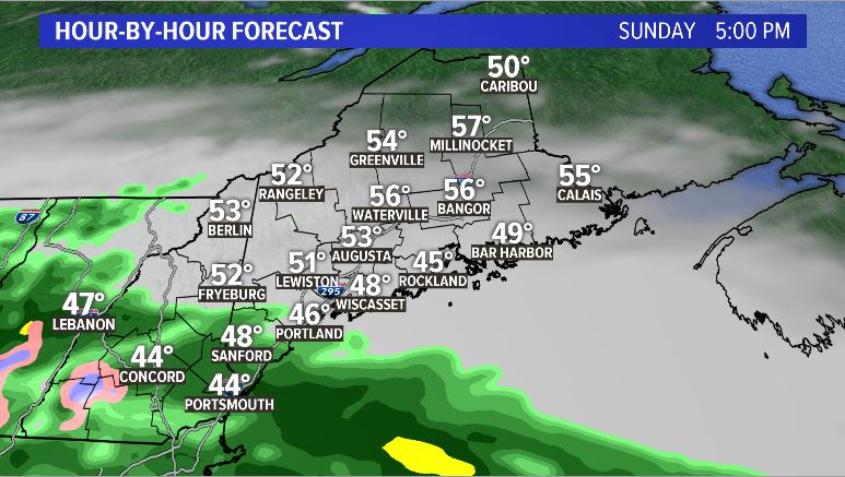
Showers start as rain Sunday evening. NEWS CENTER Maine
By Sunday evening, the western mountains will be first to see some rain showers.
These gradually build into Maine and will be generally light.
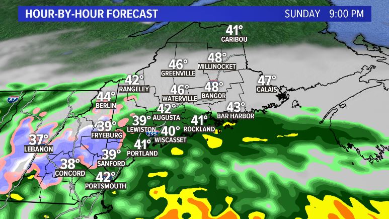
Eventually the colder air wins and starts to transition rain to snow. NEWS CENTER Maine
As the storm strengthens, the lifting (what actually allows the precipitation to occur) becomes intense. This will allow most of inland Maine to flip over to wet, heavy snow.
Snow showers are expected to continue overnight and spread east. This will cause snow to fall through the Bangor metro area as well, but it cuts off before reaching the County.
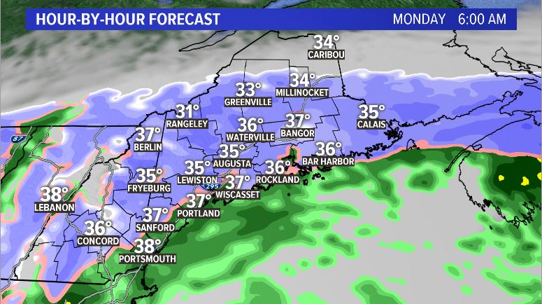
Monday morning will likely feature almost all snow across Maine. NEWS CENTER Maine
The forecast is a little less “clean” on Monday when it comes to precipitation type. There will likely be mixing taking place at the coast, with on and off rain and snow showers throughout inland Maine.
It will be a bit breezy during the day Monday, though not really enough for power outages to be a concern.
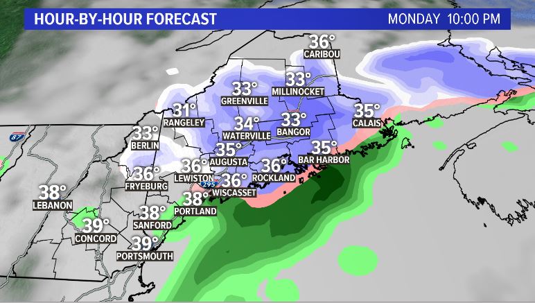
Colder air makes a return as the storm wraps up. NEWS CENTER Maine
More cold air gets pulled in through the day on Monday, resulting in a switch back over to snow late Monday evening.
Most of the accumulation will already have occurred, but I’d keep watch for an extra inch or two when this happens.
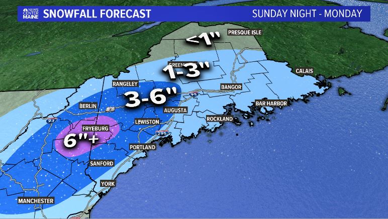
Snow totals with this storm could change a bit as we get closer, but here are the latest totals.
NEWS CENTER Maine
Areas in the 3-6″ range will be somewhat elevation dependent, so I wouldn’t be surprised to hear of a stray 7″ reading or two from high peaks. The same is true for some valleys that might slightly underperform.
In the Fryeburg area, watch for some power outages. With wet, heavy snow, 6″ is generally the threshold for when power issues pop up.
There could be some stray outages elsewhere, too. Most of the outages that occur will be late Sunday into Monday morning.
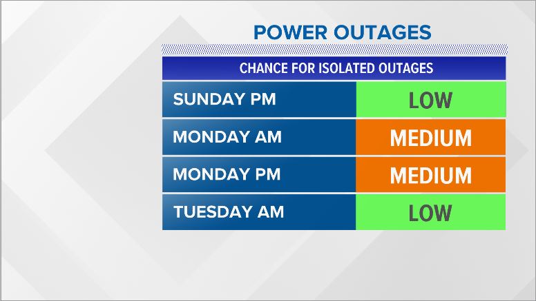
Power outage risk through the storm. NEWS CENTER Maine
Tuesday remains breezy and could allow for a couple more showers. In general, though, Sunday into Monday will be the most active.
Will this be the last snow map I make forecasting more than 6″ before fall? Maybe, maybe not. The pattern — which we couldn’t manage all winter long — is ripe for wet and cold. We’ll just have to see what May brings.
For the latest forecast info, follow me on Twitter and Facebook.
Copy the Story LinkSend questions/comments to the editors.

Success. Please wait for the page to reload. If the page does not reload within 5 seconds, please refresh the page.
Enter your email and password to access comments.
Hi, to comment on stories you must . This profile is in addition to your subscription and website login.
Already have a commenting profile? .
Invalid username/password.
Please check your email to confirm and complete your registration.
Only subscribers are eligible to post comments. Please subscribe or login first for digital access. Here’s why.
Use the form below to reset your password. When you've submitted your account email, we will send an email with a reset code.