

Ah, spring in New England. Usually we play the back-and-forth of snow and thunderstorms a bit earlier than the middle of May, but 2020 is a weird year.
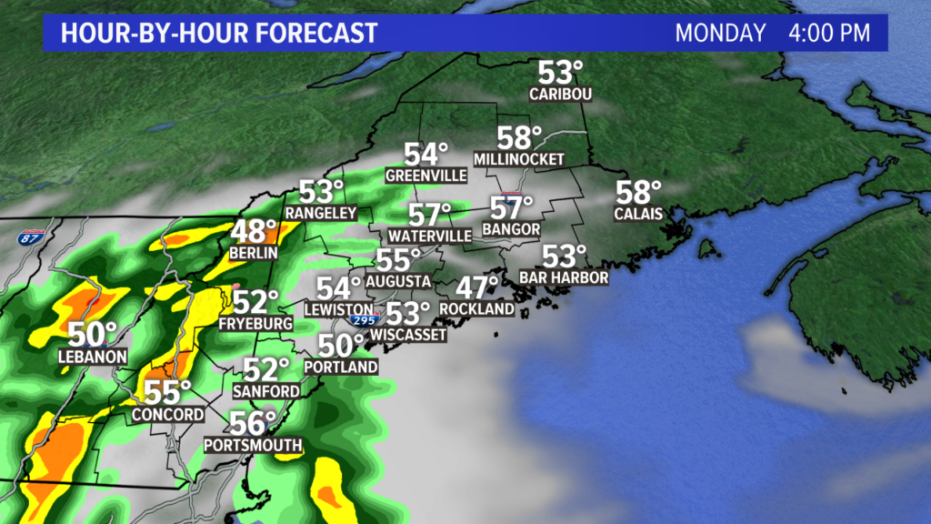
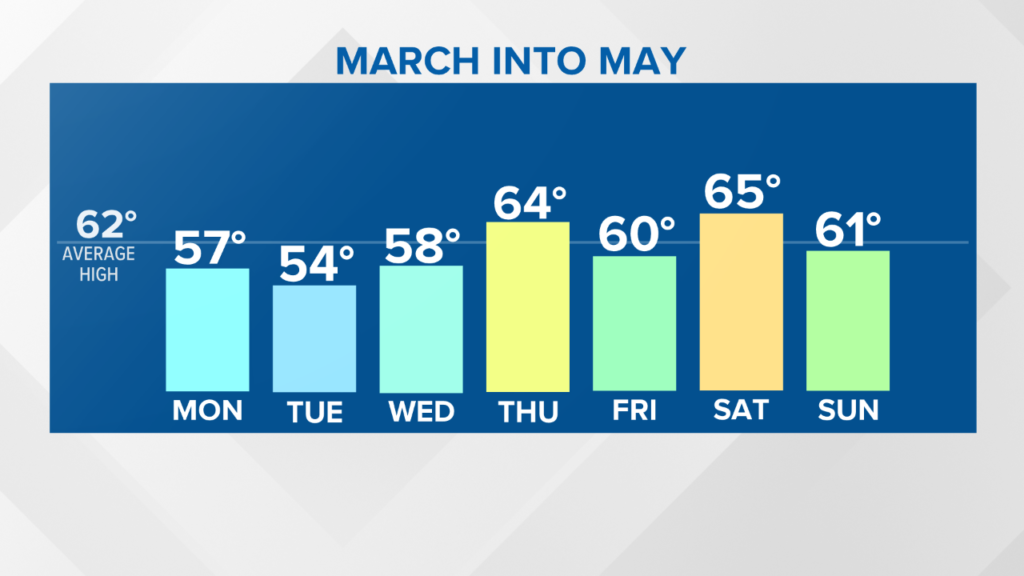
Monday morning starts off with quiet conditions. A bit of sunshine is likely early, but clouds quickly build in. Temperatures jump quickly to near 50 degrees and top out in the mid 50s around noon.
A few thunderstorms are expected on Monday afternoon. NEWS CENTER Maine
Showers and thunderstorms form to our west and move into western Maine in the afternoon. Timing looks to be between 2 PM and 6 PM, with the New Hampshire border towns seeing the first rumbles. Or, rather, hearing the first rumbles.
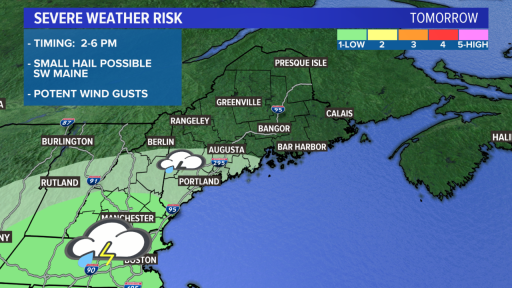
The severe outlook for Monday shows the best chance for stronger storms is to our south and west. NEWS CENTER Maine
As of late Sunday night, the biggest threat for any storms to be borderline severe is only in far southwestern York county. Overall, I think the severe risk is pretty low for most Mainers.
Still, some of these storms could bring about some stout wind gusts and small hail.
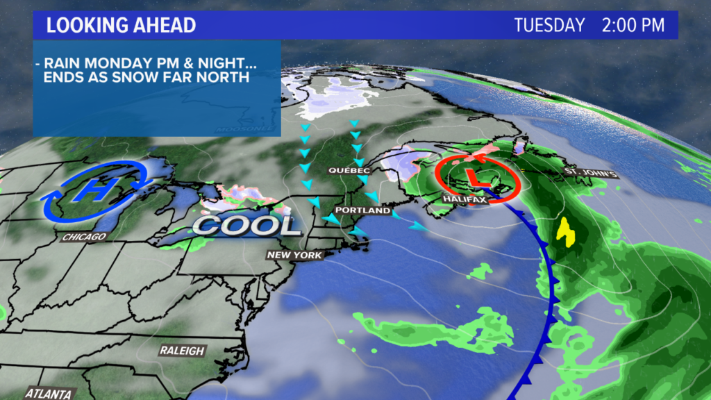
Storms push east toward Augusta before falling apart completely. Rain showers continue overnight and into Tuesday morning, with most spots staying in the 40s.
NEWS CENTER Maine
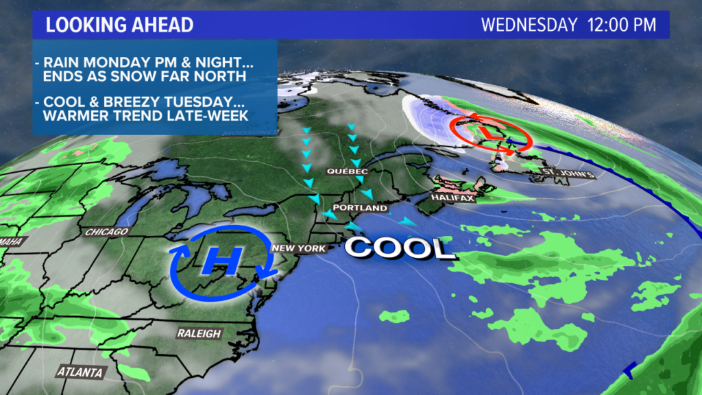
Tuesday will be breezy and chilly for this time of year. In other words, it’s the same we’ve been seeing the last few weeks. Showers start off the morning on Tuesday. There could even be some flakes that mix in through The County.
NEWS CENTER Maine
Sunshine is back in full force on Wednesday. Temperatures will climb pretty nicely, with most topping out near 60. That feels pretty good under full sunshine.
The downside, though, is that it will still be quite breezy.
Thursday looks like a really solid day, though. Highs get into the 60s just about everywhere! There will be full sunshine early in the day, and that fades behind cloud cover later on.
Things do warm a bit by the end of the week. NEWS CENTER Maine
Rain showers return Friday, but it looks warm still. The pattern favors warmth into the weekend.
We might be able to hit 70 inland on Saturday, if we can keep any chances at a backdoor cold front low. We’ll be watching as we get closer!
Follow me on Twitter and Facebook for updates on the warm up. And also the thunderstorms.
Send questions/comments to the editors.

Success. Please wait for the page to reload. If the page does not reload within 5 seconds, please refresh the page.
Enter your email and password to access comments.
Hi, to comment on stories you must . This profile is in addition to your subscription and website login.
Already have a commenting profile? .
Invalid username/password.
Please check your email to confirm and complete your registration.
Only subscribers are eligible to post comments. Please subscribe or login first for digital access. Here’s why.
Use the form below to reset your password. When you've submitted your account email, we will send an email with a reset code.