

Good news to kick off this week’s forecast! The rainy pattern has paid off. We’re not out of the woods just yet, but we saw big improvements on the drought monitor. More unsettled weather is on the way so we should be able to knock back our rainfall deficit a bit more.
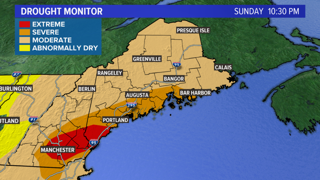
The drought has improved, but we still have a lot of room for improvement. NEWS CENTER Maine
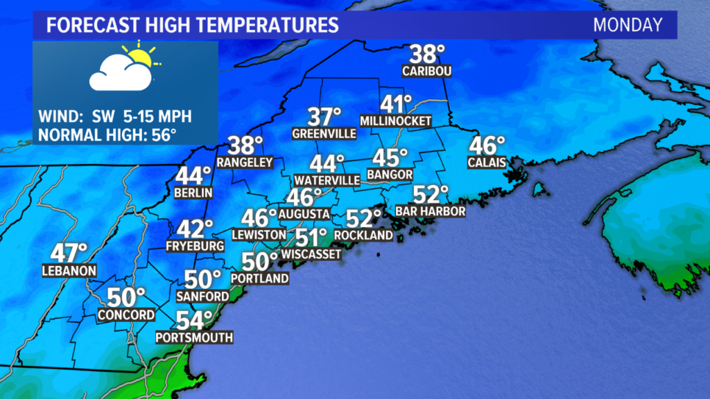
Saturday and Sunday were starkly different, setting the stage for a cool week of weather in Maine. This is the first time in a while where the entire week looks like it’ll be below average.
NEWS CENTER Maine
Monday kicks off the cool week with temperatures running in the 40s to near 50. This is a solid five to ten degrees below normal for this time of year.
NEWS CENTER Maine
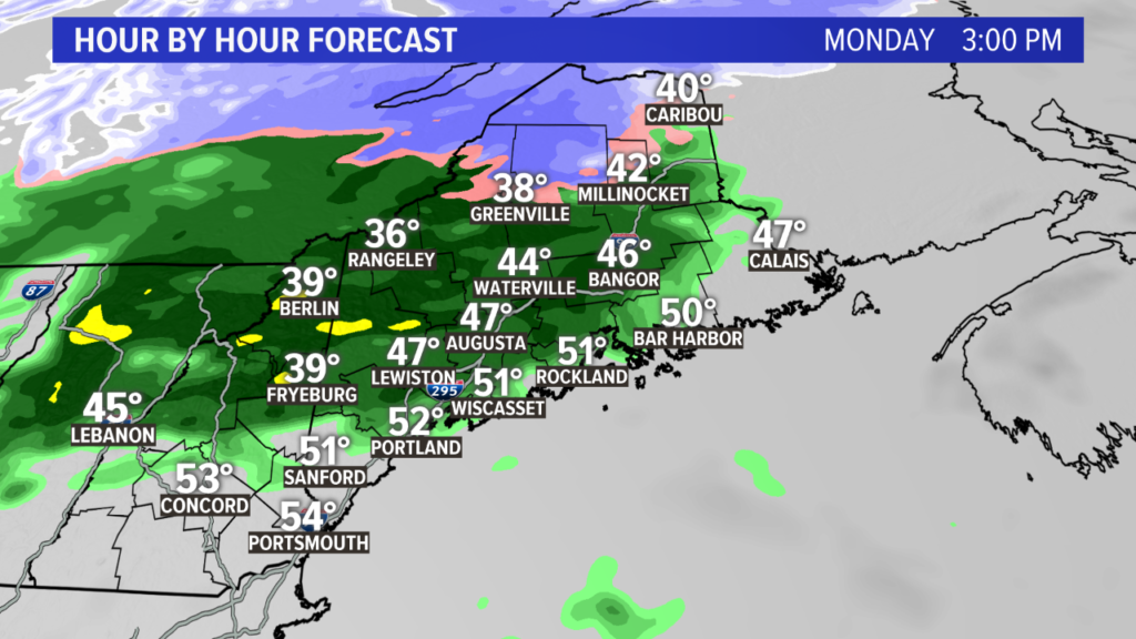
A few spotty showers are expected in the morning. As moisture builds in, steadier light showers and drizzle looks likely. Combined with the cool air, it’s going to be a fairly raw day.
NEWS CENTER Maine
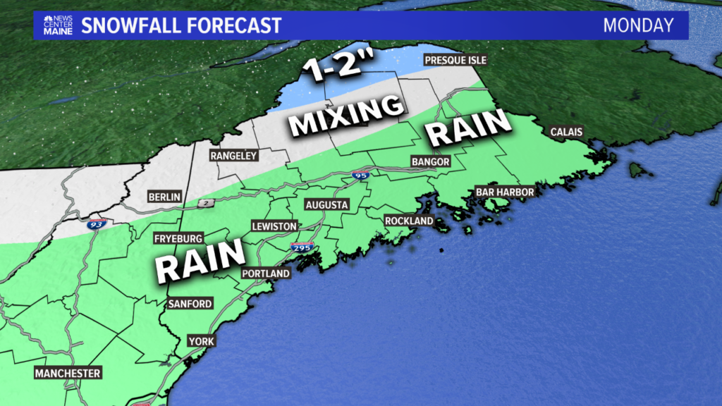
This snow map is mostly just for giggles, but the forecast information is absolutely legitimate. There will likely be some very minor snowfall accumulations in northern most sections of Maine and on the highest peaks.
NEWS CENTER Maine
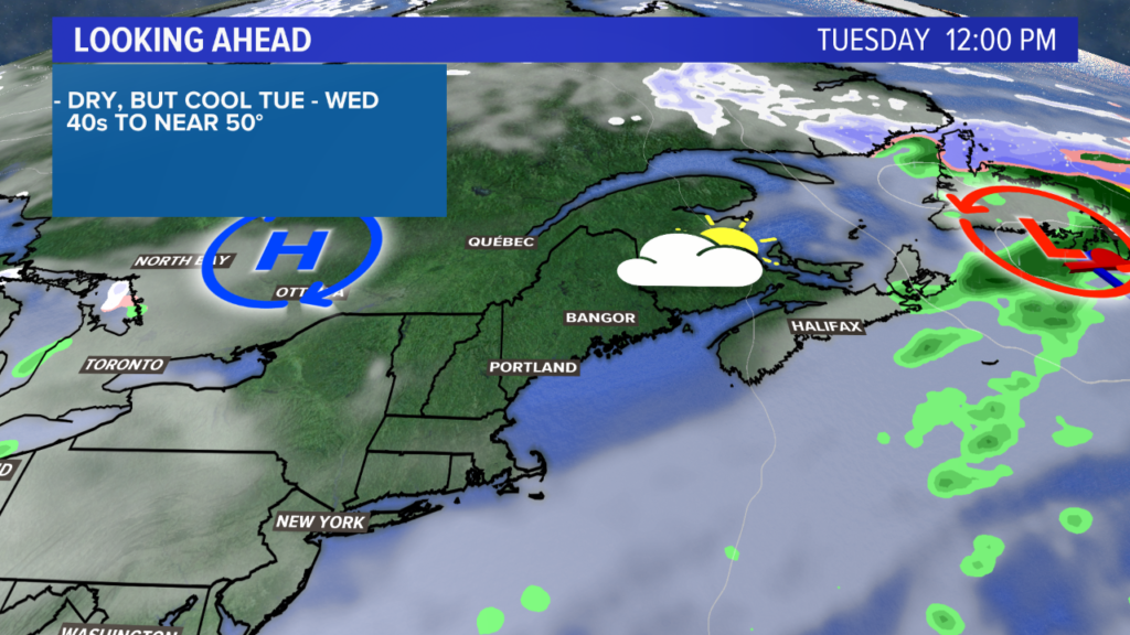
Tuesday has been trending nicer of the last few days. There could still be a sprinkle in the early morning, but the remainder of the day looks pretty good. Temperatures will be near 50 for most under mostly cloudy skies.
NEWS CENTER Maine
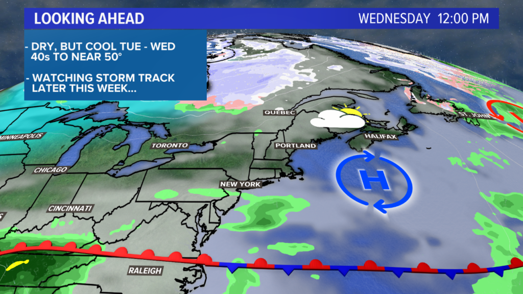
Sunshine tries to peak back out on Wednesday. Again, it looks like clouds will be in control for most of the week, but a bit of sun will be possible on Wednesday. High temperatures return to the low 50s.
NEWS CENTER Maine
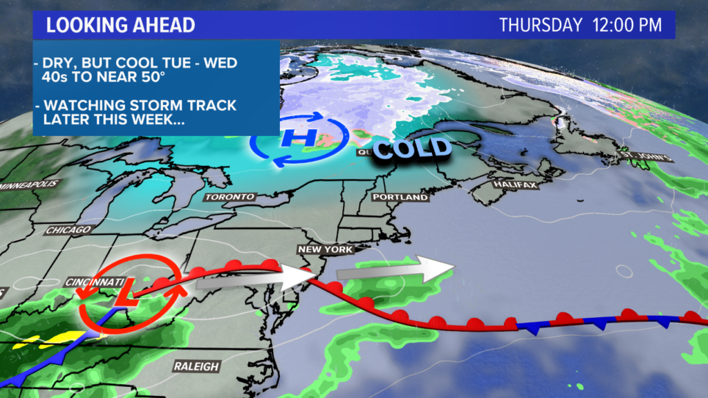
Warmer air pushes in Thursday with a light west wind. Afternoon temperatures top out in the 50s under increasing clouds.
There are two big players in the forecast Thursday night and Friday. These will ultimately have a big impact on our weather Friday.
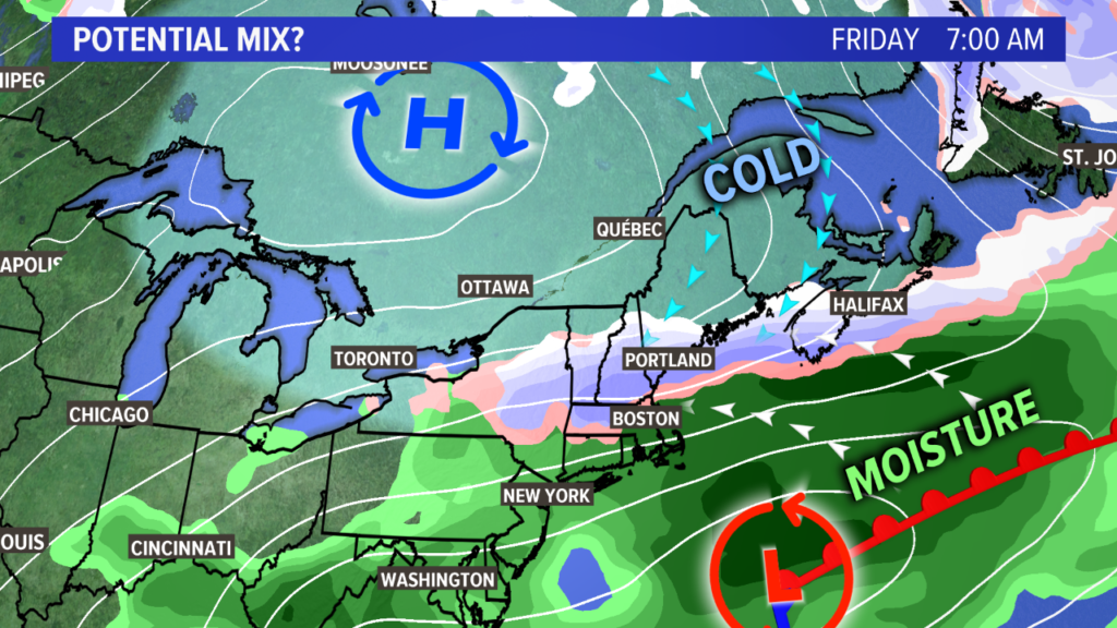
A wintry mix is possible if the pieces come together. NEWS CENTER Maine
Cold, high pressure from Canada tries to sink in. At the same time, a storm will move through the Ohio valley and off the coast of New England. The surface wind direction here will be out of the northeast, wedging colder air here.
If the storm gets close enough to us on Friday, there is a risk for at least wintry mix, if not some snow. I don’t think this will be anything too remarkable, but the first chance for widespread flakes is always worth talking about. Or, typing about. You know what I mean.
NEWS CENTER Maine
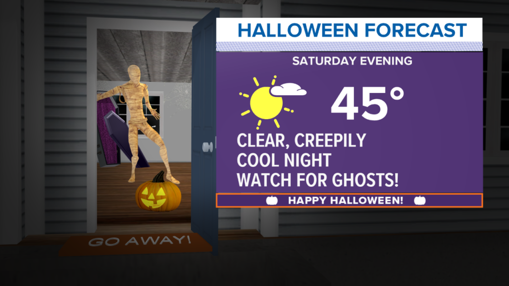
The dancing mummy makes its return this year! No matter what happens Friday, Saturday looks good. It’ll be cooler than normal, with most in the 40s. Some could even be in the 30s shortly after the sun sets. Sunset is around 5:30 on Saturday, October 31.
NEWS CENTER Maine
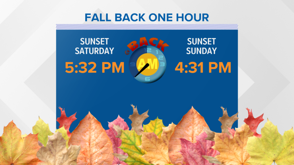
The sun will set closer to 4:30 on Sunday, November 1. That’s right! It’s that time of year. The clocks fall back an hour at 2 a.m. on Sunday morning. If you’re awake, you’ll get to see the clock hit 1:59 a.m. and then revert back to 1:00 a.m.
Sunday looks a bit more seasonable with some sunshine. Enjoy the nice day to start off November.
For other forecast musings and occasional cool weather pictures, follow me on Twitter.
Comments are not available on this story.
Send questions/comments to the editors.
