

Get ready to break out the snow shovels.
Thankfully, this storm is going to feature a lot of fluffy snow and not much in the way of heavy, wet snow.
There are also some concerns about how far north the moisture actually gets.
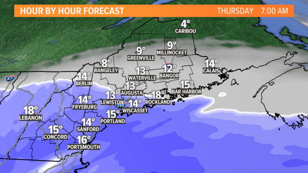
As the storm progresses north, snow showers begin through southwestern Maine, with the first flakes falling in Portland around 3 a.m.
NEWS CENTER Maine
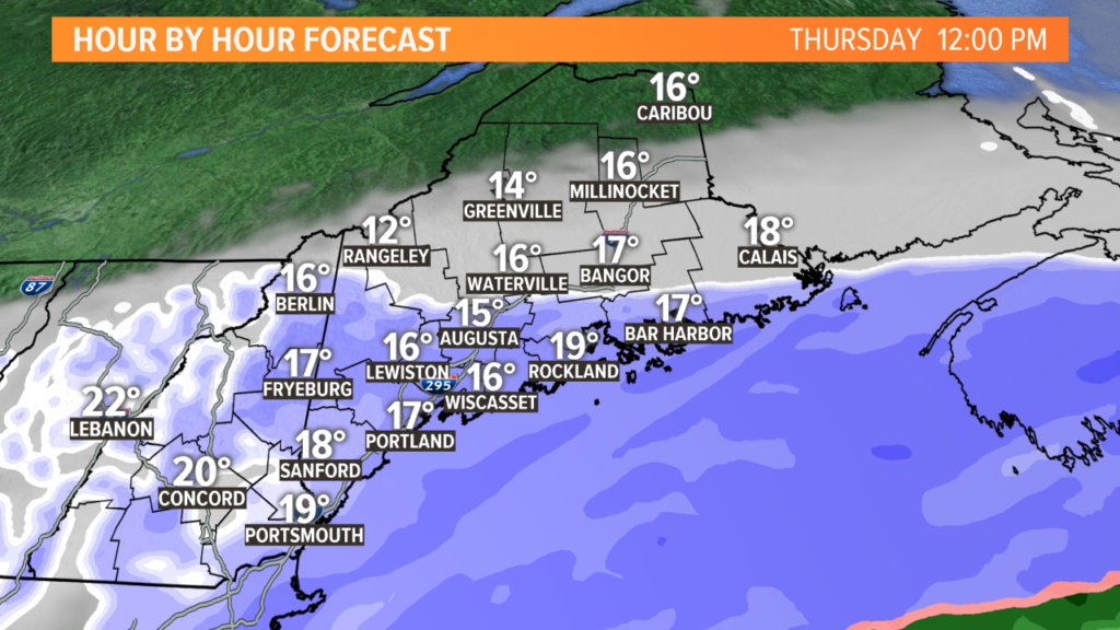
Expect the snow to keep slowly moving north. As the center of the storm gets closer, there will be some heavier snow along the Maine coastline up through Wiscasset and Rockland.
While the models are trying to show snow as far north as Route 2, I think the dry air will keep the flakes away until a little bit later.
NEWS CENTER Maine
Peak intensity for snow is likely through the late morning and early afternoon. Snow will be falling quickly into a very cold atmosphere, so it will be fluffy and should stack up pretty quickly.
Some snow bands could reach rates of an inch per hour, if not a little more. Reduced visibility is expected and roadways will be very slick.
On the bright side, it will be wicked easy to shovel!
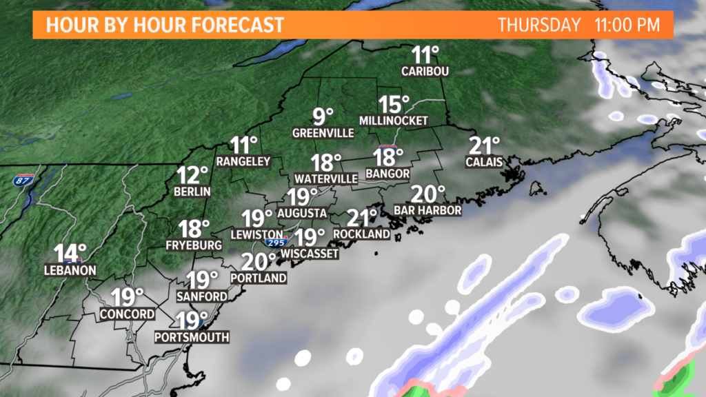
The storm clears out Thursday evening. NEWS CENTER Maine
Snow showers wrap up Thursday evening and clearing conditions will be on the way for Thursday night.
And now, the moment you’ve been waiting for…
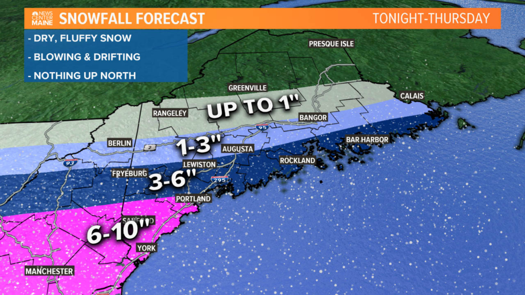
Given the latest forecast outlook, these totals seem pretty good. The bullseye for highest totals will be from Kittery to Portland and then east along the immediate coastline. Fryeburg to Lewiston will get a solid 3-6″ of snow, with a little bit less near Augusta.
My biggest concern with this map is the northern extent of the snowfall. Given the really dry air in place, that could push totals toward the lower end of the forecast range from Fryeburg and north. It also could cut back even more on totals north of Route 2.
Either way, expect travel issues all day Thursday.
Blowing snow is possible in the afternoon, too, which will reduce visibility and re-coat the roadways.
Plan ahead and stay safe. For more forecast information, follow me on Twitter, @MikeSliferWX.
Copy the Story LinkSend questions/comments to the editors.

Success. Please wait for the page to reload. If the page does not reload within 5 seconds, please refresh the page.
Enter your email and password to access comments.
Hi, to comment on stories you must . This profile is in addition to your subscription and website login.
Already have a commenting profile? .
Invalid username/password.
Please check your email to confirm and complete your registration.
Only subscribers are eligible to post comments. Please subscribe or login first for digital access. Here’s why.
Use the form below to reset your password. When you've submitted your account email, we will send an email with a reset code.