

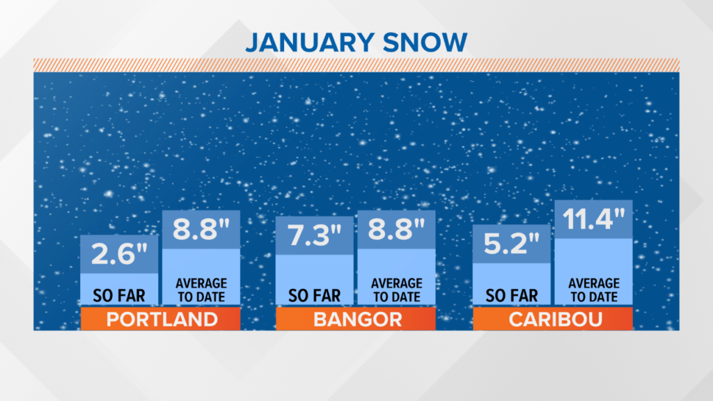
January has been a lackluster month for snowfall.
Other than one stronger storm in central Maine and a couple days of light snow, the pattern has settled on mild temperatures and calm days.
NEWS CENTER Maine
I don’t think these numbers will change much after Saturday, given the warm air with this storm.
NEWS CENTER Maine
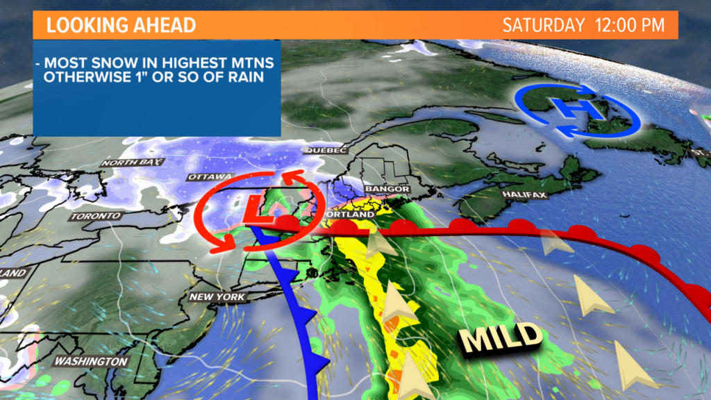
The storm approaches with increasing clouds overnight Friday.
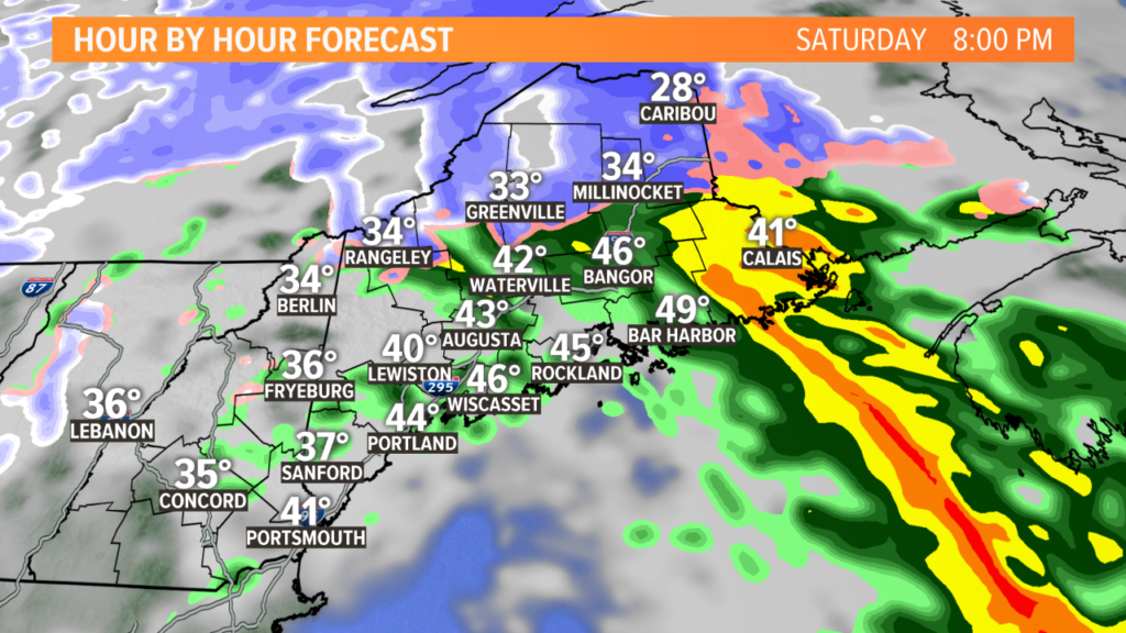
By Saturday morning, showers will start to edge in.
NEWS CENTER Maine
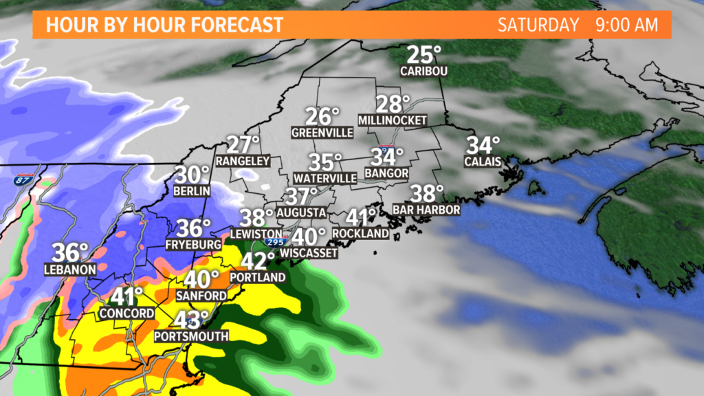
The first spots to see showers are York and Oxford counties.
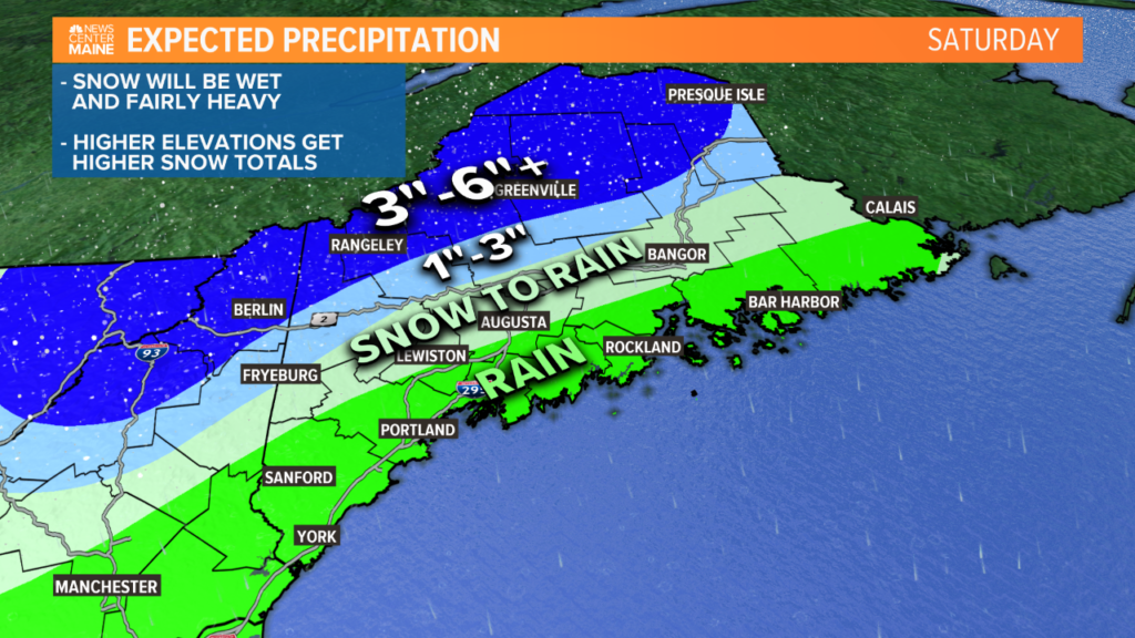
At the onset, there could be mixing even in southern areas. This will likely be snow for the mountains.
Between 7 a.m. and 10 a.m., heavier rain at the coast will move in.
The heaviest rain for Portland is likely in the late morning. Augusta and Lewiston could start as a bit of a wintry mix before the warm air wins and rain takes over.
NEWS CENTER Maine
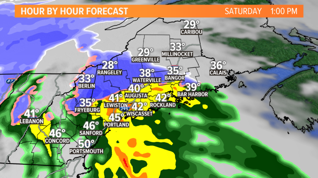
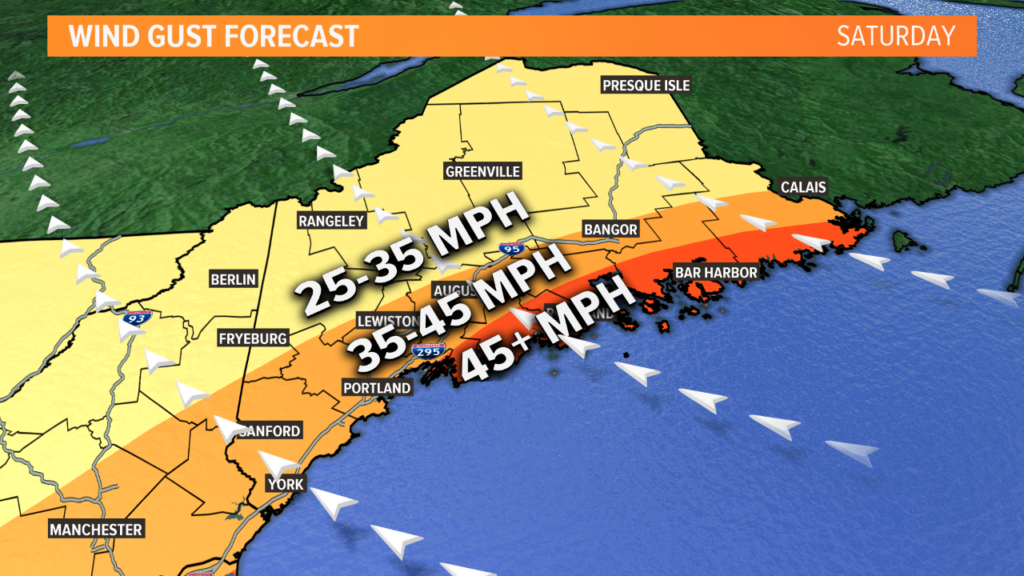
Rain progresses east through the day while snow continues in the mountains. Heavy rain is more likely through the Midcoast in the afternoon. The heavy rain will also bring stronger wind gusts.
NEWS CENTER Maine
Drier air will filter in late in the afternoon. Some snow showers may continue in the mountains and across The County, but most will see showers wrap up in the later afternoon and early evening.
NEWS CENTER Maine
Good news: forecast wind gusts are below the “widespread outage” threshold by a decent margin! The highest gusts will likely be along the Midcoast and Downeast, where gusts between 45 and 50 mph are possible. Elsewhere, gusts will stay in the 35-45 mph range.
It’s worth noting that a few isolated power issues are possible, but I don’t think the outage numbers will be too high at all.
NEWS CENTER Maine
Here’s the moment you’ve been waiting for…the snowfall forecast.
Any peaks in the 3-6″ range that are over 2,500 feet should get decent totals. I would expect a few of these peaks to get over a foot of snow, by the time all is said and done.
Along Route 2, expect lower amounts since mixing eventually takes hold.
South of that, it could start as mix but the rain wins.
It will only be rain at the coastline.
Expect rain totals of 1-1.5″ by Saturday night. Snow totals, if melted down, should end up the equivalent of 1-1.5″ of liquid.
NEWS CENTER Maine
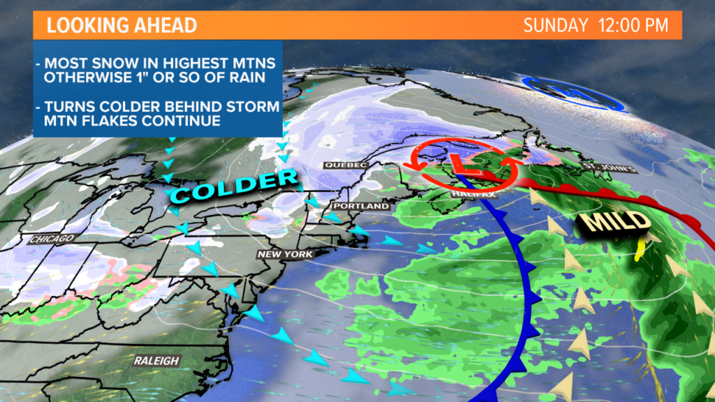
Sunday will be blustery with temperatures falling later in the day. Snow continues in the mountains, but the colder air should yield much fluffier snow. Some of the high peaks might get another few inches of accumulation out of it.
Beyond that, the next storm to watch is Wednesday.
For the latest and greatest in the world of Maine weather, follow me on Twitter, @MikeSliferWX.
Send questions/comments to the editors.

Success. Please wait for the page to reload. If the page does not reload within 5 seconds, please refresh the page.
Enter your email and password to access comments.
Hi, to comment on stories you must . This profile is in addition to your subscription and website login.
Already have a commenting profile? .
Invalid username/password.
Please check your email to confirm and complete your registration.
Only subscribers are eligible to post comments. Please subscribe or login first for digital access. Here’s why.
Use the form below to reset your password. When you've submitted your account email, we will send an email with a reset code.