

The last time significant snow fell in Maine was the first day of the year. If you’re talking about southern Maine in particular, that was way back in December.
Groundhog Day should change that. The groundhog itself may tell us whether spring starts early or not, but I can tell you that Groundhog Day itself will be a classic winter day.
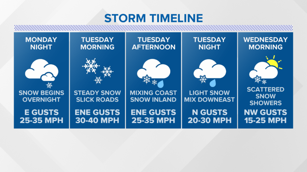
The nor’easter brings in a fresh coat of snow, but could get complicated with some mixing later in the day. Minor coastal flooding is also an issue as wind gusts pick up out of the east and northeast.
A few isolated power outages are possible, but I do not anticipate widespread issues right now.
NEWS CENTER Maine
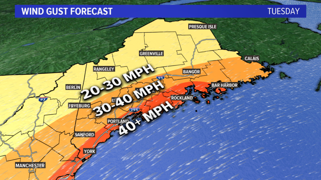
The timeline of this storm shows the bulk of the snow on Tuesday. Later in the day is when mixing becomes an issue at the coastline. The strongest wind gusts will occur on Tuesday morning near Portland and along the Midcoast.

NEWS CENTER Maine
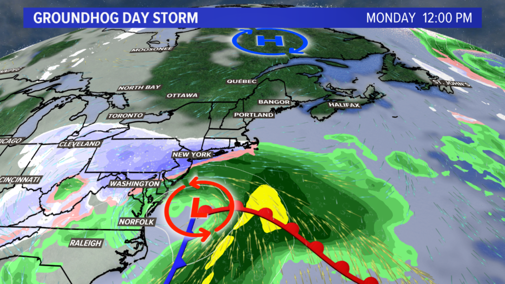
A deteriorating low near the Great Lakes on Sunday will transfer its energy offshore, sparking a new storm off of the Delmarva Coastline.
NEWS CENTER Maine
As the new low strengthens, snow showers will start up in Maine. The first place to see flakes fly will be Kittery, but it will not take long for snow to begin in all of western Maine.
NEWS CENTER Maine
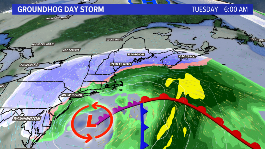
By sunrise on Tuesday morning, roads will already be a mess. Moderate to heavy snow bands keep moving north and east, spreading across much of Maine.
Conditions deteriorate in Bangor through the late morning. The only place to not see snow by noon is the far northern sections of Aroostook county.
NEWS CENTER Maine
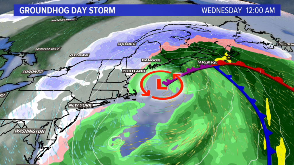
Warm air becomes a player in the afternoon and evening. As the coastal low strengthens and possibly nudges north, Expect a transition over to mix or rain for most of the coast. This is especially true east of Wiscasset, through Rockland and the Penobscot Bay to Lubec.
This mixing signal will cut down on snow totals. Elsewhere, such as along the southwestern coastline, the mixing will happen after the heaviest snow. This means that snow totals will not suffer much.
The forecast is a little less clear at this point in time. Some models are suggesting a little bit more snow to linger through Wednesday; others clear things out pretty quickly.
Given the pattern, though, I’m banking on steady snow wrapping up late Tuesday evening.
Snow showers linger through the day on Wednesday, but they will not be as impactful as the forecast snow on Tuesday.
NEWS CENTER Maine
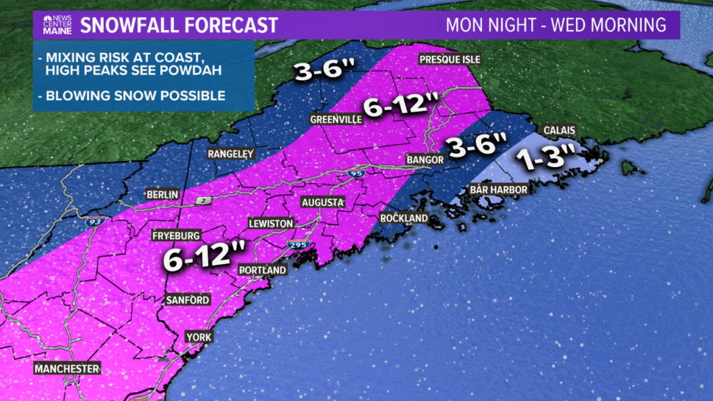
And here it is….the highly anticipated snow map.
Some tweaks are likely moving forward, as a shift in the track of the low will affect where the heavy snow bands set up.
Most of this falls on Tuesday. Roads will likely be worst for the morning hours, but still not great in the evening.
NEWS CENTER Maine
A strong breeze on Tuesday also brings blowing snow into the equation. Reduced visibility and drifting snow are expected through the day. The most likely time frame for power issues to pop up will be through the morning on Tuesday.
NEWS CENTER Maine
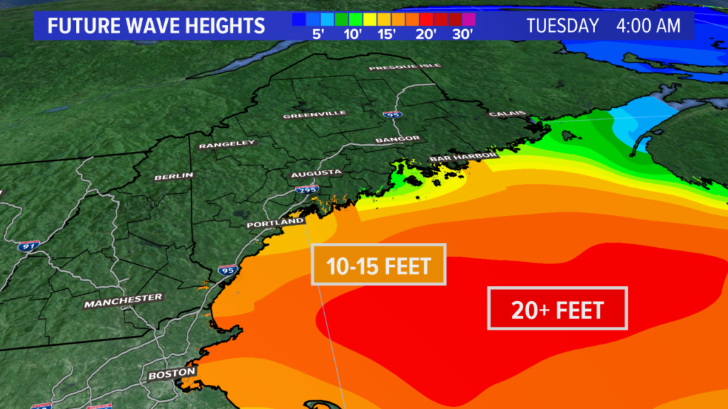
With strong wind gusts out of the east, there could be some splashover issues and minor coastal at high tide in southwestern Maine.
The tides are not at their astronomical highs, but the prolonged duration of east and northeast wind will keep pushing water into the bays along the coast.
After this, the next storm slides through on Friday or Saturday. It could bring rain, but we’ll get to that as we get closer.
Keep an eye out for Ryan’s updates in the morning. We’ll be getting more in depth with this forecast over the next day or so.
Otherwise, follow me on Twitter for more forecast data, @MikeSliferWX.
Send questions/comments to the editors.

Success. Please wait for the page to reload. If the page does not reload within 5 seconds, please refresh the page.
Enter your email and password to access comments.
Hi, to comment on stories you must . This profile is in addition to your subscription and website login.
Already have a commenting profile? .
Invalid username/password.
Please check your email to confirm and complete your registration.
Only subscribers are eligible to post comments. Please subscribe or login first for digital access. Here’s why.
Use the form below to reset your password. When you've submitted your account email, we will send an email with a reset code.