

April showers bring … wait, April showers? Not this year. At least, not yet.
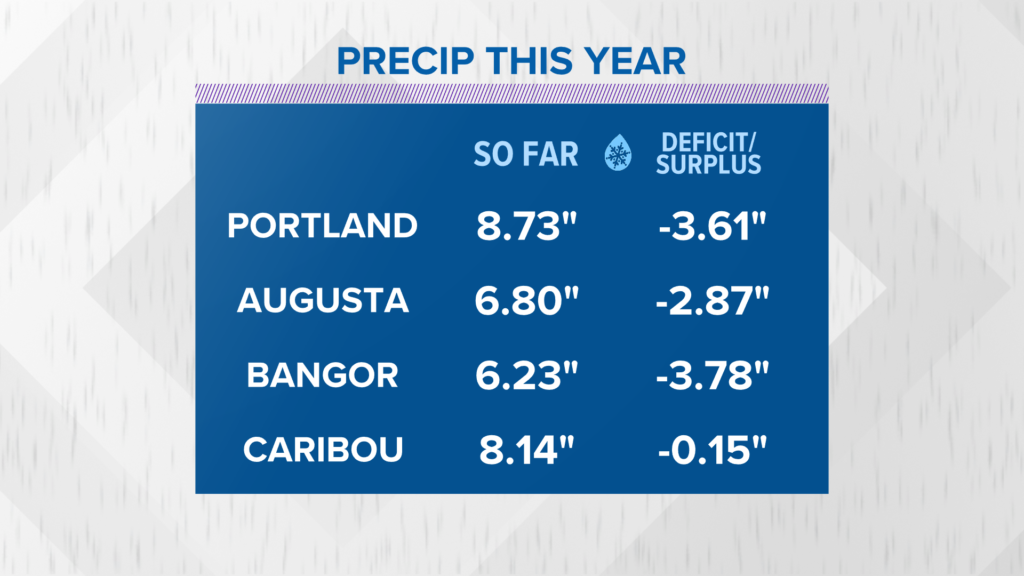
So far, the precip deficits that began over the winter have gotten worse.
Even in northern Maine, the area that is closest to normal for recorded precip, deficits have started showing up yet again.
NEWS CENTER Maine
We need rain. If this pattern continues, drought related issues may pop up in the early summer.
NEWS CENTER Maine
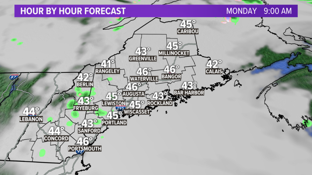
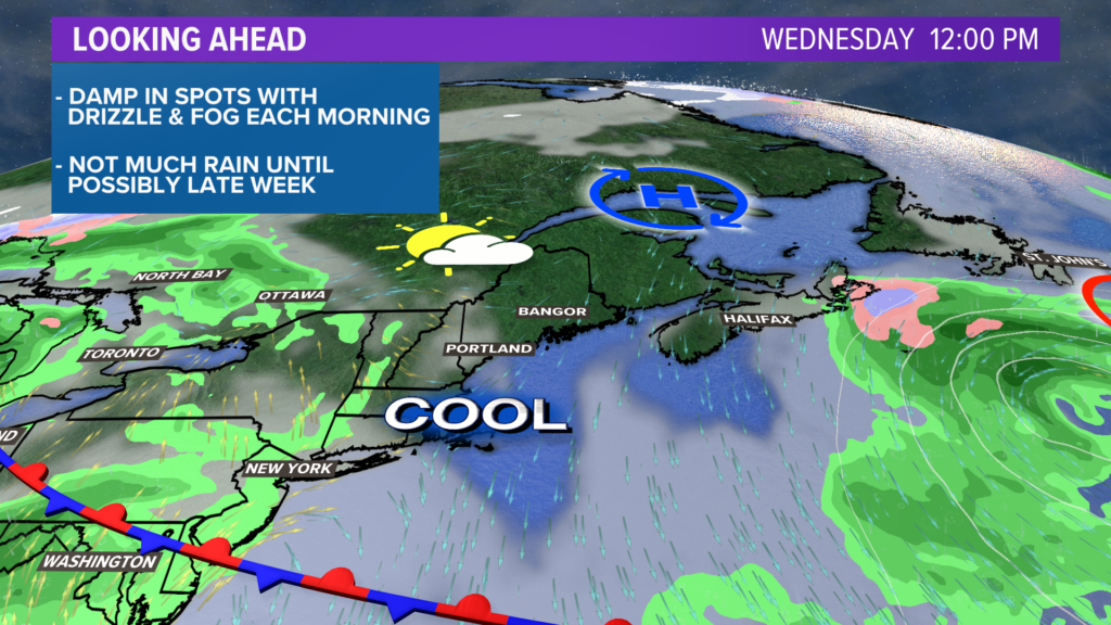
Low clouds, drizzle, and fog linger through Monday morning before the clouds mix out. Some sunshine is expected in the afternoon, helping bump temps up a little bit.
NEWS CENTER Maine
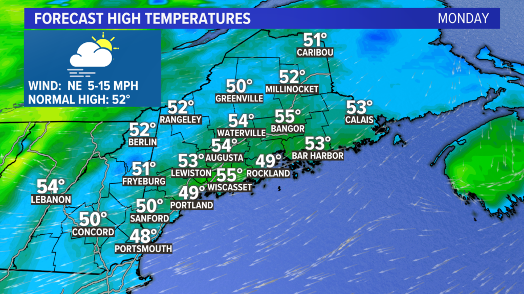
Wind comes out of the east and northeast on Monday. It could be breezy at times, especially right at the coastline. High temperatures will generally range from 50-55° for most.
NEWS CENTER Maine
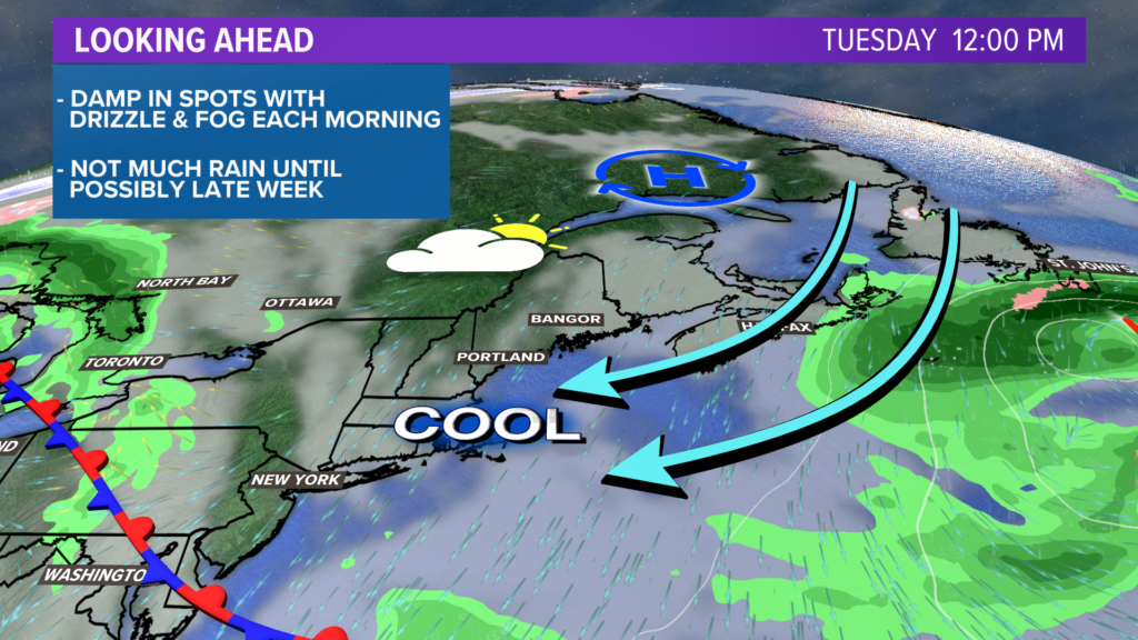
Onshore flow continues Tuesday.
Originally, it looked like Tuesday would bring a chance for showers. Now, though, it just looks cloudy.
Highs will again be around 50-55°.
NEWS CENTER Maine
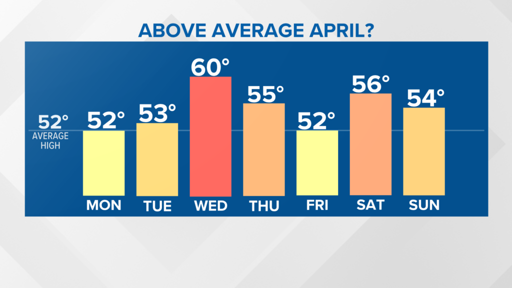
Clouds break a bit for Wednesday.
The afternoon should be warmer with the sunshine. Highs at the coastline will be around 55 degrees, while inland areas could make it slightly above 60. It will probably be the warmest day this week.
NEWS CENTER Maine
Signals point a cooler end to the week, with an increasing threat for showers on Friday. The best chance looks like the coastline, but rain could spread a bit further inland.
If it gets cold enough on the peaks, there might even be some snow that mixes in.
After Friday, the pattern trends dry with temperatures back in the 50s. Next Saturday and Sunday could be another really nice stretch of weather!
For the latest forecast details, follow me on Twitter, @MikeSliferWX.
Send questions/comments to the editors.

Success. Please wait for the page to reload. If the page does not reload within 5 seconds, please refresh the page.
Enter your email and password to access comments.
Hi, to comment on stories you must . This profile is in addition to your subscription and website login.
Already have a commenting profile? .
Invalid username/password.
Please check your email to confirm and complete your registration.
Only subscribers are eligible to post comments. Please subscribe or login first for digital access. Here’s why.
Use the form below to reset your password. When you've submitted your account email, we will send an email with a reset code.