

“Plus, it’s pretty difficult to get accumulating snow in southern Maine after April 15.” — Mike Slifer on live TV a few weeks ago
“Late-season snowstorm begins tonight.” — Mike Slifer, now, in a blog for Portland Press Herald
This whole forecasting thing keeps you humble.
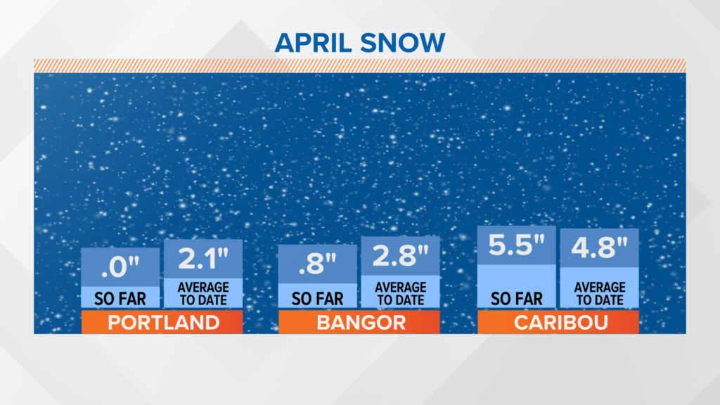
So, what are the average April snow figures? Portland averages around 2.8 inches for the entire month, which is biased more toward the beginning of the month than the end.
NEWS CENTER Maine
Note: This is only observed snowfall versus average through April 14.
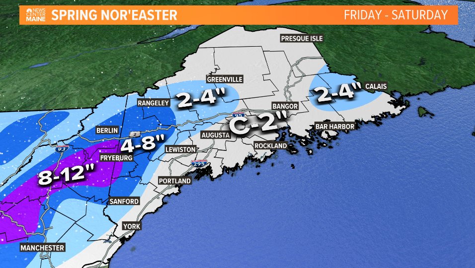
The bulk of this snow is going to be mostly outside of these climate sites, due to the elevation factor.
It’s possible that we see some big changes to this graph starting tomorrow.
NEWS CENTER Maine
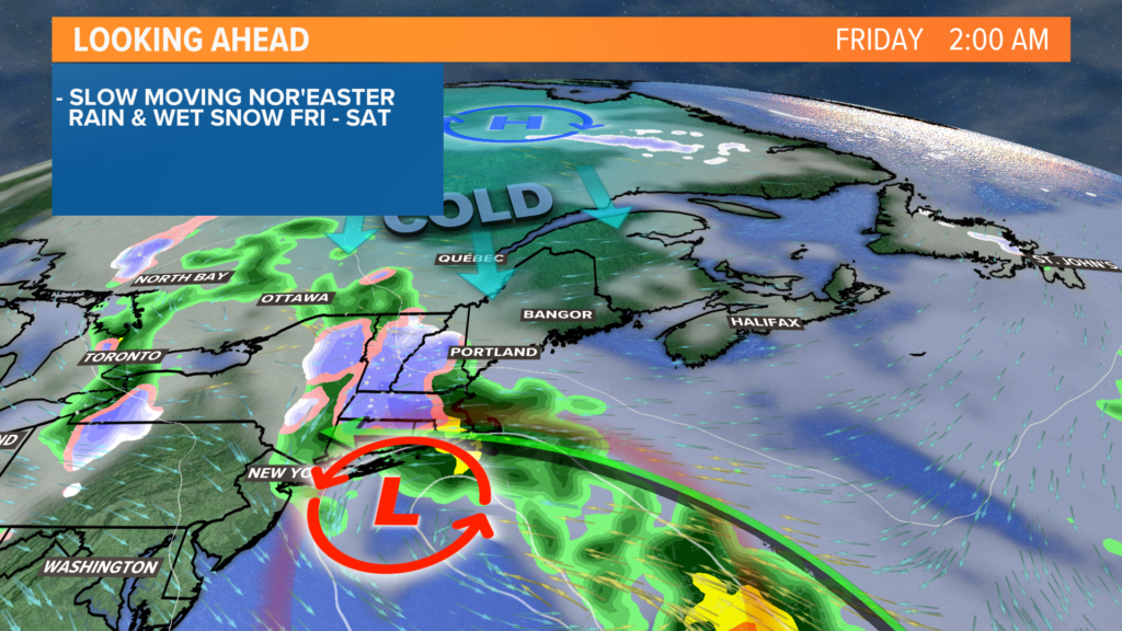
As I write this blog, there is rain falling across western New England. It’s slowly moving east, expected to drop the first showers locally late Thursday evening or early Friday morning.
NEWS CENTER Maine
What starts as rain in the valleys and snow on the peaks transitions to mostly snow by sunrise on Friday.
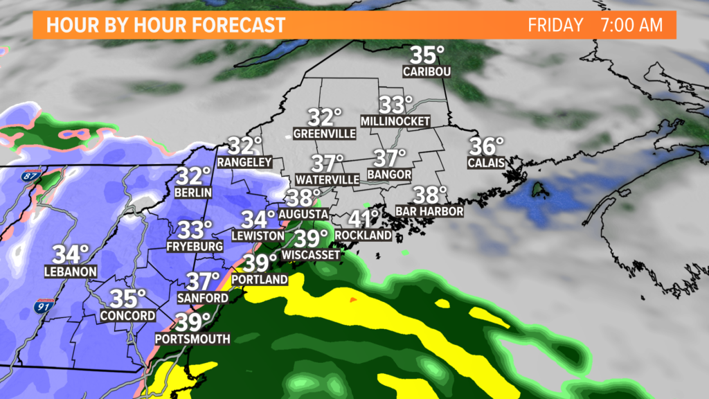
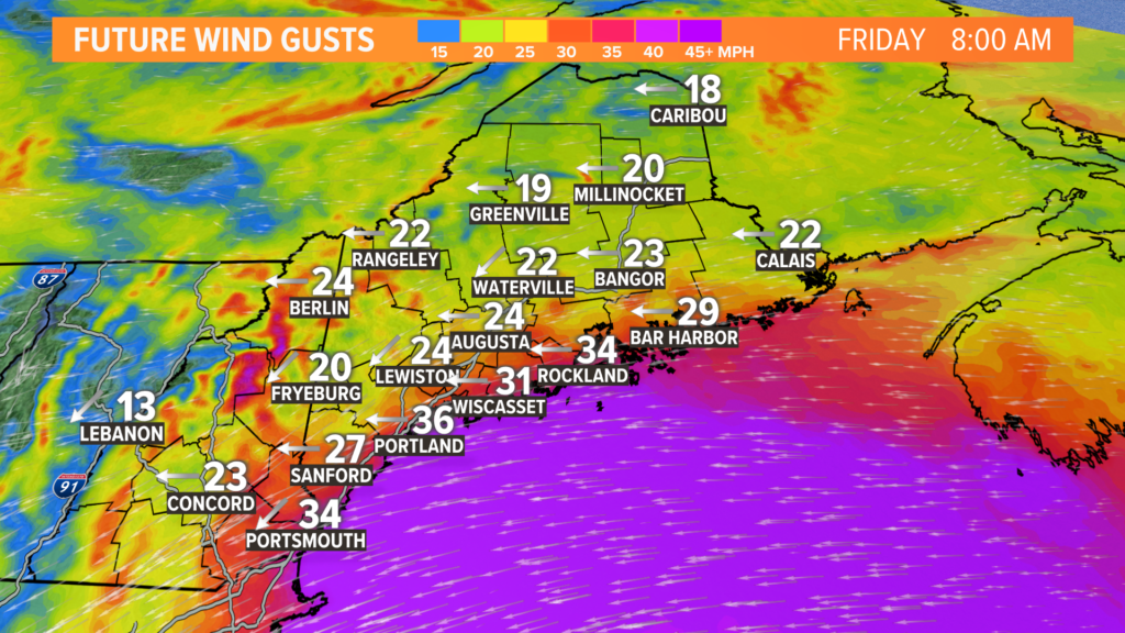
It could get a bit slick inland for the morning commute. This is especially true in the foothills, mountains and across northern New Hampshire.
NEWS CENTER Maine
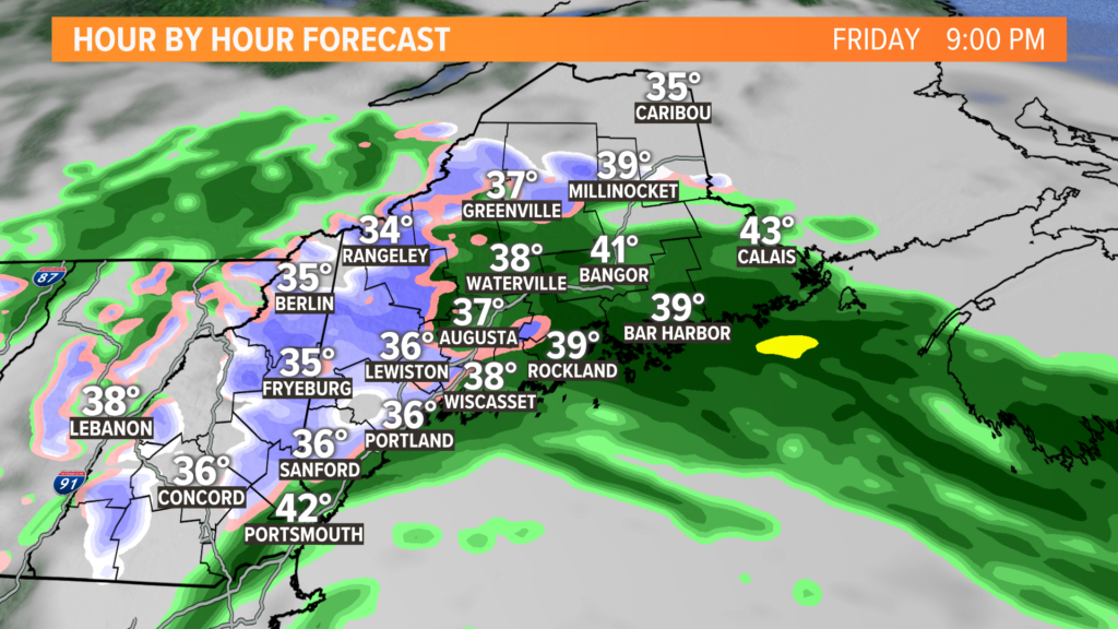
Precipitation slowly spreads east. The first flakes will fall in Lewiston and Augusta in the late morning or early afternoon. Bangor will also see some showers around or after noon.
NEWS CENTER Maine
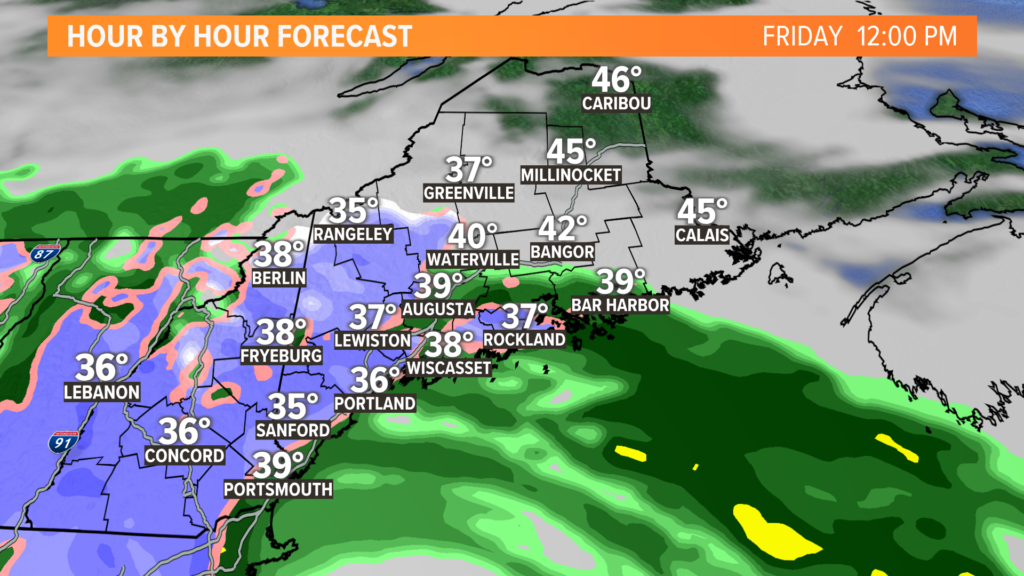
Showers continue Friday evening before slowly breaking up into the night.
There are a couple of signals that another band of snow could rotate through in the evening, bringing a bit of extra snow to the midcoast and Down East.
Northern Maine ends up on the northern fringe for most of this storm. This will keep totals a little lower locally.
NEWS CENTER Maine
The biggest changes to the map are:
- Putting Lewiston in the range of a coating to 2 inches
- Slightly downsizing the higher total ranges since they are elevation-dependent
- Tightening the gradient between little snow and more significant accumulation through interior York County
The threshold of the wet, heavy snow that causes outages is usually measured around 5 inches or so.
The highest risk for outages will be in western Maine, where the highest accumulations are expected.
Snapped tree limbs and downed wires will be possible, especially if snowfall rates pick up a bit on Friday morning. Widespread issues look unlikely.
NEWS CENTER Maine
Wind gusts will also play a factor in making it feel quite raw outside, but I don’t think they will be a huge factor in outages. Most of that is due to the snow.
At least the trees aren’t full of leaves yet.
The storm clears on Saturday with some lingering showers. Sunday will be warmer with sunshine. Highs could even make it back into the 60s early next week – so don’t expect this to stick around for long.
For more forecast info, you can follow me on Twitter, @MikeSliferWX.
Comments are not available on this story.
Send questions/comments to the editors.
