

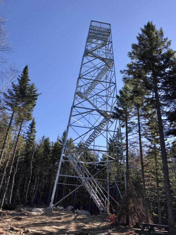

The forested dome of Trout Mountain, just a mile south of Baxter State Park, rises to an elevation of 1,409 feet in the unorganized township of T2 R9 WELS. An old and rusted fire tower, toppled more than four decades ago and resting on its side amid the thick canopy of spruce and fir, left errant explorers without any view from the peak. Until 2020, that is.
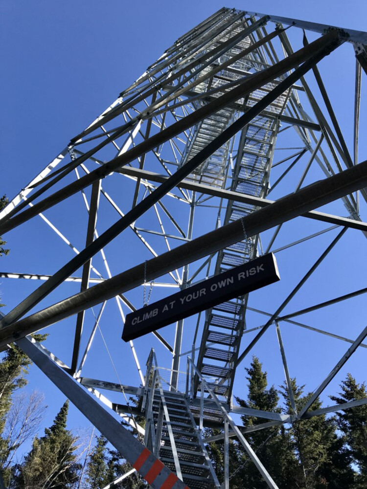
Climbing to the top of Trout Mountain’s summit tower is an exhilarating experience, but make sure the heed the “Climb at your own risk” sign. Photo by Carey Kish
Last year, The Nature Conservancy had a refurbished fire tower constructed on Trout Mountain, an imposing 80-foot steel structure with six flights of stairs leading to a wide-open observation platform on top. A new hiking trail meanders for nearly 3 miles over the mountain’s western slopes to reach the summit, where the real excitement begins.
The picnic table in the clearing at the tower’s base is a good place to relax, enjoy a snack and contemplate the sign at the start of the stairs, “Climb at Your Own Risk.” As Maine fire towers go, this is a tall one, but it’s solidly built and quite safe to ascend. So, it’s clang, thump and bang, hiking boots on heavy metal, section after exhilarating section.
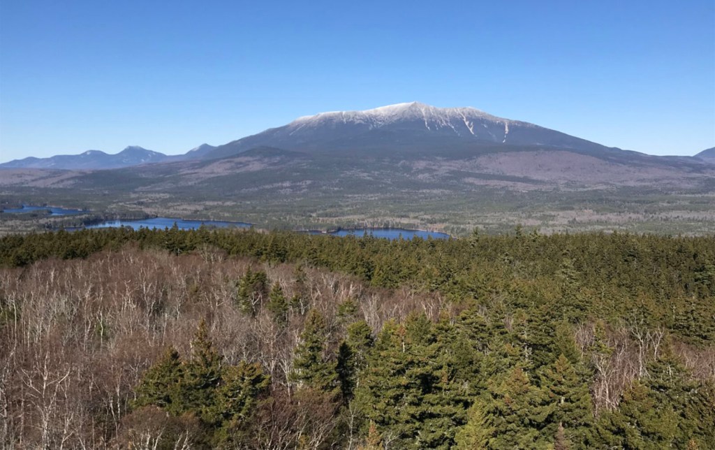
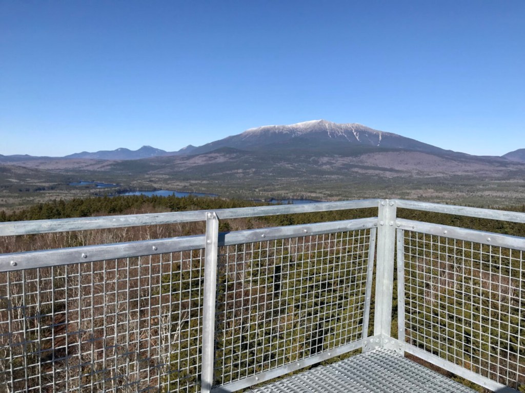
Break out of the tree cover and the view is stunning, but there’s more, so steel your nerves for the final scramble up to the ultimate prize – a breathtaking 360-degree panorama featuring Katahdin in all its glory. It’s 8 miles distant, yes, but feels so close it seems like you could almost reach out and touch our state’s “Greatest Mountain.”
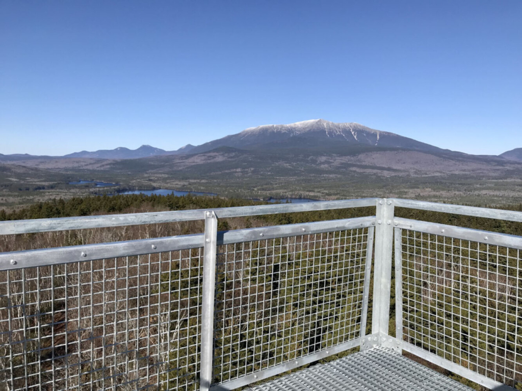
The observation platform atop the 80-foot tower on Trout Mountain takes in Katahdin and a 360-degree panorama. Photo by Carey Kish
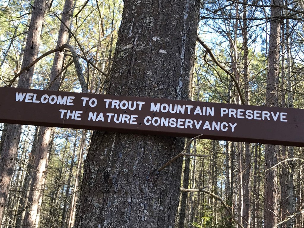
The Nature Conservancy purchased 3,598 acres around Trout Mountain some 20 years ago and established the Trout Mountain Preserve. TNC has been “conserving the lands and waters upon which life depends” around the globe for more than 100 years. Right here in Maine, TNC has worked to preserve more than 2.4 million acres of ecologically significant lands.
The Trout Mountain property abuts Baxter State Park to the north, wrapping around Lower Togue Pond before continuing toward Sandy Stream. The wild and remote Logan Ponds and Twin Ponds are protected along the eastern edge of the preserve, which extends to meet Millinocket Lake. To the south and west, TNC’s land abuts the Katahdin Forest Project Easement.
So, about that fire tower view. Bracing against the wind and holding on to your hat, looking north you can pick out Barnard and Deasey mountains in Katahdin Woods and Waters National Monument, and the tops of Sugarloaf and Mt. Chase just showing beyond The Traveler summits, Pamola Peak and Baxter Peak on Katahdin, the shoulder of Mt. Coe, Mt. O-J-I and Doubletop Mountain in Baxter State Park.
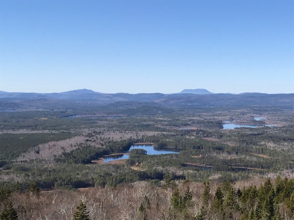
Scanning west and south, there’s the unmistakable flat-topped Big Spencer Mountain, Coburn Mountain, the multi-summited Baker Mountain, the White Cap Range and Jo-Mary Mountain in the 100-Mile Wilderness, and many others. Never mind Millinocket Lake and a whole host of other lakes and ponds. It’s an extraordinary lookout and one worth downloading a peak finder app to help identify what’s what.

The unmistakable flat-topped profile of Big Spencer Mountain (right center background), nearly 30 miles to the west, is visible from Trout Mountain’s tower. Photo by Carey Kish
The Nature Conservancy had been interested in acquiring the Trout Mountain land for some time and worked to get the funding to finally buy it, according to Nancy Sferra, TNC’s Maine Director of Land Management.
“The purpose was to add more protection around Katahdin,” said Sferra, noting that TNC also owns the 46,271-acre Debsconeag Lakes Wilderness Area just west across the West Branch of the Penobscot River. “Public access will be concentrated on Trout Mountain, leaving the remainder of the property in its wild state.”
The entirety of Trout Mountain Preserve “is managed as an ecological reserve where natural process such as ice, drought and wind shape the forest,” per TNC’s website. “Long term monitoring plots on the property are helping us track changes in forest composition,” Sferra said. “The designation also allows low impact recreational uses and traditional uses like snowmobiling.”
TNC plans to improve the Trout Mountain Trail with assistance from the Maine Conservation Corps, and an information kiosk will be erected at the trailhead parking area just off the Baxter State Park Road. In addition, a second observation platform will be built at the tower’s 60-foot level. Upon completion, the 4-wheel drive access road will be allowed to revert to the forest.
Carey Kish of Mt. Desert Island is the author of AMC’s Best Day Hikes Along the Maine Coast and editor of the AMC Maine Mountain Guide. Follow Carey’s adventures on Facebook @Carey Kish
Send questions/comments to the editors.

Success. Please wait for the page to reload. If the page does not reload within 5 seconds, please refresh the page.
Enter your email and password to access comments.
Hi, to comment on stories you must . This profile is in addition to your subscription and website login.
Already have a commenting profile? .
Invalid username/password.
Please check your email to confirm and complete your registration.
Only subscribers are eligible to post comments. Please subscribe or login first for digital access. Here’s why.
Use the form below to reset your password. When you've submitted your account email, we will send an email with a reset code.