

Monday is going to be wicked hot. A real summah day. Don’t forget to hydrate and grab the SPF if you head outdoors! Speaking of …
NEWS CENTER Maine
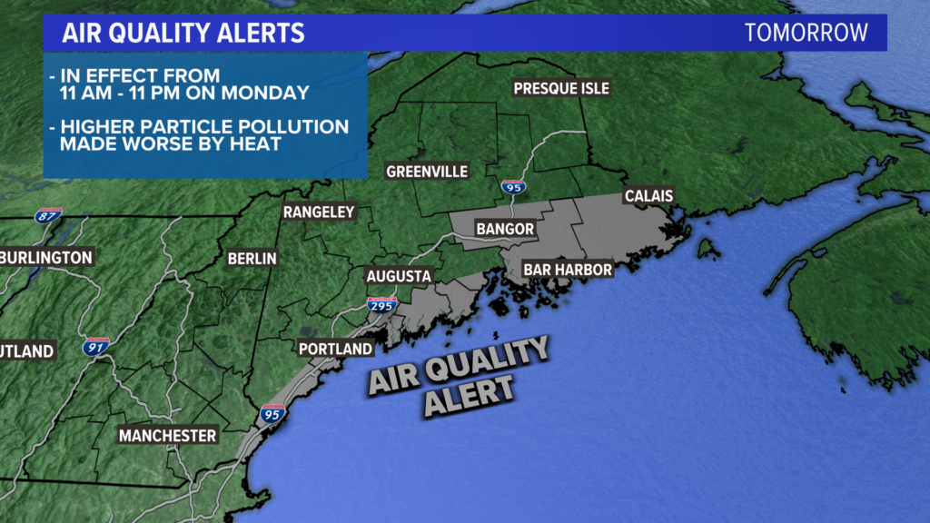
Air quality alerts have been posted for coastal Maine on Monday.
Given the higher amount of particle pollution and the impending heat and humidity, some people may have difficulty breathing. It’s a good idea to take it easy if you plan on spending time outside.
NEWS CENTER Maine
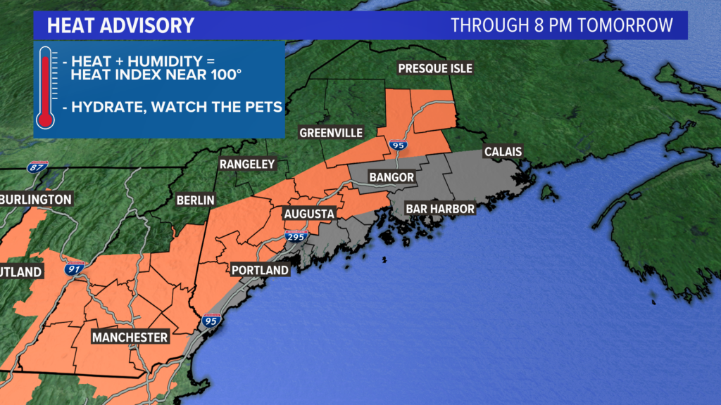
The heat gets its own set of headlines tomorrow.
Heat advisories are in effect for all of the areas highlighted in orange. The heat index, which is what it feels like when you combine the temperature and humidity, will be near or over 95°. Water is going to be wicked important tomorrow. That goes for pets, too!
NEWS CENTER Maine
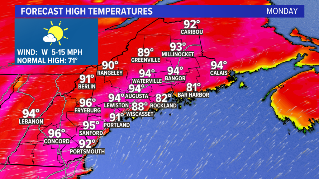
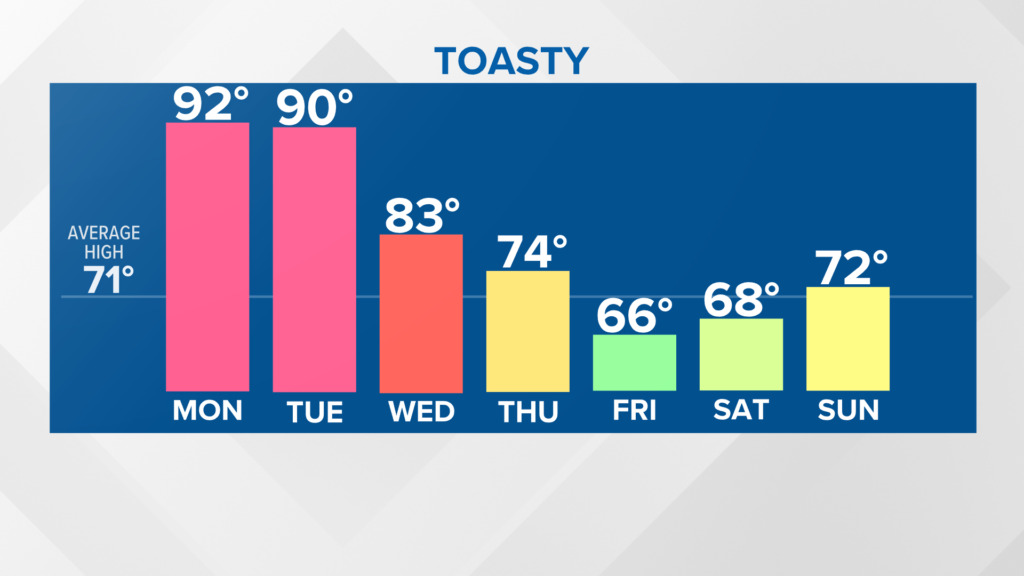
Here’s the heat in all its glory. A scorcher. And the hottest day of the year so far, too. Low to mid 90s are expected just about everywhere, with the exception along some coastal spots where the wind comes in out of the southwest.
NEWS CENTER Maine
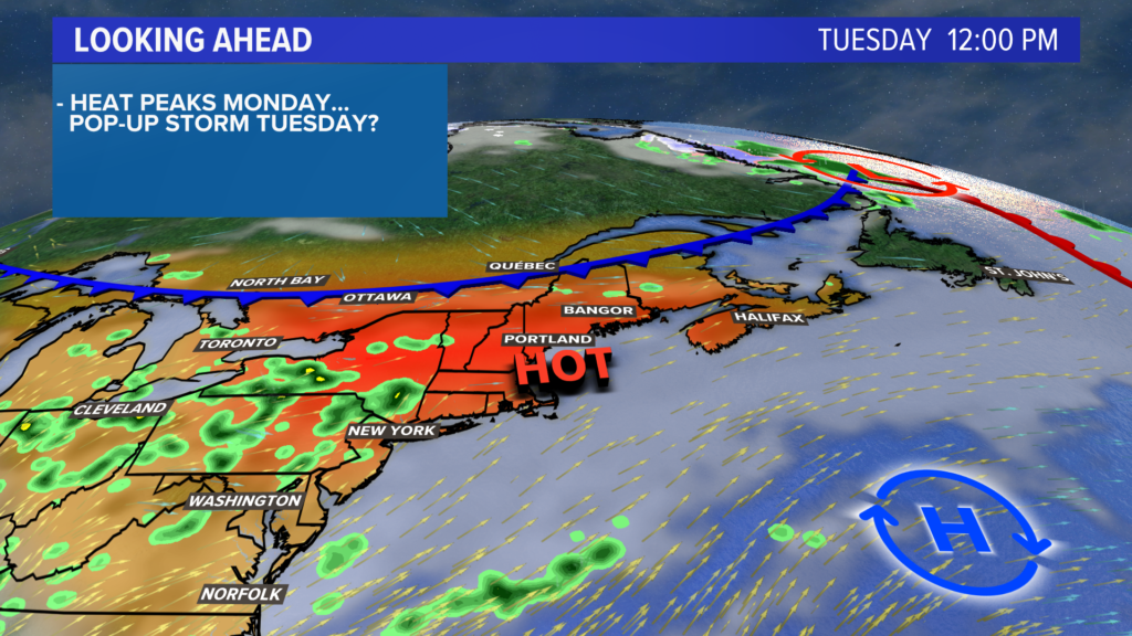
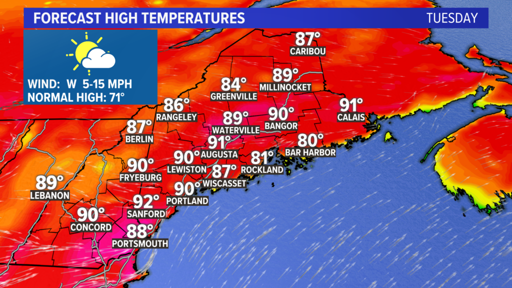
The heat does not go anywhere on Tuesday.
In fact, it will be within a couple of degrees of Monday.
NEWS CENTER Maine
Most spots will again approach 90°, although a couple of subtle shifts in the upper atmosphere will cap temperatures below 93° just about everywhere.
Records could be broken each day. Take a look at the list below.
Monday, June 7 records:
• Portland: 95° set in 1999. Forecast high is 91°.
• Augusta: 92° in 1999. Forecast high is 94°.
Tuesday, June 8 records:
• Portland: 90° set in 1999. Forecast high is 90°.
• Augusta: 90º set in 2008. Forecast high is 91°.
NEWS CENTER Maine
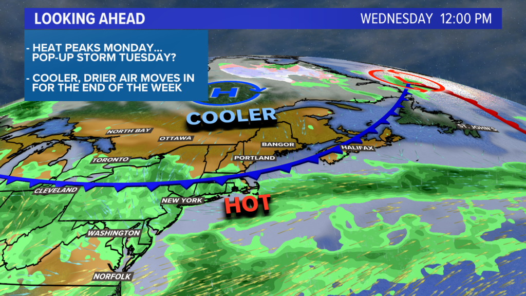
A cold front rolls through late Tuesday, breaking the heat and humidity.
Temperatures are still expected to make it into the 80s with a bit of mugginess by Wednesday afternoon, but this is the last sticky day for a while.
NEWS CENTER Maine
Things are looking much cooler starting Thursday. Most will top out in the low to mid 70s. On the bright side, the sunshine will be beaming.
Friday and Saturday feature more clouds and the threat for an isolated shower or two. Rain chances may increase as we get closer, but it looks fairly dry as of now.
High temperatures both days will only be in the 60s.
For reference, the high temperature is typically in the low 70s in early June.
You can always get more forecast info by following me on Twitter, @MikeSliferWX.
Send questions/comments to the editors.

Success. Please wait for the page to reload. If the page does not reload within 5 seconds, please refresh the page.
Enter your email and password to access comments.
Hi, to comment on stories you must . This profile is in addition to your subscription and website login.
Already have a commenting profile? .
Invalid username/password.
Please check your email to confirm and complete your registration.
Only subscribers are eligible to post comments. Please subscribe or login first for digital access. Here’s why.
Use the form below to reset your password. When you've submitted your account email, we will send an email with a reset code.