

Much, much cooler weather settled in this past weekend, giving a quick preview of what’s coming over the next couple of months.
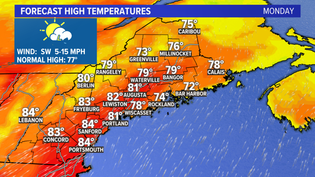
Monday will be warmer, though.
NEWS CENTER Maine
The afternoon will see temperatures in the 80s for most as dew points climb back into the 60s.
This juicy air will be primed for thunderstorms in the afternoon.
As the cold front approaches from the northwest, expect storms to fire off. Western Maine will see the first storms shortly after noon. These will move south and clear the coastline before 9 or 10 p.m.
Given the energy these storms have to work with, expect some of them to be a bit gusty. There could also be some localized high water in areas with poor drainage since the downpours will be wicked heavy.
NEWS CENTER Maine
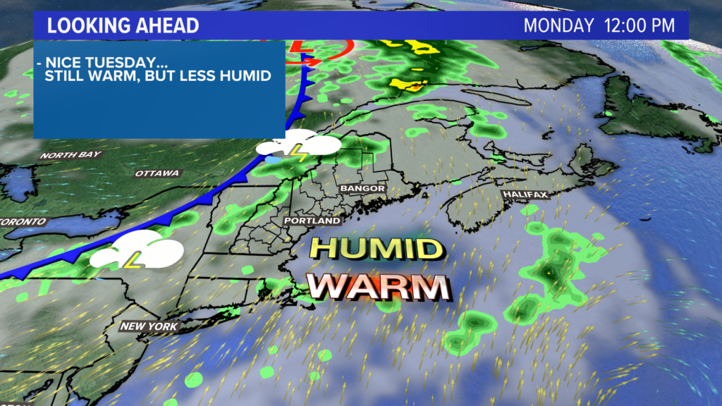
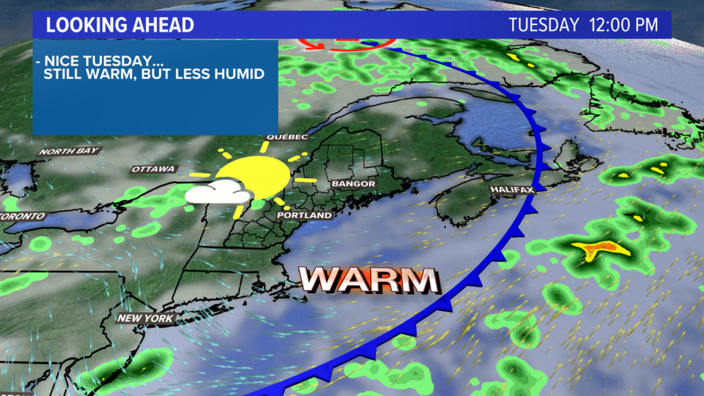
Drier, less humid air returns on Tuesday. Temperatures will still reach the low to mid 80s, though, as the air comes down off of the western mountains.
Clouds are expected to linger through the morning, but skies should clear a bit for the afternoon.
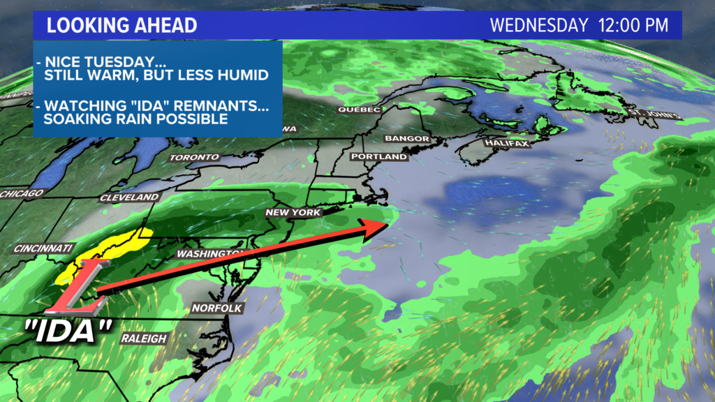
Locally, Wednesday looks like a decent day.
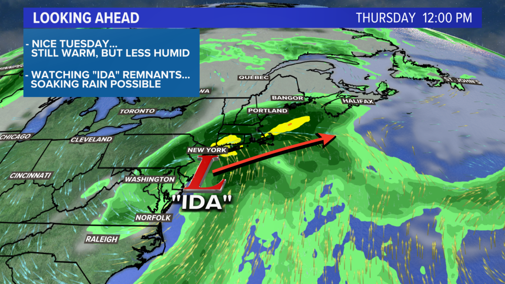
Temperatures will top out in the 70s as clouds increase through the day. These will be out ahead of Ida’s remnants. Speaking of Ida…
NEWS CENTER Maine
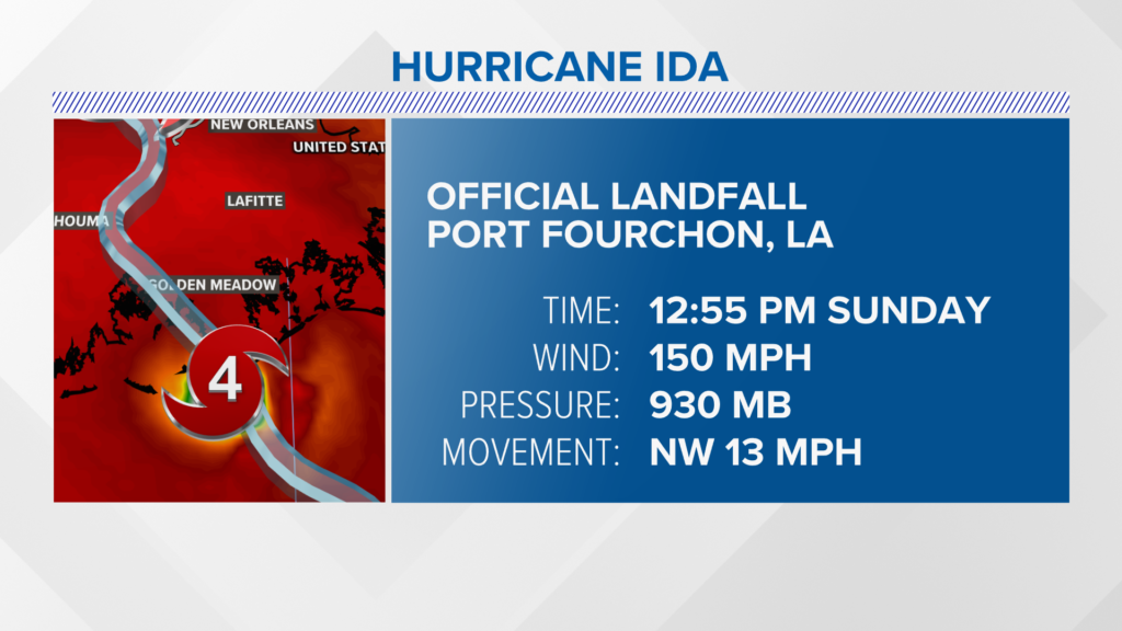
Ida made landfall in Port Fourchon, Louisiana, at 12:55 p.m. on Sunday. It was a category 4 hurricane at the time of landfall, with sustained winds around 150 mph.
NEWS CENTER Maine
Ida will play a role in our forecast for the end of the week.
While the local impacts will not be nearly as significant as the impacts along the Gulf Coast, tropical moisture will still return to Maine.
Rain is expected most of the day Thursday. Given the dynamics of the storm and the amount of moisture with it, someone in New England will likely end up with 2-4″ of rain.
It’s certainly worth watching and we will nail the details down as we get closer. On the bright side, an early glance at the Labor Day weekend forecast is looking pretty favorable for nice weather.
For other forecast info, follow me on Twitter, @MikeSliferWX.
Comments are not available on this story.
Send questions/comments to the editors.
