

What a weekend! Areas east of Portland dealt with a deluge on Saturday night, with rain totals approaching and exceeding 5″ in some spots.
Thankfully, Monday looks like a much quieter day.
NEWS CENTER Maine
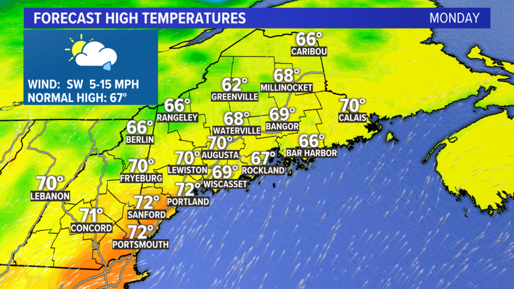
Most will be able to get into the 70s on Monday afternoon.
It actually starts off as a really nice day. Sunshine eventually gives way to clouds through the early afternoon.
NEWS CENTER Maine
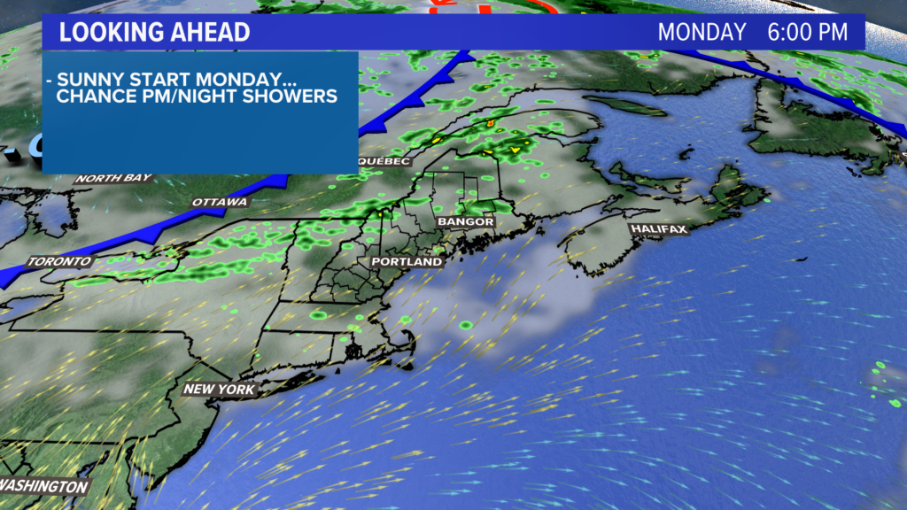
In the evening, a couple of showers will be possible. Highest risk is through the foothills and mountains of western Maine.
NEWS CENTER Maine
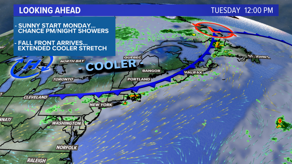
As the weak front washes out south of Maine, cooler air will be slow to return.
This means one last day of highs near 70 under partly sunny skies.
NEWS CENTER Maine
Remember that “fall feel” I referenced earlier?
NEWS CENTER Maine
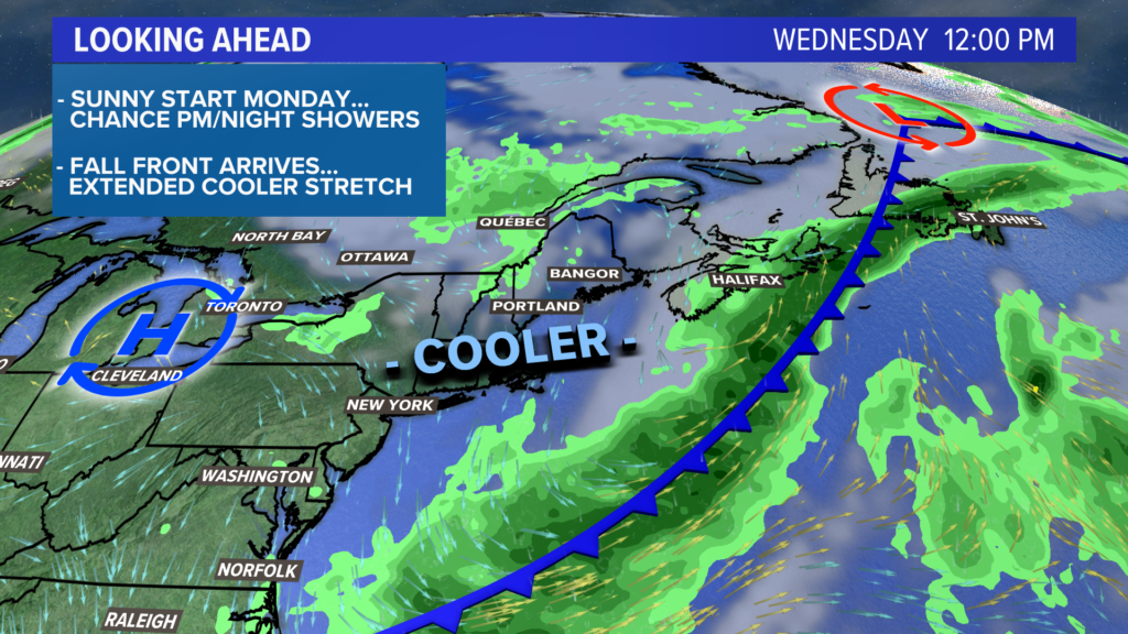
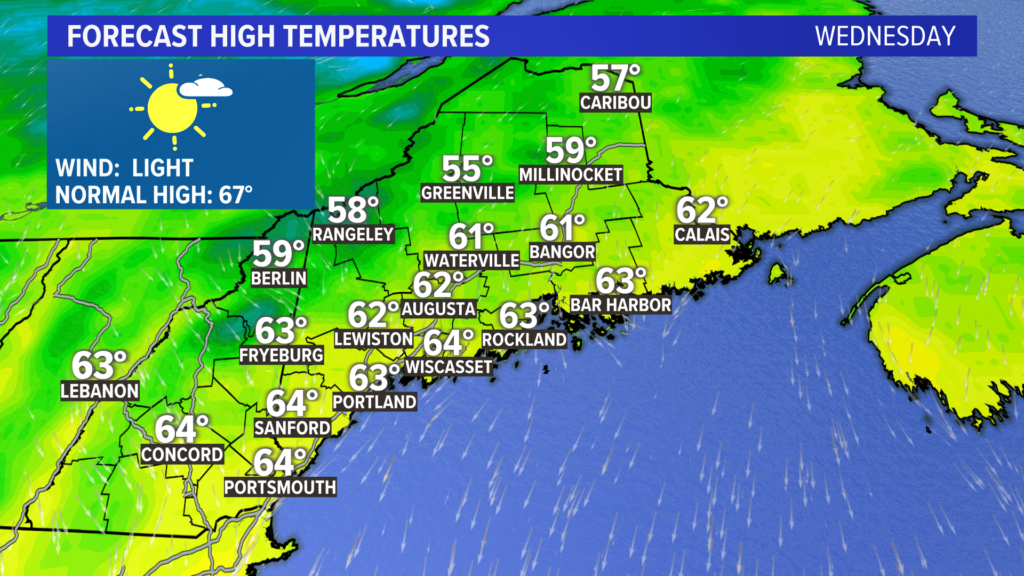
Here it is! A mix of sun and clouds on Wednesday afternoon will keep most spots in the mid 60s.
At night, temperatures will fall down into the 40s.
NEWS CENTER Maine
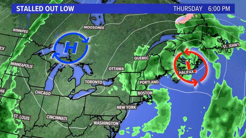
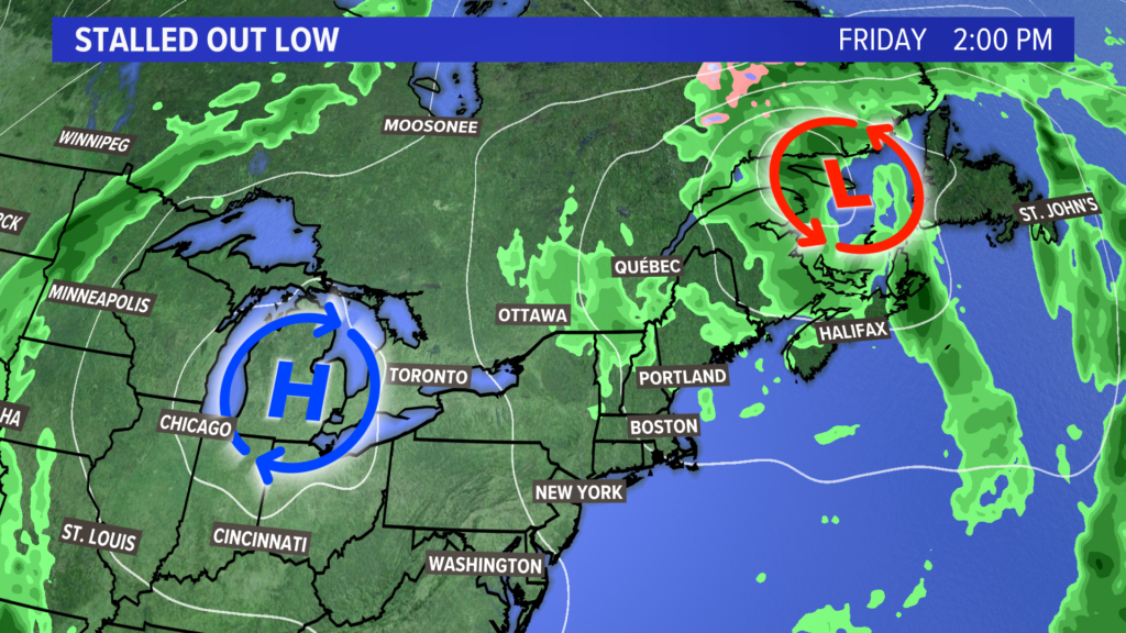
Unfortunately, the end of the week trends a bit wetter.
An area of low pressure gets stuck nearby. This means cool conditions will be locked in place for at least Thursday and Friday.
NEWS CENTER Maine
It also means there will be a few chances for showers. Right now, Thursday looks like the more unsettled day.
With some luck, the weekend will turn sunny with just-about-perfect fall weather to ring in October.
More details on that, of course, as we get closer.
You can always get more forecast info from me on Twitter, @MikeSliferWX.
Copy the Story LinkComments are not available on this story.
Send questions/comments to the editors.
