

All week long, Keith Carson has been wishing that this snowstorm would move closer to the coastline.
I’m not sure if it’s luck or he actually can control the weather (which is what he told me in my interview almost 3 years ago), but the storm track definitely bumped west.
If you’re a winter weather lover, you know that means one thing: bigger snow totals are on the table.
No, this will not be a huge blockbuster event.
It will, however, freshen up the snowpack and allow for Mainers to get out and enjoy some winter recreation.
Both the National Weather Service in Gray and Caribou have winter storm warnings posted for various parts of Maine.
NEWS CENTER Maine
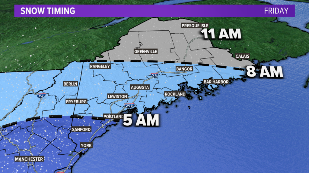
First things first: the timing of this snow is not ideal for travel on Friday morning.
By 5 a.m., most spots in York county will have flakes falling. Given the cold air as snow begins, it will stick to the roads immediately.
The Midcoast and central Maine to Bangor will see snow start up between 5 a.m. and 8 a.m.
If you’re north of Bangor, it will not happen until after 8, but will start up before noon.
NEWS CENTER Maine
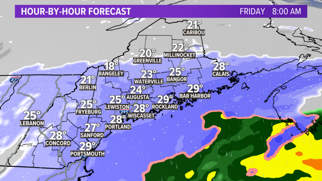
Here’s an idea of what the radar will look like at 8 in the morning on Friday.
Throughout almost all of Maine, snow will be falling into some cold air. Temperatures will likely be in the 20s.
While I do not get to make the final call, I expect a lot of schools will be off tomorrow.
NEWS CENTER Maine
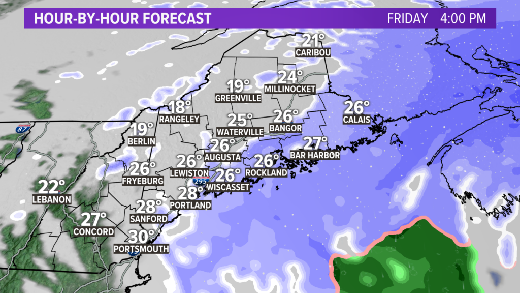
This storm is a pretty quick mover, with most areas only seeing snow for roughly 12 hours.
Fast forward to 4 p.m. Friday.
Snow will be winding down across the western half of Maine, while Downeast gets an extra bump from a moderate snow band.
NEWS CENTER Maine
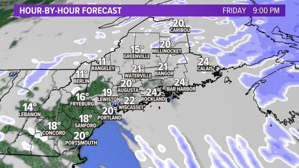
In just a few hours, all that remains from the storm is some cloud cover and lingering flurries.
NEWS CENTER Maine
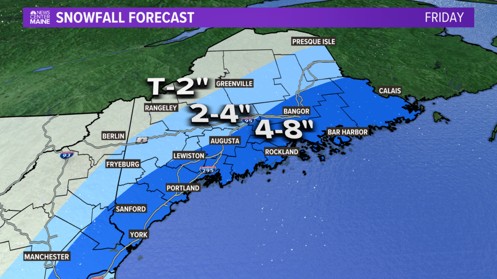
I know, I know…there’s a whole group of skiers and snowboarders and snowmobilers asking why there is no area on that map that has a minimum of 12″.
All things considered, the 4-8″ range will probably see the most impacts.
Given the temperature profiles, it should be pretty light and fluffy snow.
Even better, no need to worry about mixing with this one.
Behind this, a blast of Arctic air is slated for Tuesday. The coldest temps of the season, and maybe even the past few seasons, is looking likely.
However, no snow is coming with it. If you’re waiting for something bigger, keep an eye on the middle of the month. We’ll see what happens…
Comments are not available on this story.
Send questions/comments to the editors.
