

Look, I’m going to be honest. I got too attached to this storm. I got too close.
I watched it grow up from a mere six-day out EURO model projection to a more independent, functional Ensemble GFS storm.
And now that the storm has trended JUST a bit too far east, I’m not mad; I’m just disappointed. I only wanted this storm to fully apply itself, to be the storm I know it can be. But time is running out for that.
Come to papa. pic.twitter.com/QSns3nQEVM
— Keith Carson (@KeithCarson) January 6, 2022
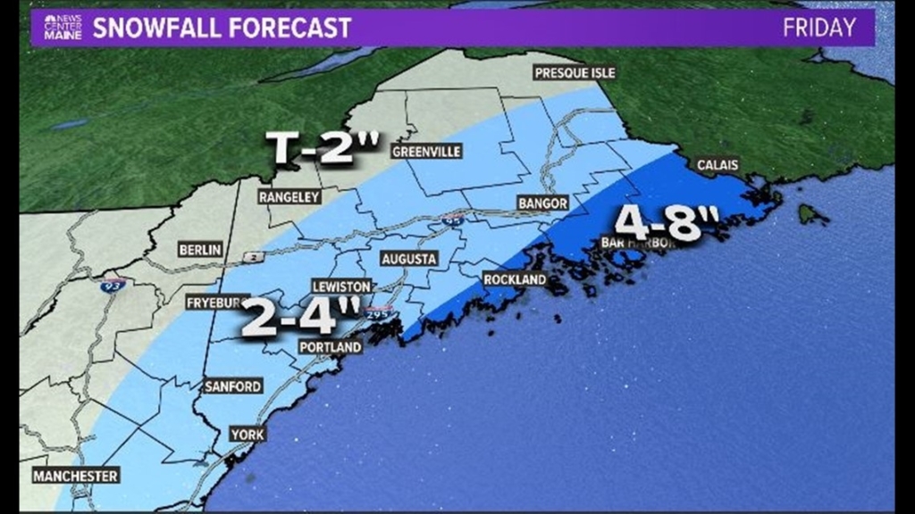
As it stands, with its slightly too far east track, it’s a moderate-to-light event.
That low position isn’t terrible, but it’s just not close enough to get the really deep moisture into the state. A shift of 75 miles to the west or even northwest would give us a solid six to 12 inches-type event.
Snow begins on Friday morning.
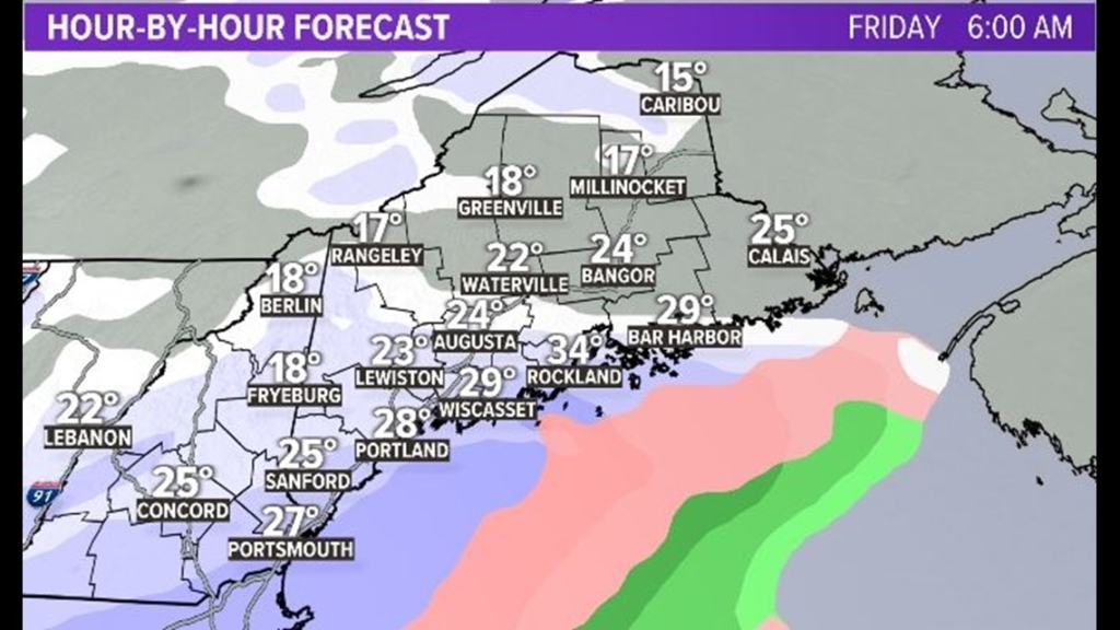
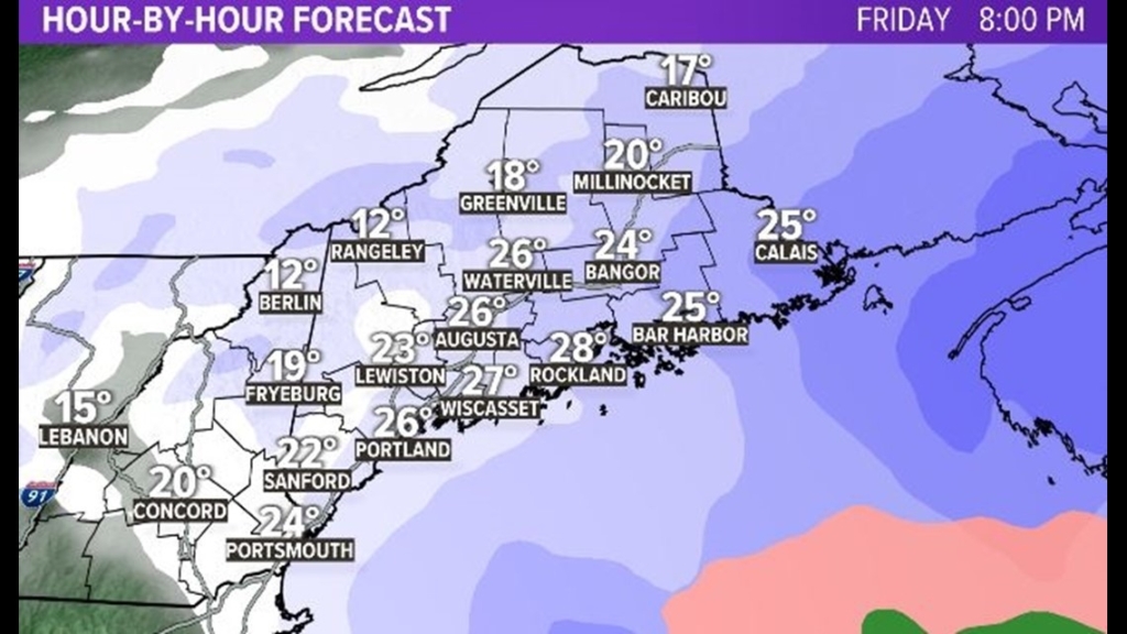
It’s likely the most intense during the afternoon and early evening, especially along the coastline, where we will get some more substantial bands.
The snow wraps up overnight on Friday.
I still think this storm could be a bigger deal. Often the models tick northwest with low pressure systems within 48 hours or so of the onset of a storm. It’s a known bias.
In addition, snowfall isn’t linearly related to distance from the center of a low. Deformation zone bands of snow and CSI bands often increase snowfall amounts well away from the center itself.
Bottom Line: Give me any reason to increase this snowfall map, and I’m dying to do it. It’s a hunch.
But based on all the information we have right now and leaving wish-casting out of it, this is our snowfall map for Friday.
Send questions/comments to the editors.

Success. Please wait for the page to reload. If the page does not reload within 5 seconds, please refresh the page.
Enter your email and password to access comments.
Hi, to comment on stories you must . This profile is in addition to your subscription and website login.
Already have a commenting profile? .
Invalid username/password.
Please check your email to confirm and complete your registration.
Only subscribers are eligible to post comments. Please subscribe or login first for digital access. Here’s why.
Use the form below to reset your password. When you've submitted your account email, we will send an email with a reset code.