

Ah, winter in Maine. December started off very quiet, but January is making up for it on all fronts – no pun intended.
Remember how cold it was earlier in the week? Get ready for another blast of that beginning as early as Friday night.
NEWS CENTER Maine
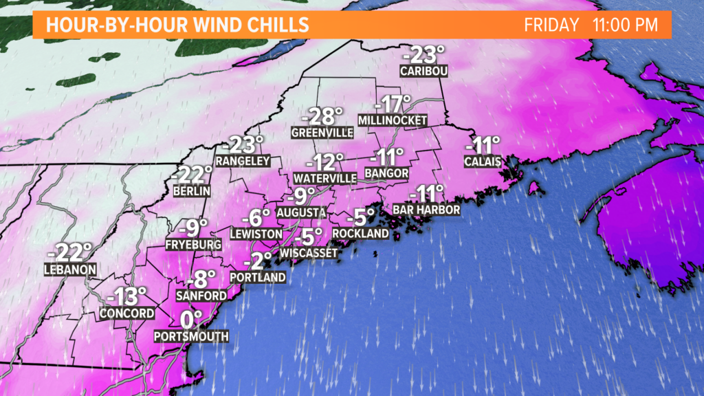
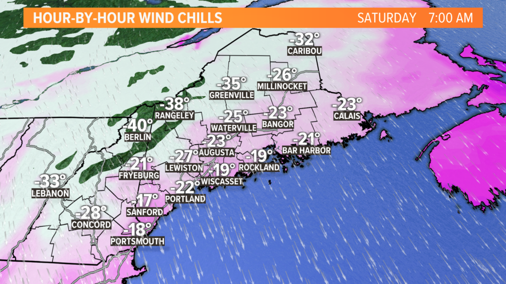
The most extreme wind chills will be across the high peaks in western Maine. The Rangeley area might see wind chills drop down to minus 35 or minus 40 by Saturday morning.
NEWS CENTER Maine
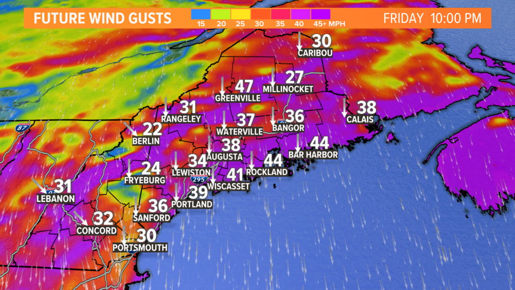
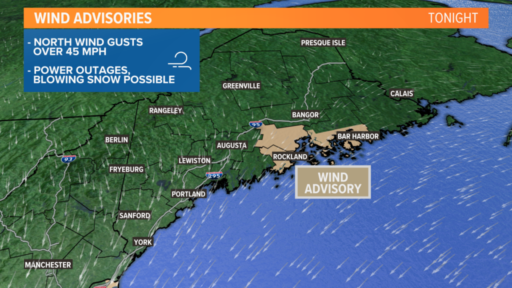
That is, of course, thanks to strong wind gusts. With gusts approaching or even exceeding 45 mph, a wind advisory has been issued by the National Weather Service for some areas.
NEWS CENTER Maine
A few power outages are certainly on the table, but I don’t expect widespread issues. The bigger story with the wind is just how much colder it makes the air feel on nights like this.
NEWS CENTER Maine
The brutal cold will be worst right around sunrise on Saturday. With air temperatures near zero and a strong north breeze, it’s going to feel well below zero everywhere.
On the bright side, the wind does relax pretty quickly by Saturday afternoon.
NEWS CENTER Maine
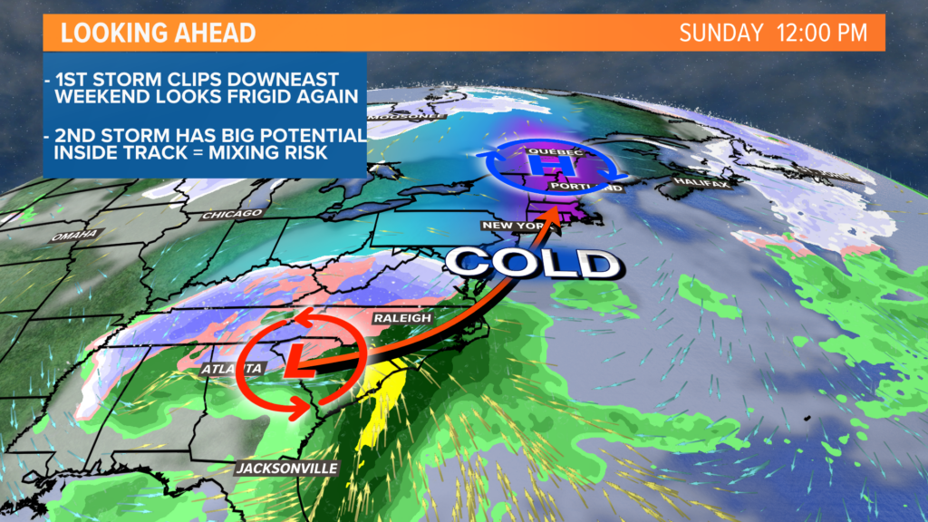
Sunday will be quiet and cold. Most spots start below zero on Sunday morning, but the wind will not be nearly as bad as Saturday. Clouds thicken up a bit later in the day ahead of Monday’s storm.
NEWS CENTER Maine
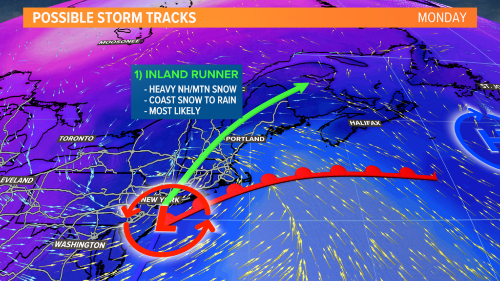
While new data is still coming in, and there could be some shifts, I think this is the most likely outcome.
Arctic air will be departing ahead of this storm. That almost ensures a thump of heavy snow before the warmer air can infiltrate and switch things over to rain.
Still, an inland track like this would mean that New Hampshire and Maine’s mountains get dumped on.
I’m not ready to make a snow map just yet, but I could easily see a foot or more from Concord, N.H., to Rangeley, Maine.
At the coastline, the effects become more complicated.
Snow gives way to rain, and wind gusts pick up a bit. A strong southeasterly wind could cause some minor coastal flooding.
There might be some mixing or ice potential for inland sections of coastal counties, too.
Given the forecast, I expect travel to be affected by the snow everywhere on Monday morning. However, travel along Interstate 95 south of Augusta and along the midcoast should improve quickly in the late morning or early afternoon.
NEWS CENTER Maine
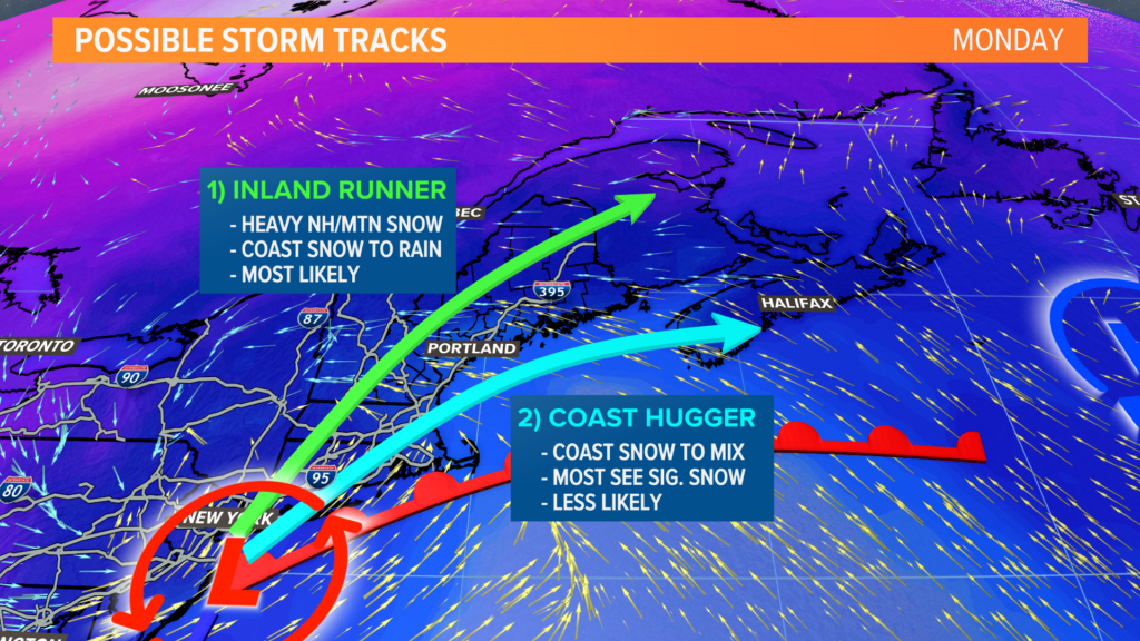
This scenario, while much less likely at this point, is still very important to consider:
If there’s a transfer of energy that favors a southern storm track, the storm itself will be along or near the coastline.
This would cut down on icing potential as well as bump up snow totals inland.
This would still deliver a solid amount of snow to the mountains, so the skiers should be happy with this forecast.
Should there be a trend toward this solution, I will update as necessary.
For now, though, I’m expecting the inland track with a thump of snow for the coast and a switch to plain rain.
No matter how you slice it, Monday looks like a tough day for travel. Plan around it if you wanted to spend your long weekend out and about.
You can follow me on Twitter, @MikeSliferWX, for more data as we get closer.
Send questions/comments to the editors.

Success. Please wait for the page to reload. If the page does not reload within 5 seconds, please refresh the page.
Enter your email and password to access comments.
Hi, to comment on stories you must . This profile is in addition to your subscription and website login.
Already have a commenting profile? .
Invalid username/password.
Please check your email to confirm and complete your registration.
Only subscribers are eligible to post comments. Please subscribe or login first for digital access. Here’s why.
Use the form below to reset your password. When you've submitted your account email, we will send an email with a reset code.