

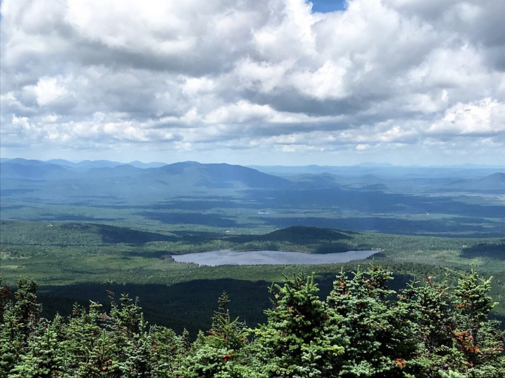
Mountain peaks as far as the eye can see rule the rugged terrain of the Upper Kennebec River and Moose River valleys between Moosehead Lake and the Canadian border. Commercial forestlands dominate this remote region, but it is also sprinkled liberally with public and private conservation lands and conservation easements.
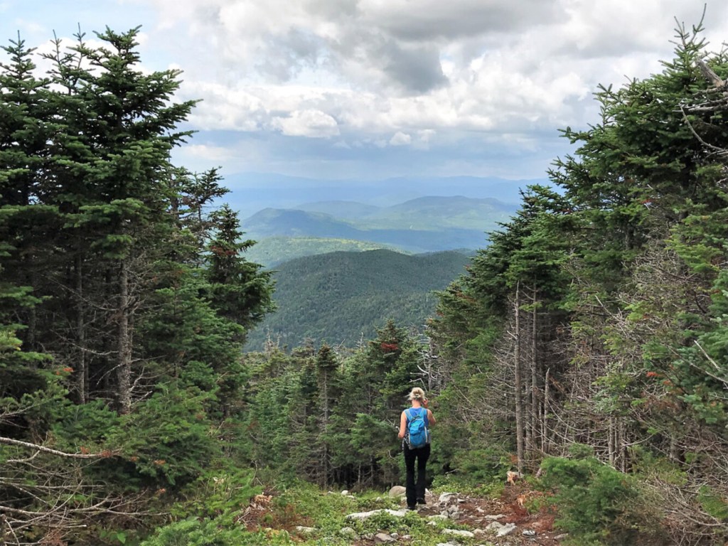
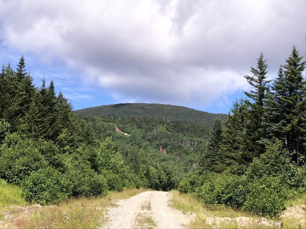
Located in Somerset County and rising to a lofty elevation of 3,717 feet, Coburn Mountain reigns supreme over this veritable sea of green summits. The mountain’s rounded dome, recognizable from many compass points around this part of northwestern Maine, can be reached by a short but steep climb – 1,300 feet in just 1.2 miles – over its eastern flank.
Coburn Mountain is the site of the long defunct Enchanted Mountain Ski Area, which operated briefly from 1966 to 1973. Billed as the “Switzerland of Maine,” skiers were encouraged to “come to Enchanted Mountain … where the skiing is fun and exciting, for beginner and expert.” Today, hikers can follow one of the old ski trails on the way to the top.
The Coburn Mountain trailhead is just north of the former ski area base. It’s a 2 1/2-mile drive in on Enchanted Mountain Road, which used to be in rough shape but is now quite passable. The road is off U.S. Route 201, 11 miles north of the bridge over the Kennebec River in The Forks and 15 miles south of the junction of U.S. Route 201 and Maine Routes 6 and 15 in Jackman.
What was the main ski trail and lift line on the mountain is still visible as you approach the 2,424-foot base of the mountain. The first mile of the hike leads along a snowmobile trail that was once Enchanted’s northernmost ski trail. No ATVs are allowed on the trail, which is maintained by the Coburn Summit Riders snowmobile club, so it’s in really good shape.
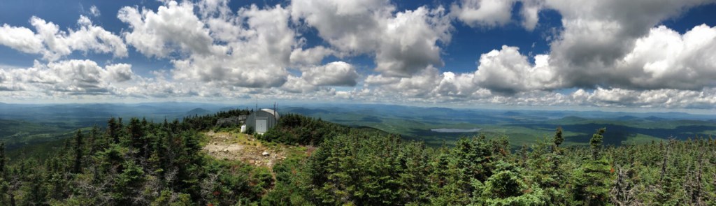
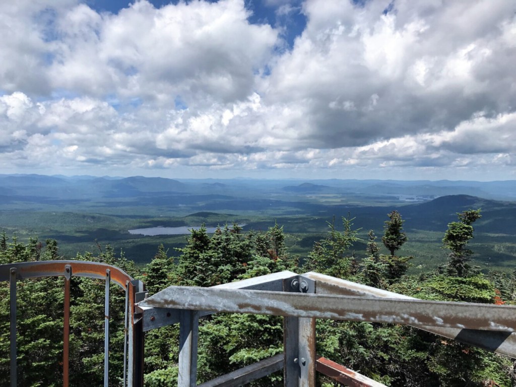
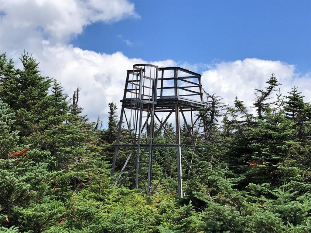
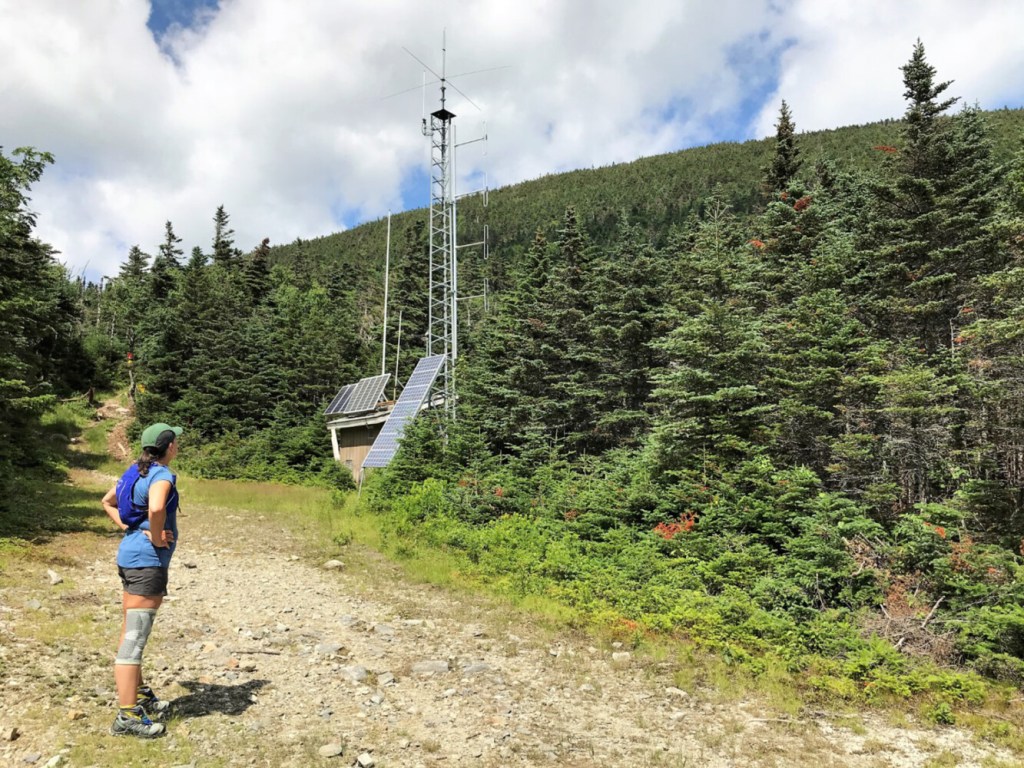
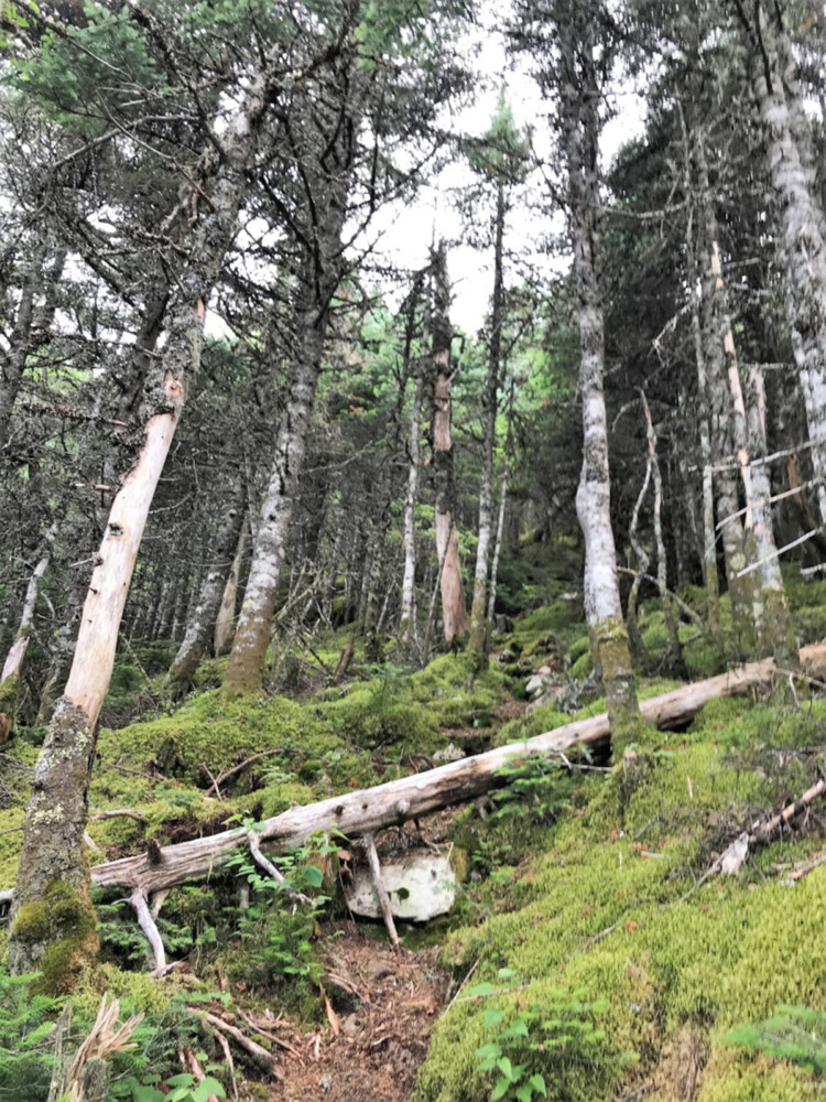
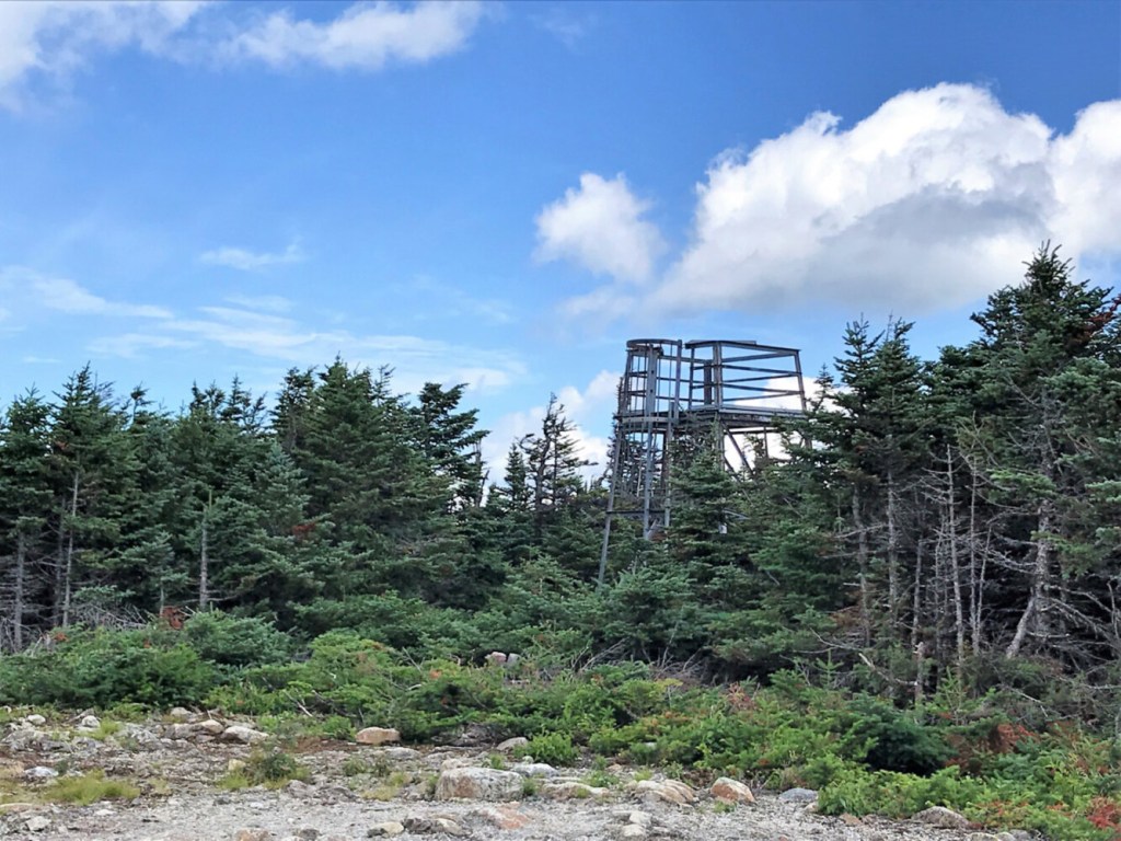
Just beyond the radio repeater tower atop the old double chairlift line, a narrow path enters the thick conifers and climbs pretty much straight up the southeast face of Coburn. On top, there’s another radio repeater tower, a Quonset hut and a solar array. The path continues a few yards to the old 1938 fire tower, the cab of which was replaced with an observation deck.
According to the AMC Maine Mountain Guide, “Coburn Mountain is the highest peak in the region, with spectacular views rivaling the best in Maine.” You can take the veracity of that statement to the bank. Make the hike, scamper up the tower steps and take a long look around at the 360-degree panorama of nothing but wonderful wildness; it’s truly amazing.
To the west are Number Five and Kibby mountains; to the north, Sally and Boundary Bald mountains; to the south, the Bigelow Range; to the east, Big Moose and Little Moose mountains. These are just a few in the astounding jumble of mountains in view, never mind those across the border in Canada. Tap the Peak Finder app on your phone and see for yourself.
The cab of the 1938 fire tower atop Coburn Mountain has been replaced with an observation deck that allows for 360-degree views. Carey Kish photo
When it’s time to head down, skip the steep upper trail section and amble back via the upper portion of the snowmobile trail, which makes a moderate descent along the southwest ridge before looping around to rejoin the lower snowmobile trail to the bottom. The total lollipop circuit is just 3.1 miles, but you’ll have certainly earned them.
The Maine Bureau of Parks and Lands owns 200 acres on Coburn Mountain, including the summit and southeastern slopes. It’s good to know that the top is in good hands and that the local snowmobile group is keeping up the trail route. This is a special place worth protecting, that’s for sure. And thanks to Weyerhaeuser Timberlands for allowing public access.
Coburn Mountain is named after Philander and Abner Coburn, two brothers who once owned the mountain and had much of the land in the area logged in the mid-1800s. Abner Coburn was a prominent Skowhegan businessman and served as the 30th governor of Maine from 1863-64. Coburn died in 1865 and left 12 acres in Skowhegan for use as a public park.
While you’re up visiting Coburn Mountain, you might want to check out other mountains nearby with hiking trails, like Number Five, Sally, Burnt Jacket, Boundary Bald and Williams.
Carey Kish of Mount Desert Island is a veteran hiker and freelance writer. His latest book, “Beer Hiking New England,” will be available later this year. Follow more of Carey’s adventures on Facebook and Instagram @careykish
Send questions/comments to the editors.

Success. Please wait for the page to reload. If the page does not reload within 5 seconds, please refresh the page.
Enter your email and password to access comments.
Hi, to comment on stories you must . This profile is in addition to your subscription and website login.
Already have a commenting profile? .
Invalid username/password.
Please check your email to confirm and complete your registration.
Only subscribers are eligible to post comments. Please subscribe or login first for digital access. Here’s why.
Use the form below to reset your password. When you've submitted your account email, we will send an email with a reset code.