


AUGUSTA — As the last of the weekend storm cleared out of Maine on Monday, public safety officials in communities in the Kennebec River watershed were preparing for the flooding expected to follow.
After the moisture-laden storm dumped up to 5 inches of rain across central Maine on Sunday night and early Monday, roads in low-lying areas throughout the area were flooded or washed out, forcing travelers to seek alternate routes.
Sunday’s 3 inches of rainfall in Augusta smashed the previous record for that date that was set in 1963, when 1.17 inches of rain fell. Sarah Thunberg, a meteorologist with the National Weather Service in Gray, said because rain continued to fall into Monday, it is possible the May 1 record could be broken as well.
In Somerset County, the worst of the storm was felt in Mercer, Skowhegan and Madison, Michael Smith, Somerset County Emergency Management Agency director, said. Water levels were high in both the Kennebec River and the Carrabassett River, one of the Kennebec’s tributaries, with the flow in the Carrabassett expected to peak Monday afternoon.
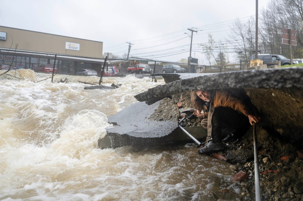
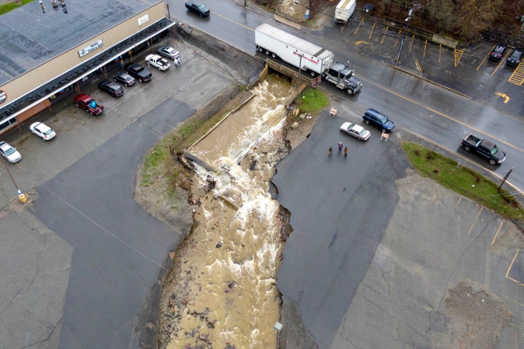
Skowhegan Fire Chief Ron Rodriguez said his department had responded to reports of flooding and road washouts Monday, including the eastbound side of U.S. Route 2, where traffic was diverted around the flooding and at the New Balance factory warehouse off of Waterville Road, where the parking lot was washed out.
“The river is raging,” Rodriguez said.
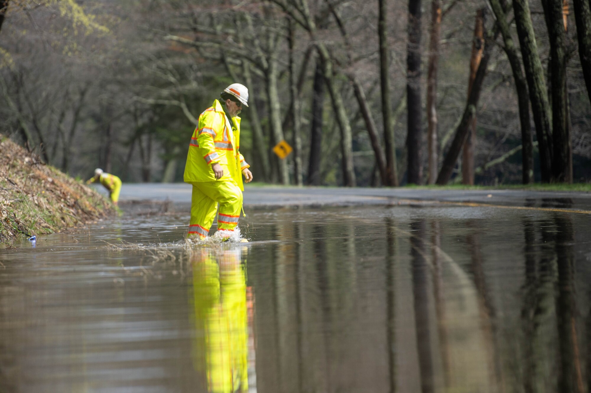
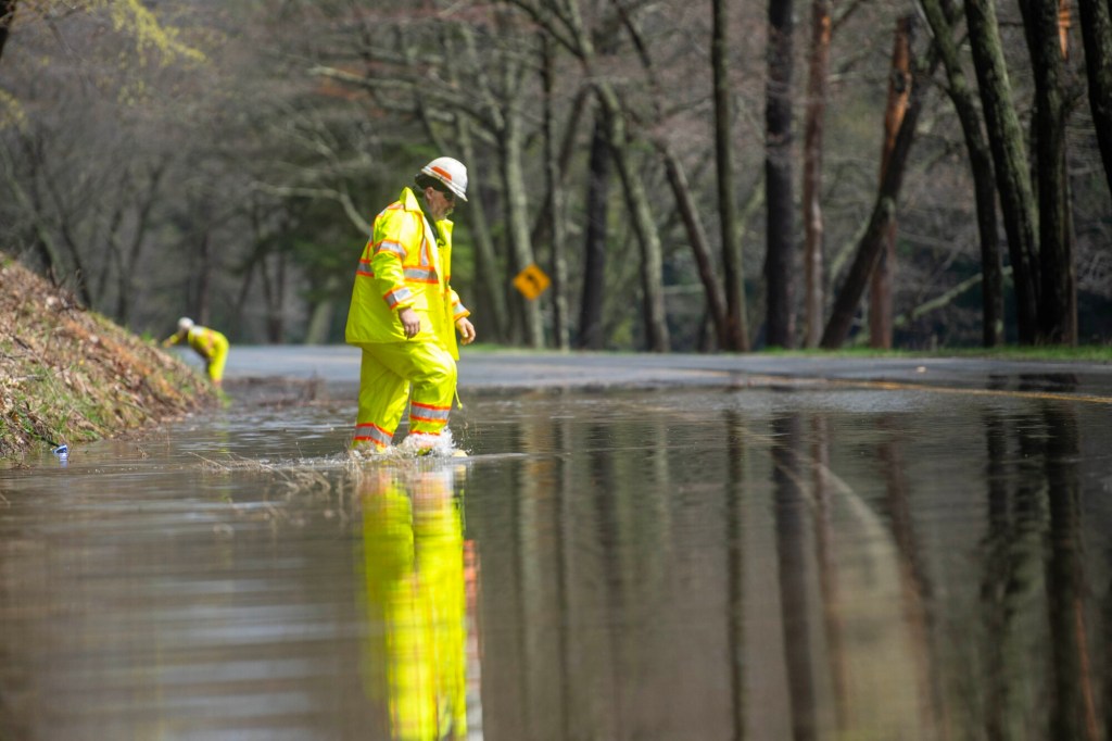
A worker with the Maine Department of Transportation tries to clear drains Monday along a flooded River Road in Skowhegan. Michael G. Seamans/Morning Sentinel
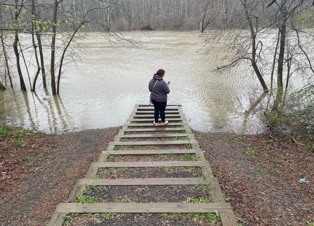
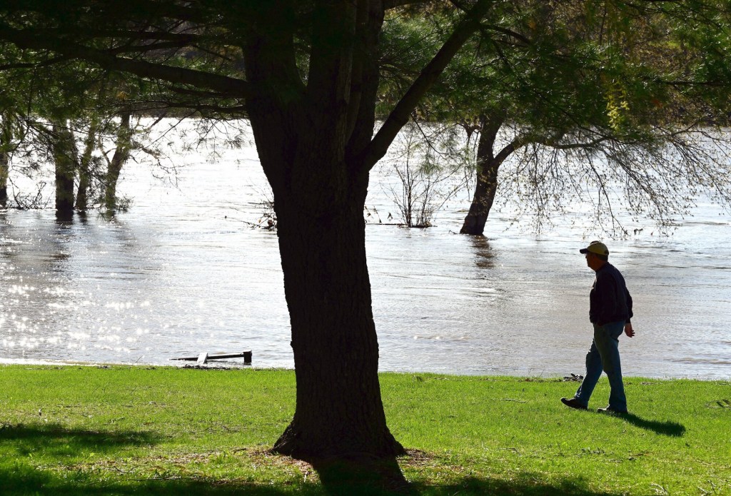
In Kennebec County, low-lying areas along the river in Augusta, Hallowell and Gardiner as well as waterfront recreation areas were being closed down ahead of expected flooding late Monday into Tuesday.
Jason Decker, deputy director of the Kennebec County Emergency Management Agency, said Monday that the Kennebec River was expected to come over its banks at about midnight Monday, reaching 20 feet 4 inches in Augusta and 16 feet and 10 inches in Hallowell. By early afternoon, the river had already reached flood stage in Augusta at 12 feet, and in Hallowell at 11 feet.
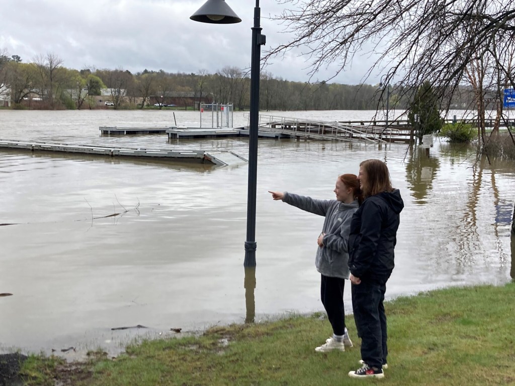
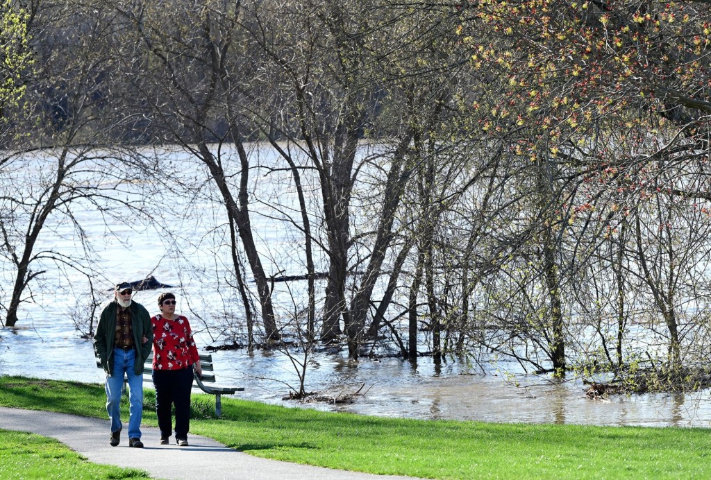
Before Waterfront Park in Gardiner was closed, Sandy Sutherland, 46, and her daughter Molly Sutherland, 13, took a break from work and schoolwork at their Gardiner home to check out the high river flows.
They had first stopped at the New Mills Dam on Cobbosseecontee Stream, where an alert about a dam failure had been issued earlier in the day.
Gardiner Fire Chief Rick Sieberg said the higher streamflow had washed away some of the bank along the Harrison Avenue side of the fast-moving stream, but the dam was not affected.
“Because of all this, FEMA activated its emergency action plan,” Sieberg said. “We’re monitoring the situation. The owner has opened the gates on the upper dam and on his dam to try to control the situation.”
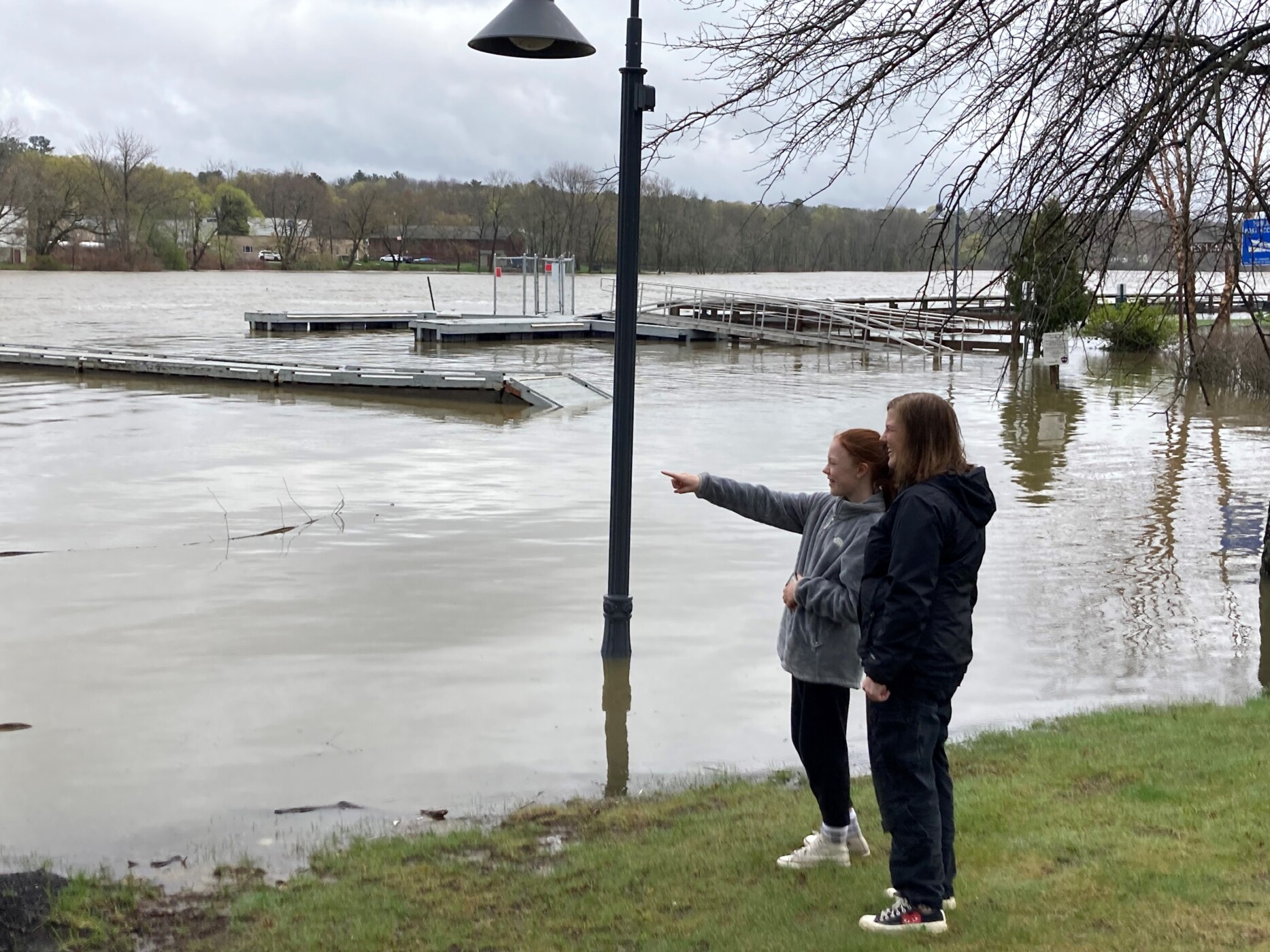
Sandy Sutherland, right, and her daughter Molly check out the Kennebec River in Gardiner. The rising water prompted officials in several communities to close low-lying areas to parking. Jessica Lowell/Kennebec Journal
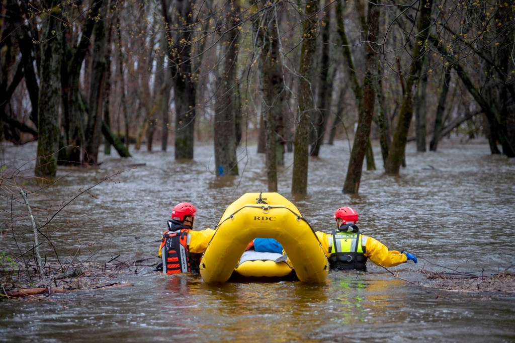
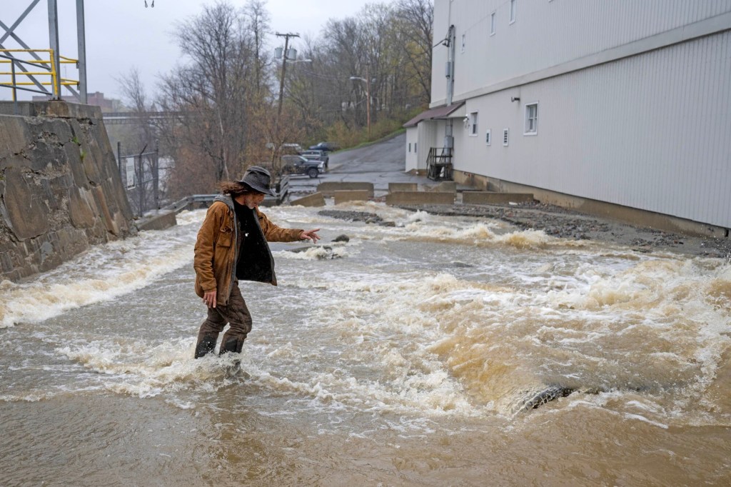
In Waterville, firefighters and emergency medical staff searched Leeman Island, where a tent had been set up on high ground. The island has been the site of homeless encampments.
“We went down this morning and checked the tent, and there was no one in it at that time,” Chief Shawn Esler said, noting that it appeared the tent had been used at some point recently. “We ran a pretty aggressive campaign last year and the start of this year to keep people out of there because it’s prone to flooding.”
In Monmouth, as in a number of other towns in the region, town officials urged residents to be cautious when traveling through low-lying areas where water covered the roads.
T.J. Siderio, assistant fire chief in Monmouth, said state Route 132, also known as Main Street, was closed for a while, but the worst of the flooding was in the Waugan Road area on the west side of Annabessacook Lake, where the water level rose.
“The bridge sits so low, and the water level rises with any significant rain,” Sidario said. “We’ve had issues there before.”

Waterville firefighters and EMS personnel Monday search near a small homeless encampment for people stranded by the rising Kennebec River below the Hathaway Creative Center in the South End of Waterville. Michael G. Seamans/Morning Sentinel
In Regional School Unit 3, which serves 11 towns between Waterville and Belfast, officials were working to establish new bus routes because of road closures and detours and notified families to expect delays in bus drop-offs after school. Richmond schools and Dresden Elementary School, which are all part of Regional School Unit 2, did not open Monday because of washouts, downed wires and flooding that closed several roads in those towns.
The storm, which also brought high winds to the area, knocked over trees and knocked out power around the region, bringing out both fire departments and electric line workers to clear up the damage.
In some cases, access to downed lines was blocked by flooded roads, Jonathan Breed, Central Maine Power Co. spokesman, said. That could slow the company’s ability to reach some areas, prolonging restoration efforts into Tuesday.
By Monday morning, CMP reported about 2,400 outages in Kennebec County, with Litchfield, West Gardiner and Vassalboro the hardest hit.
#DEVELOPING: A tree destroyed a shed and damaged part of a home in Randolph early this morning. Heavy rain and strong winds have caused damage across Maine.
DETAILS: https://t.co/t0lu4LxGEi pic.twitter.com/bBpedzlarH
— CBS 13 News (@WGME) May 1, 2023
Stephen Baron, meteorologist with the National Weather Service in Gray, said the storm system was fed by winds that came from the east off the Atlantic Ocean, drawing in moisture.
“It’s not the most common situation, but it’s one we do see,” Baron said. “Normally when we get storms, the wind direction is out of the south or out of the northeast.”
The highest wind gust in Augusta was 49 mph reported at 2 a.m.
While the clouds cleared away Monday, Baron said more rain is expected through Thursday, although not nearly as much as fell in the late weekend storm.
In Somerset County, Smith said his agency would continue assessing damage in the coming days and keep an eye on the rivers, where even less than an inch of rain could affect the water levels.
Morning Sentinel Staff Writer Kaitlyn Budion contributed to this report.
Copy the Story LinkSend questions/comments to the editors.

Success. Please wait for the page to reload. If the page does not reload within 5 seconds, please refresh the page.
Enter your email and password to access comments.
Hi, to comment on stories you must . This profile is in addition to your subscription and website login.
Already have a commenting profile? .
Invalid username/password.
Please check your email to confirm and complete your registration.
Only subscribers are eligible to post comments. Please subscribe or login first for digital access. Here’s why.
Use the form below to reset your password. When you've submitted your account email, we will send an email with a reset code.