


-

View images from the Portland Public Library archival collection of Portland Press Herald, Maine Sunday Telegram and Evening Express photos.
-
-
-
View images from the Portland Public Library archival collection of Portland Press Herald, Maine Sunday Telegram and Evening Express photos.
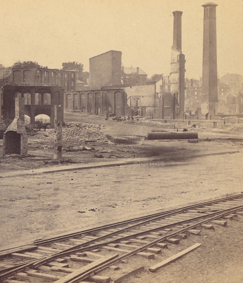
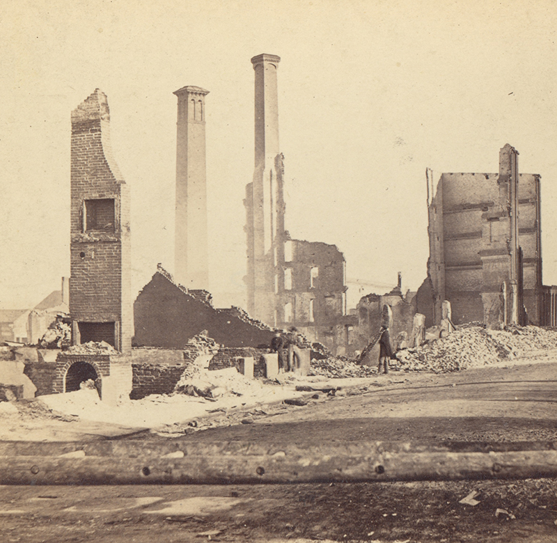
The ruins of J.B. Brown's Portland Sugar House photographed in the days after the fire by S. Towle
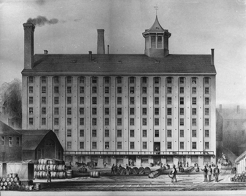
BEFORE THE FIRE: Portland Sugar House, one of J.B. Brown's businesses in Portland and one of the first to burn in the Great Fire.
York and Danforth streets, view of the rear of the Portland Sugar House. Photograph by J.A. Whipple.
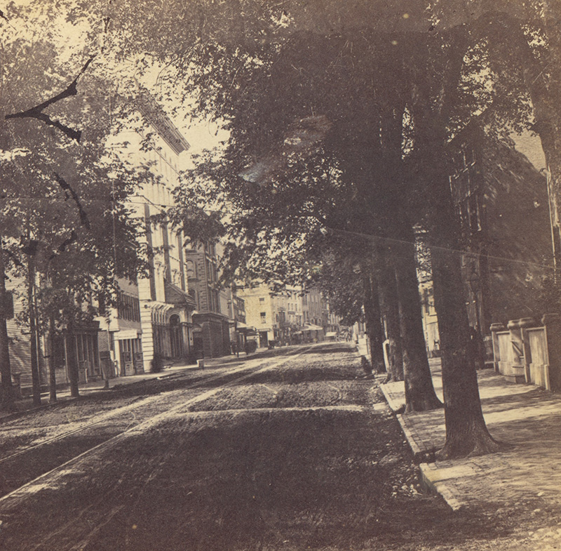
Center Street looking north. Photo by John A. Whipple
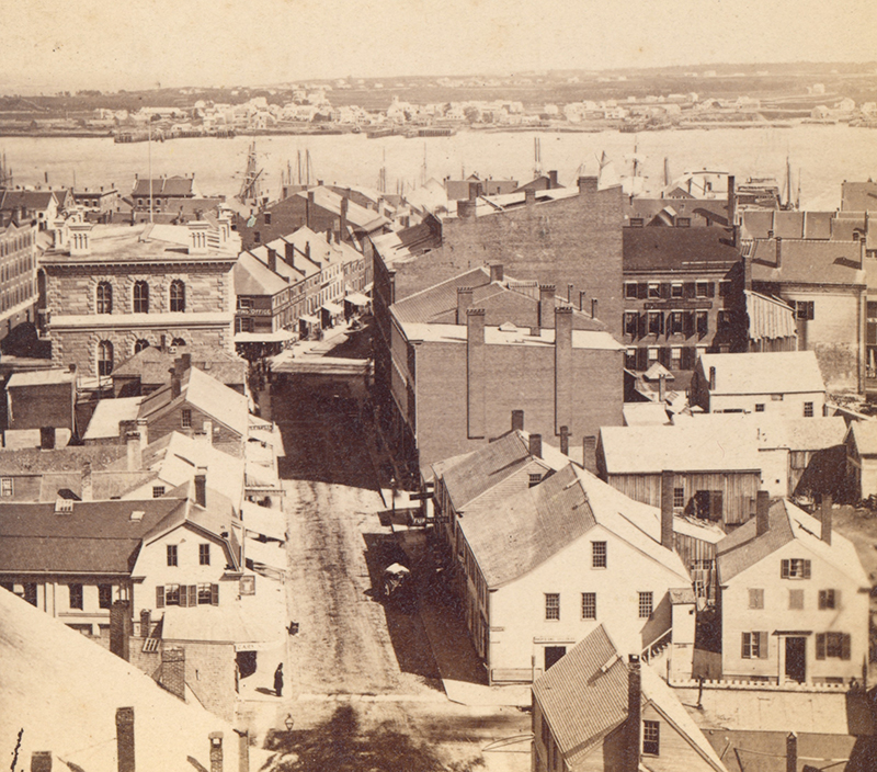
BEFORE THE FIRE: 1865 photo looking down Exchange Street from City Hall prior to the Great Fire. The large building to the left was the Custom House which also housed the post office. Photographer unknown.
Looking south along Exchange Street from the Custom House, photographed by S.W. Sawyer
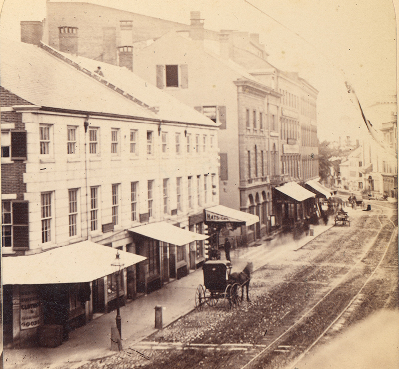
BEFORE THE FIRE: Lime (Market) and Exchange streets from City Hall in 1865. Photographer unknown.
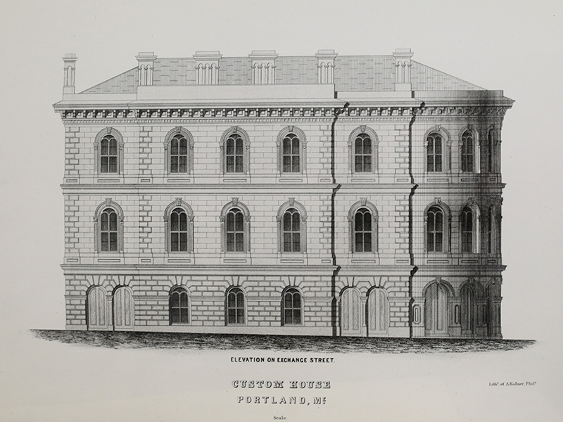
BEFORE THE FIRE: Lithograph of the Custom House that stood facing Middle Street between Exchange and Lime (now Market) streets
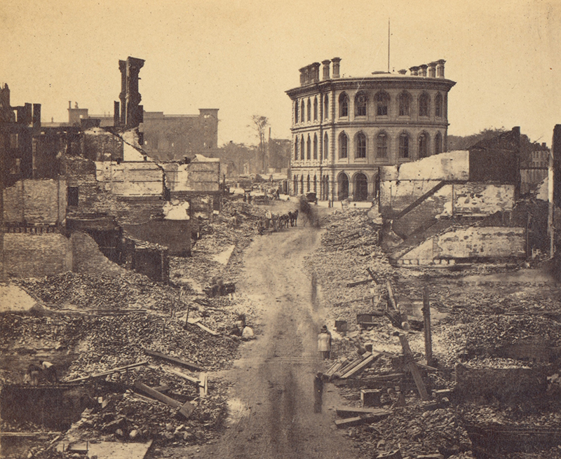
Looking up Exchange Street from Fore Street. The Custom House looks almost undamaged but the intense fire weakened the structure and it was taken down and replaced with a post office while the Custom House was rebuilt at its current location on Fore Street. Photograph by S.W. Sawyer
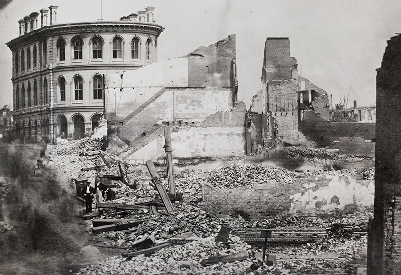
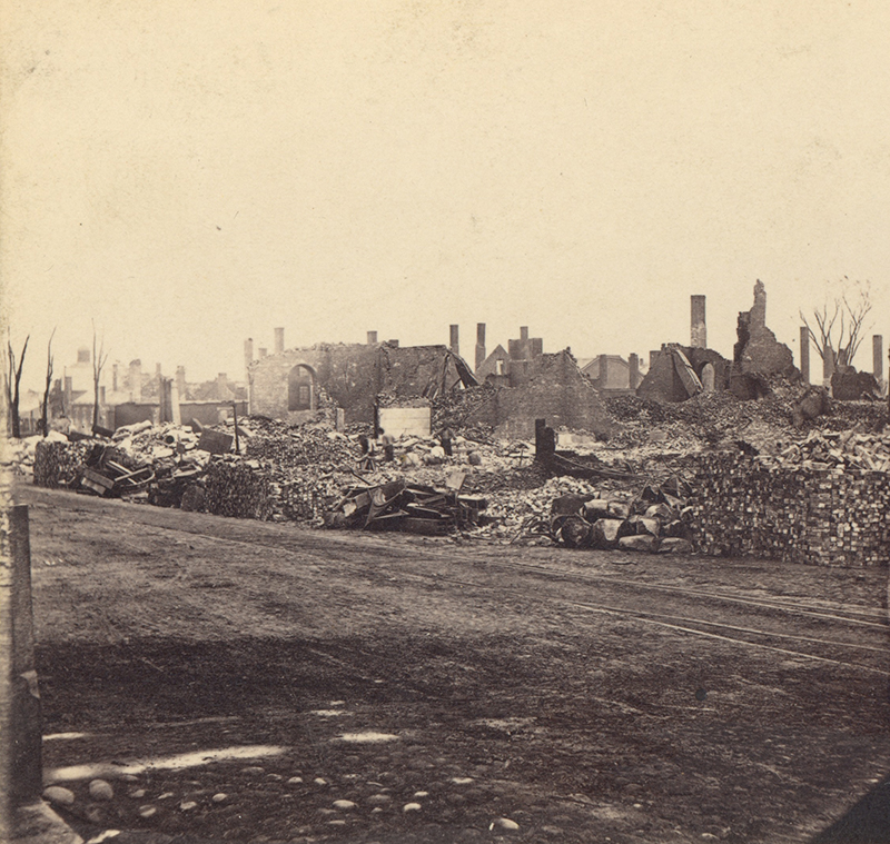
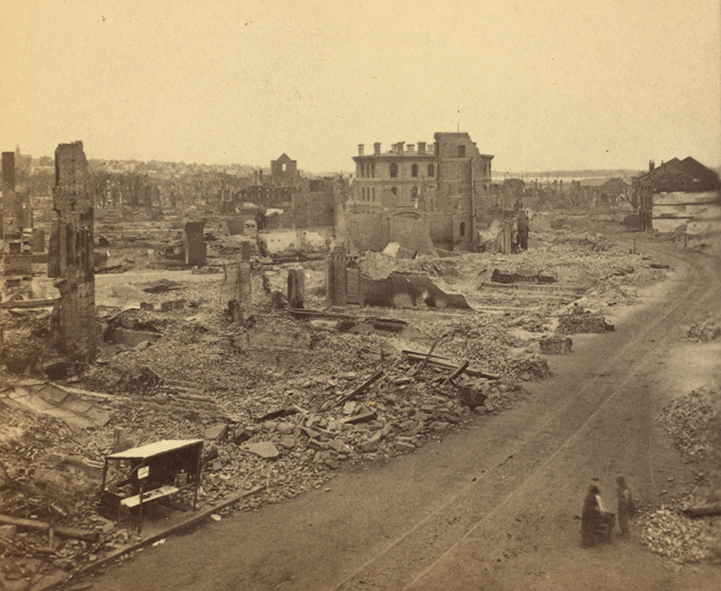
A closer view of the rubble of the north side of Exchange Street and the Custom House.
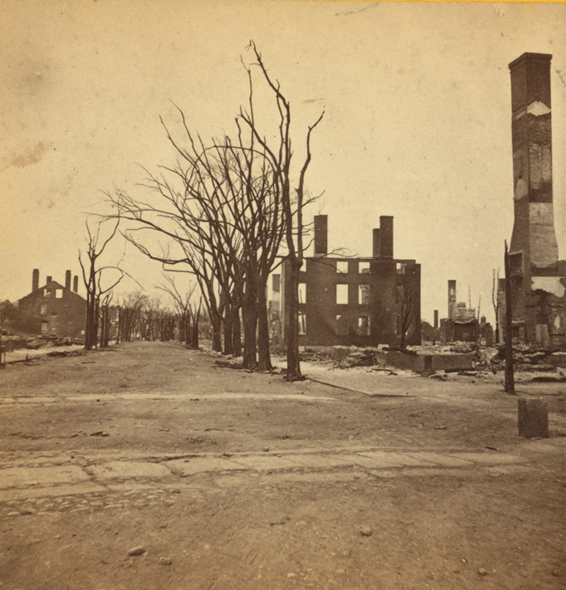
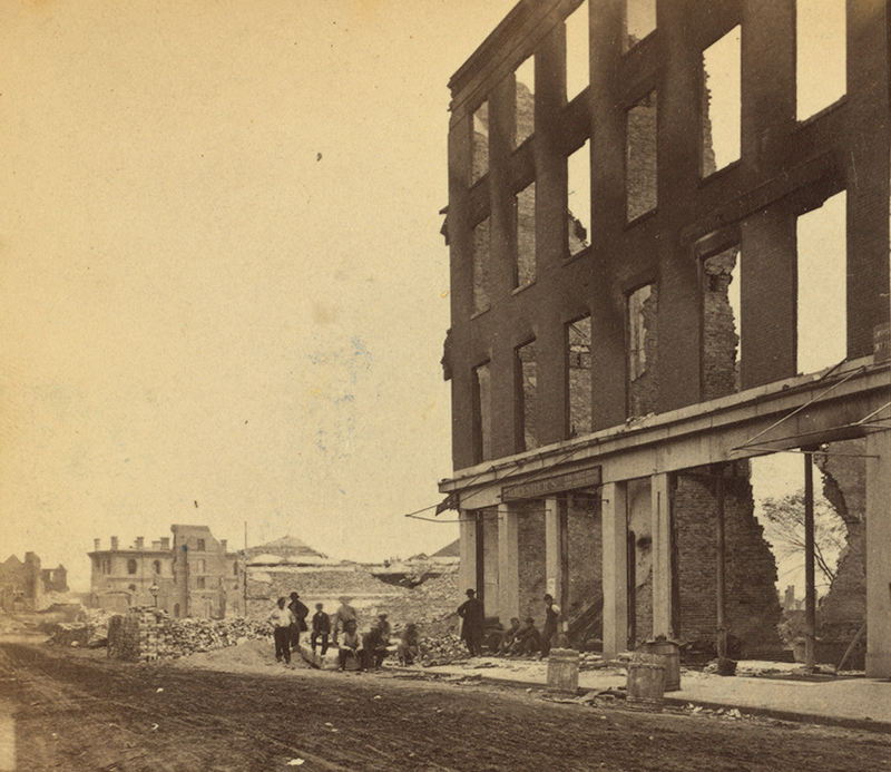
South side of Middle Street west of Pearl photographed by S.W. Sawyer
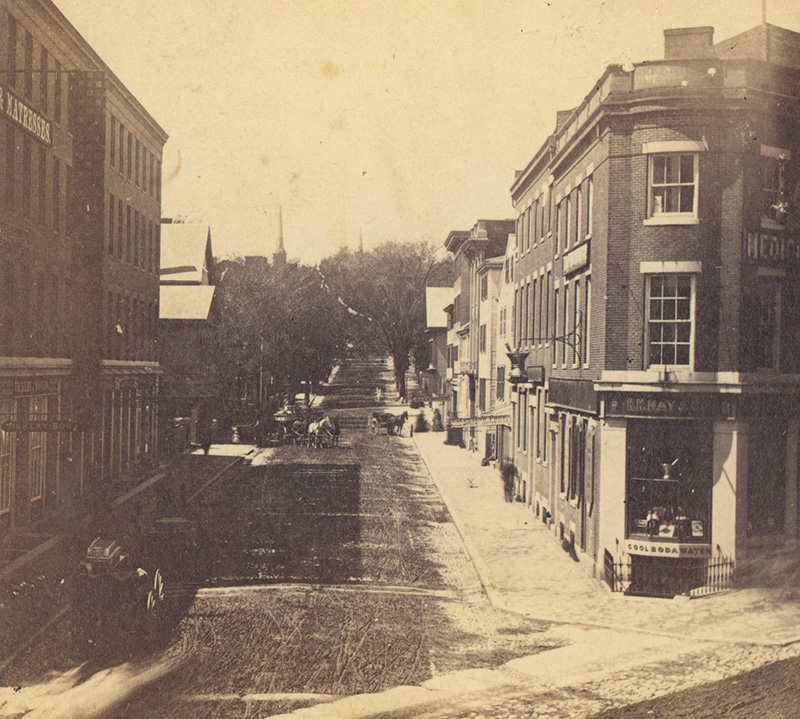
Lime Street looking south, photographed by J.A. Whipple
Looking up Exchange Street from Fore Street. Photograph by J.P. Soule. As John Marshall Brown wrote: "Every building on Middle & Exchange is gone. Every bank, printing office, lawyers office, jewelers shop. 6 hotels, 6 churches..."
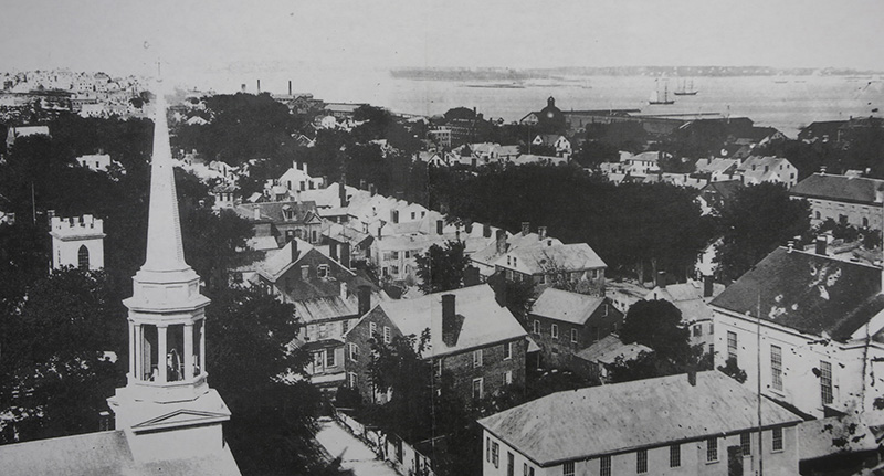
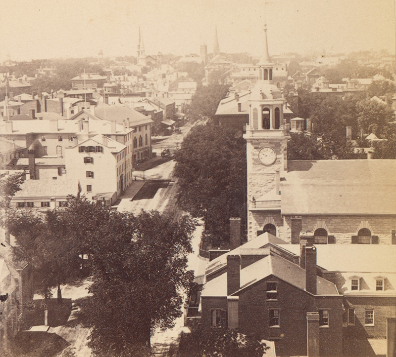
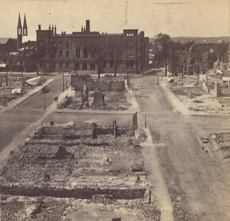
BEFORE THE FIRE: View from City Hall in 1865, looking northeast. Across Congress Street is the tightly built area where Lincoln Park now is. Unknown photographer
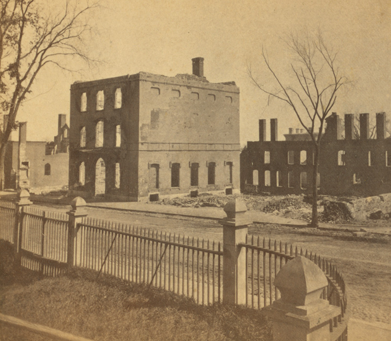
Looking northeast at Federal Street from Pearl Street. The Cumberland County and Federal courthouses are now to the right and Lincoln Park is across the street. Photographed by J.P. Soule between July 12 - 14, 1865
BEFORE THE FIRE: This scene, taken by an unknown photographer in 1865, shows upper Exchange Street and City Hall before the Great Conflagration.
BEFORE THE FIRE: A view of Middle Street looking north from Union taken in 1865 before the Great Fire. Unknown photographer
BEFORE THE FIRE: Middle Street as seen from Free Street in 1865. Photographer unknown
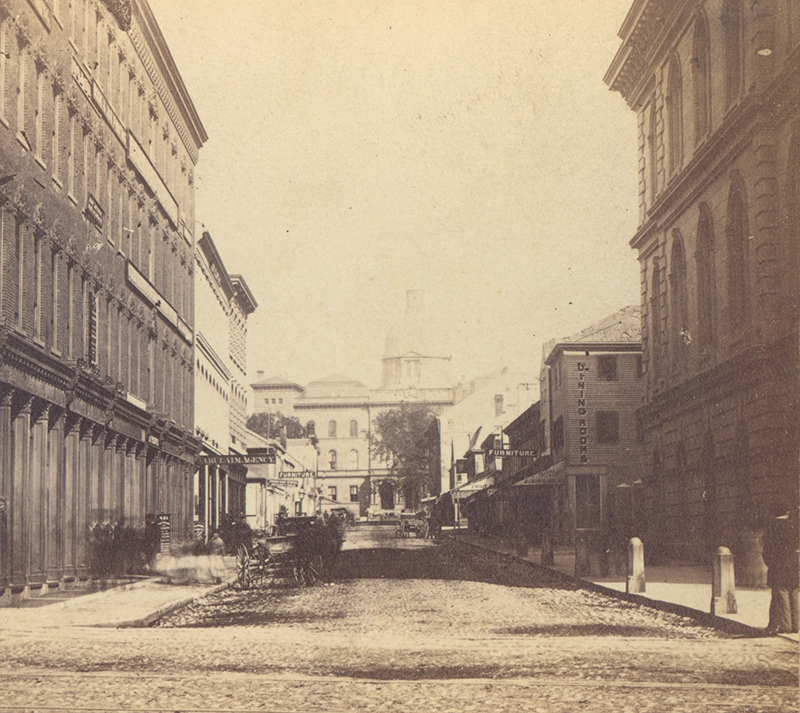
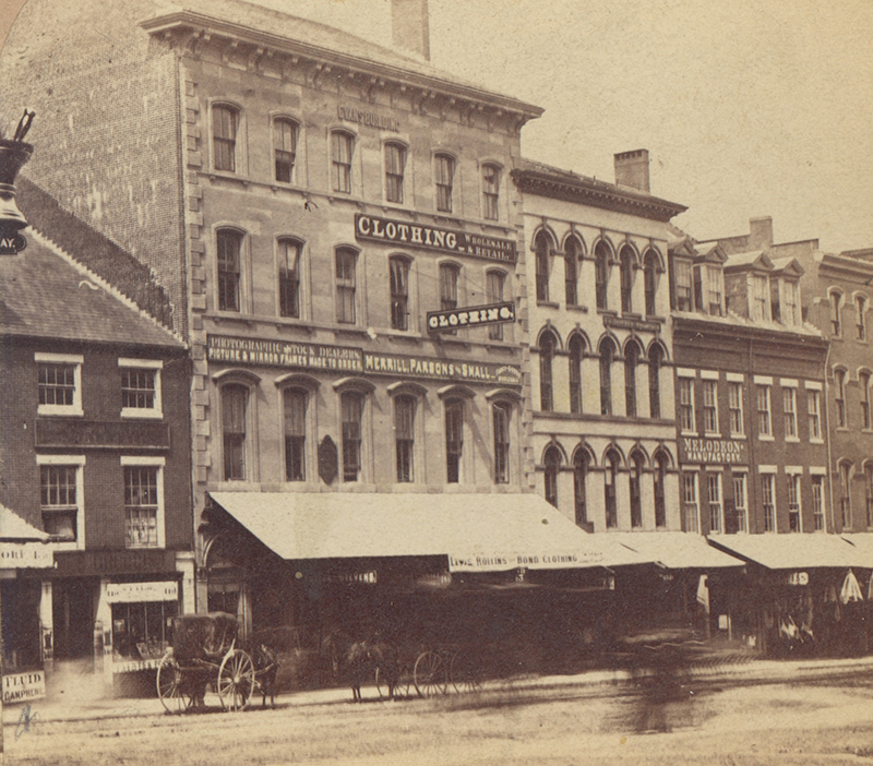
A photograph taken by J.P. Soule between July 12 - 14, 1866 of Middle Street looking south. The building across the street was the Canal Bank building. Canal Bank, which was established in 1803, became Key Bank in 1988.
BEFORE THE FIRE: Middle Street looking south from Union taken in 1865 before the Great Fire. Unknown photographer
BEFORE THE FIRE: Photograph of Middle Street taken from Franklin in 1865. Photographer unknown.
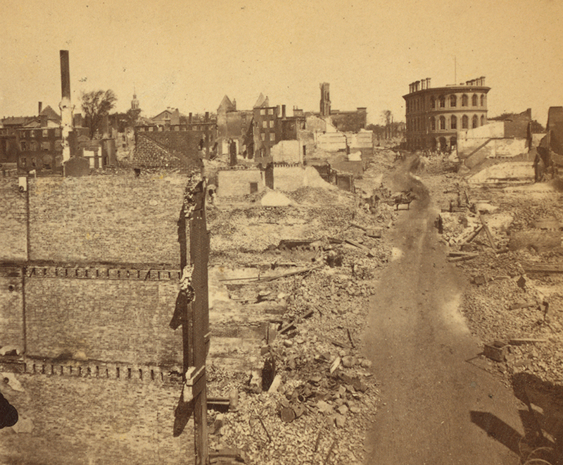
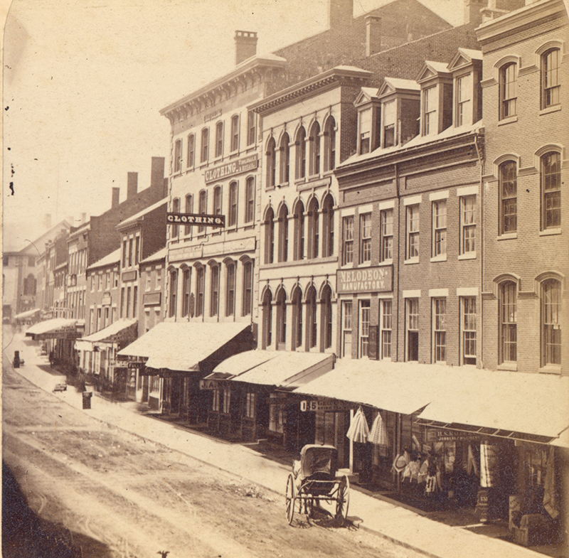
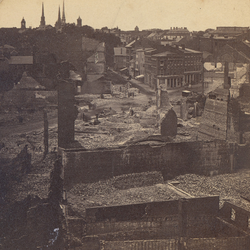
Looking northeast along Middle St., showing portion of Temple and Exchange streets. The Custom House is the large building in the center, St. Stephen's Church is slightly to the left of that and in the top left is the Observatory. The building standing to the right of the frame is the ruin of the Canal Bank building. Photographed by J.P. Soule between July 12 - 14, 1866
BEFORE THE FIRE: Free Street at the corner of Middle Street in 1865.
Looking over the rubble to the corner of Middle and Free streets photographed by S.W. Sawyer
Photographed by J.P. Soule who stood on Free Street, looking north with the Custom House in the distance on the left.
BEFORE THE FIRE: View of Congress Street in 1865 taken from the vantage point of City Hall. What is now Monument Square can be seen to the left, the angled building was Portland's old City Hall which was used as a soup kitchen after the fire in 1866. Unknown photographer.
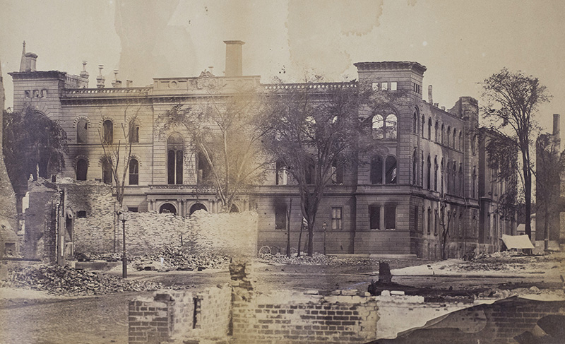
The Natural History Museum on Congress Street near Temple. Photographed by J.P. Soule between July 12 - 14, 1866
City Hall after the fire.
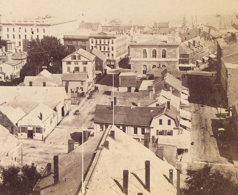
City Hall viewed from the Custom House showing upper Exchange and Lime streets, photographed by J.A. Whipple
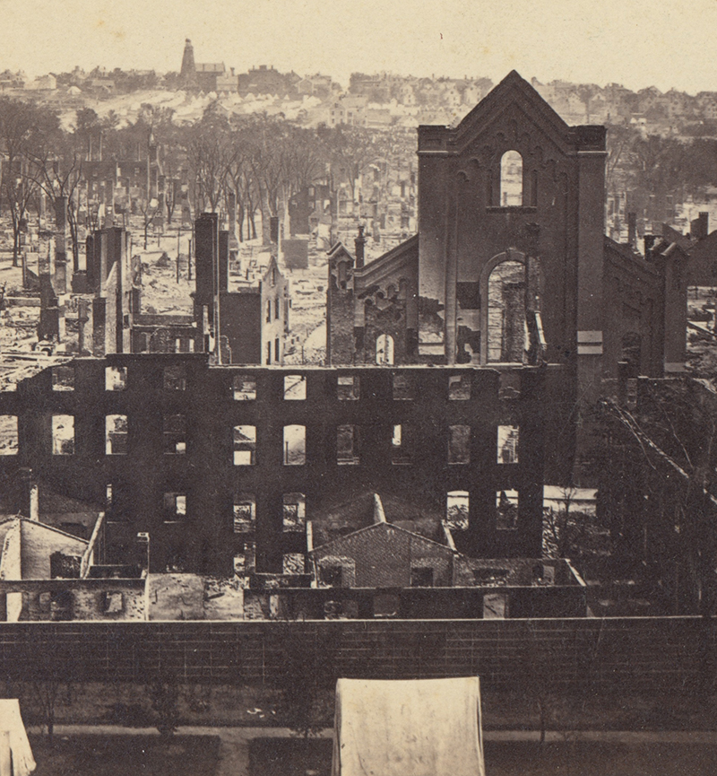
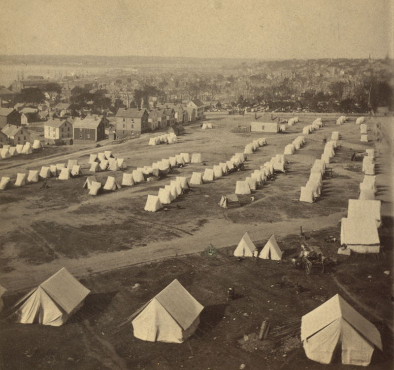
Munjoy Hill as seen from the Custom House (today’s Post Office Park). The church in the mid-ground was St. Stephen’s, at the southwest corner of Newbury and Pearl streets. The Observatory can be seen in the distance with the tents housing the dispossessed in rows before it. Photo by R.E. Mosely

St. Stephen's Church which stood at 7 Pearl.
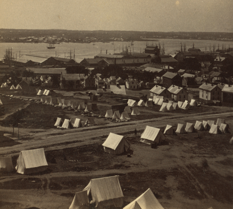
Tents set up below the Observatory to house the homeless after the fire. Photographed by J.P. Soule between July 12 - 14, 1866
Looking west from India Street. The destruction of buildings makes it possible to see through to the Custom House on Middle and (now) Market streets. Photographed by S.W. Sawyer
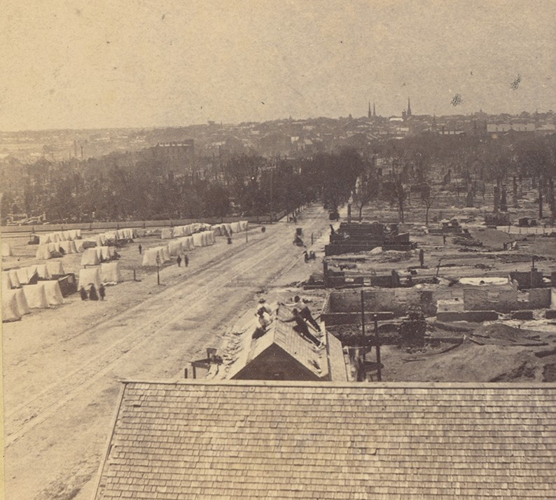
View west from Munjoy Hill. Repair and rebuilding are underway. Photograph by J.A. Whipple
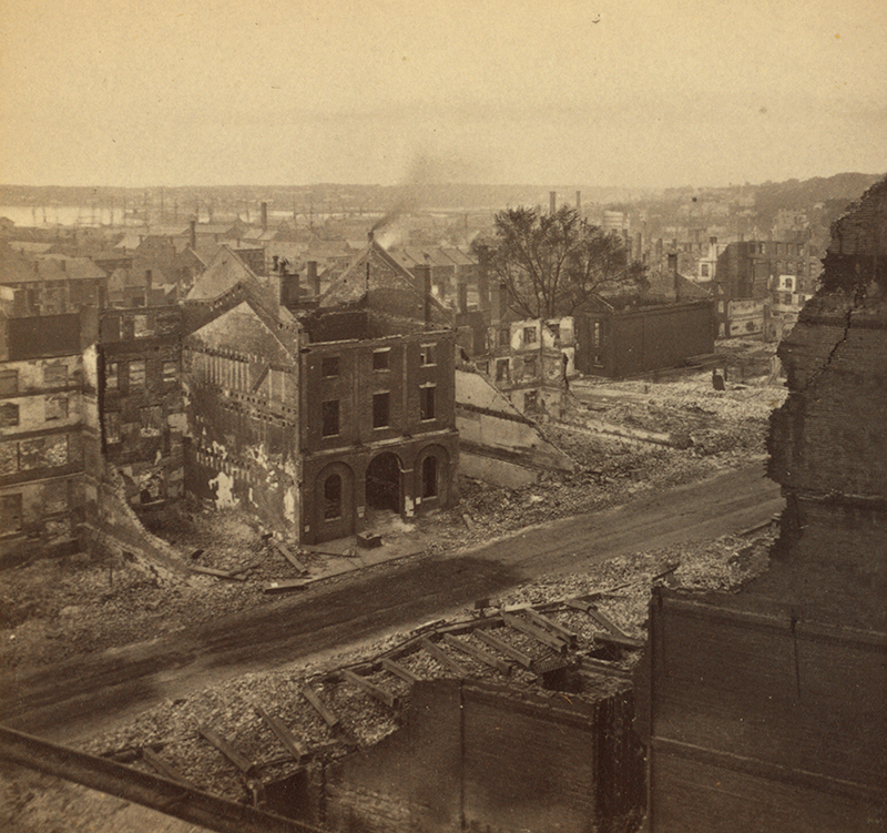
Panoramic view of the 'burnt district' looking southwest from the Observatory. Photographed by J.P. Soule between July 12 - 14, 1866